
The Discovery
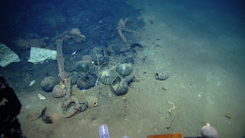
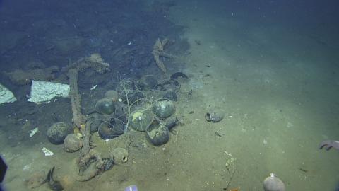
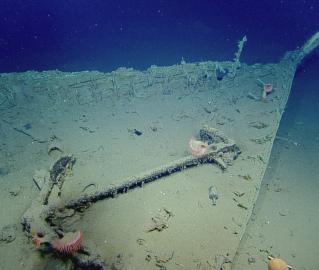
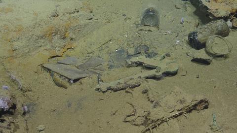
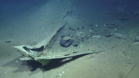
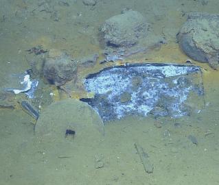
In April 2012, the National Oceanic and Atmospheric Administration (NOAA) ship Okeanos Explorer conducted the first reconnaissance of shipwreck site 15577 as part of an interdisciplinary exploration mission focusing on deepwater hard-bottom habitat, naturally occurring gas seeps, and potential shipwrecks in the Gulf of Mexico. First identified as a side scan sonar target in 2011, Okeanos's brief ROV dive made a truly exciting discovery contributes to our understanding of a turbulent period of American history. The shipwreck appears to be an undisturbed, early 19th century, wooden-hulled, copper-clad sailing vessel containing artillery, firearms, navigation instruments, cooking and food storage items, medicines, and personal artifacts.
The sonar target first came to light when Shell Oil notified the Bureau of Offshore Energy Management (BOEM) and the Bureau of Safety and Environmental Enforcement (BSEE), agencies of the U.S. Department of Interior tasked with overseeing oil and gas exploration and development on the Gulf of Mexico Outer Continental Shelf, that a side scan sonar target resembling a shipwreck had been found in their lease area 90 miles from Flower Garden Banks National Marine Sanctuary some 274 km (170 miles) southeast of Galveston, Texas.
The site lies in 1,330 meters (4,363 feet) of water. The depth and lack of nearby oil and gas industry infrastructure suggested that the vessel might be well preserved. The target imaged in the sonar data collected by Fugro Geosciences revealed a tightly contained site with a sharp hull-formed outline measuring approximately 25 meters (84 feet) long by 7.9 meters (26 feet) wide with indications off one beam of what were thought to be the remains of two masts.
This tantalizing discovery is one of the more significant shipwreck sites discovered in the Gulf of Mexico to date because of its amazing degree of preservation from a critical period in history in which new nations were forming at the end of Colonial-era and the Gulf was opening to global trade. As it has not yet been identified, the wreck is referred to as the “Monterrey Shipwreck” after Shell’s name for their proposed development.
Further Investigation
In a partnership between the Meadows Center for Water and the Environment at Texas State University and the Ocean Exploration Trust, a team of top-notch archaeologists and other scientists from NOAA’s Office of Ocean Exploration and Research and Office of National Marine Sanctuaries, BOEM, BSEE, the Texas Historical Commission (THC) will return to the site. They will conduct detailed documentation and recover a small number of artifacts in order to determine the historical and socio-cultural context within which it operated and, hopefully, also identify the shipwreck. Discoveries and findings shared through telepresence will inform people in the Gulf Coast and the international community about early trade, commerce, and maritime activity in the Gulf of Mexico.
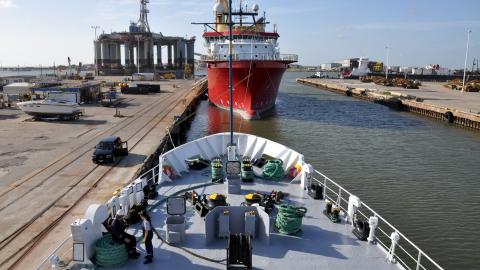
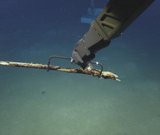
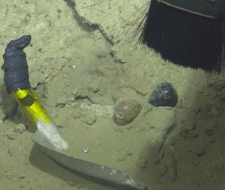
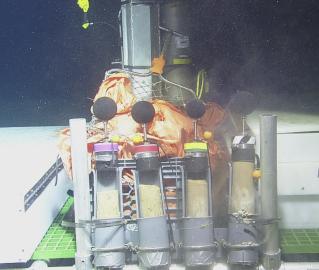
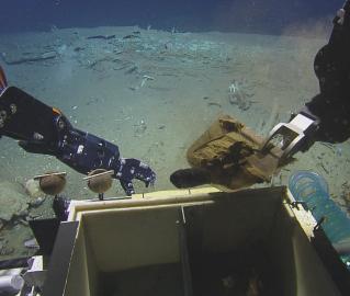
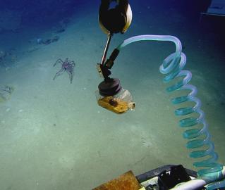
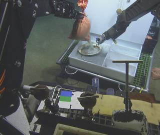
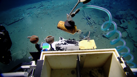
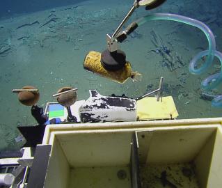
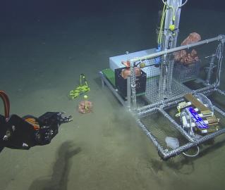
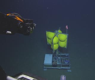
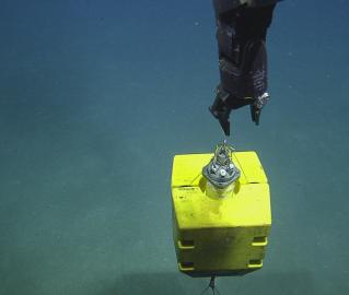
The goal of the project is to systematically study the shipwreck through in-depth documentation, including mapping the site using ROV technology. In addition, the expedition plans to recover artifacts for conservation, analysis, exhibition, future study, and public outreach. The documentation and sampled artifacts will be used to address research questions including, but not limited to, the age, function and cultural affiliation of this vessel. To accomplish this incredibly complex operation, archaeologists will work onboard E/V Nautilus 1300 meters (4,300 feet) over the site.
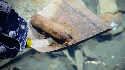
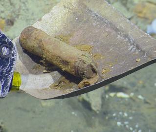
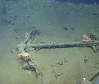
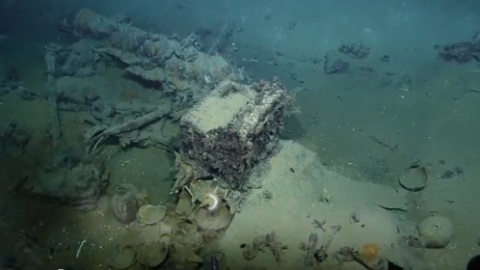
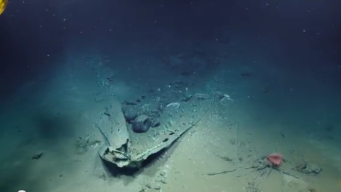
The Monterrey Shipwreck is a mystery. Exactly how old is it? Whose ship was it? How did it sink? What stories can it tell? Can some of those stories link us to specific individuals in the past? Answers come from scientific investigation and, with this shipwreck, the remains of the vessel and the things inside it will hopefully tell their tales. These artifacts – clothing, cooking equipment, weapons, and the ship’s own equipment not only provide clues to the identity of the shipwreck, but also tell stories of the crew, the activity that was occurring during that time period, and can allow for further examination of the “big picture” of maritime activity in the Gulf of Mexico by examining this well-preserved “time capsule” of a shipwreck.
Research Objectives
- Create a detailed, geo-referenced photo-mosaic and micro-bathymetric acoustic map of the site to produce a site plan in order to determine the extent of the site (including any associated debris field), to determine which diagnostic artifacts will aid in interpreting the shipwreck, to accurately place the visible contents of the ship within their relative context, and to map the physical remains of the ship’s hull.
- Obtain a sample of diagnostic artifacts in order to assign a date to the shipwreck. These artifacts will provide clear historical time markers that will aid in determining the age range of the use-life of the vessel, the functional purpose of the vessel (e.g., merchant, privateer, naval, etc.), as well as provide clues to the nationality and cultural affiliation of the vessel.
- Understand the site preservation processes that have occurred during the wrecking and settling of the wreck, as well as the on-going processes currently active at the site.
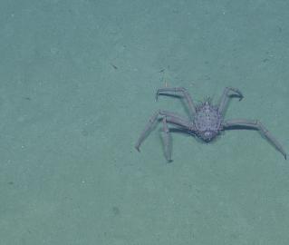
- Conduct related interdisciplinary scientific experiments that will provide additional information regarding the condition of the site as well as its potential as a habitat for benthic biological organisms. Video data collected during the 2012 archaeological reconnaissance showed the presence of a living tube worm within the confines of the hull; a phenomenon never before witnessed in the Gulf of Mexico. The site also does not appear to be near the presence of a hydrothermal seep where these animals are typically found living in symbiosis with chemosynthetic bacteria. Water, sediment and wood samples may help archaeologists and biologists determine how this site has become a benthic habitat.