2025 Expedition

Exploring the Offshore Marianas

June 2 – 28, 2025
NA172
Exploring Mud Volcanoes and the Mariana Trench
Expedition Leader
Co-Lead Scientist
Co-Lead Scientist
Co-Lead Scientist

Update: Ongoing mechanical repair of a ship system has changed operational plans for the NA172 expedition, postponing the water column exploration and remotely operated vehicles portion of this expedition within the Mariana Trench Marine National Monument. The remainder of the expedition time will be dedicated to resolving these issues and mapping operations to acquire high-resolution bathymetry in areas where no data exists, through US waters around the Mariana Islands, in the Federated States of Micronesia, international waters, and the Solomon Islands. Seafloor mapping in unexplored areas directly contributes to the US National Strategy for Ocean Mapping, Exploration, and Characterization, the Beyond the Blue: Illuminating the Pacific campaign, and other coordinated initiatives. 

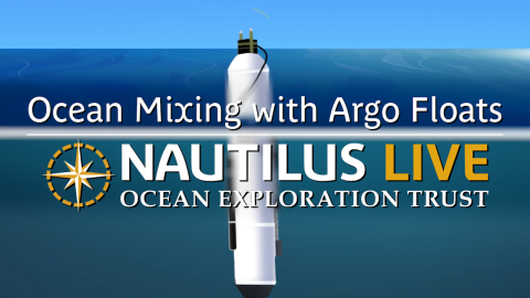
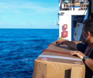
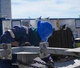
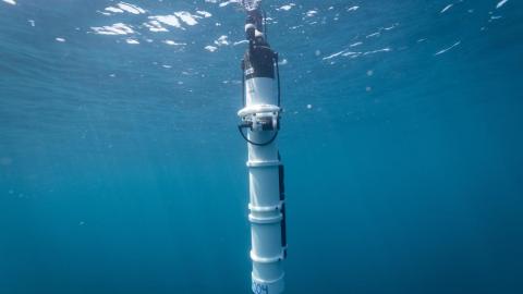
The expedition will also include deployment of Argo floats to support ocean monitoring efforts by Scripps Institution of Oceanography to add important Western Pacific coverage to the over 3,800 floats that are currently operational in the global ocean. Additionally, operations will include topside surveys by trained seabird observers to assess the diversity and abundance of seabirds offshore. 

This expedition is funded by NOAA Ocean Exploration via the Ocean Exploration Cooperative Institute.

Expedition Partners

Meet the Team

Expedition Posts

Iron Bottom Sound
Credit
Ocean Exploration Trust

Located in the Solomon Islands, the Iron Bottom Sound was the scene of five major naval battles during World War II, resulting in the loss of over 20,000 lives, 111 naval vessels, and 1,450 planes. These underwater maritime heritage sites now rest on the seafloor in a confined area offshore Honiara. To date, only 30 of the military ships lost in this area have been located, with at least 21 still missing.

karen and chris birds OET
Credit
Ocean Exploration Trust

"This is seabird habitat, but unfortunately, we don't know a lot about what seabirds are here," Karen Barid says. "It's important to understand how seabirds use the ocean - where the hot spots are, and what are the most important areas that we need to protect." 

Karen Baird is Co-Chair of the Seabird Trust, a non-profit that seeks to better understand seabirds and the ecosystems they inhabit throughout northern New Zealand, the Three Kings Islands, and the Kermadec Islands. Her husband, Chris Gaskin, is also a founding member of the trust. During this transit from Guam to the Solomon Islands (NA172), Karen and Chris have spent each day, from sunrise to sunset, on the monkey deck, photographing and logging every bird they see. 

"This transit is a brilliant opportunity to record what seabirds we can see at sea. It's important to understand what seabirds are around, particularly in Oceania, where there is very little known about the populations. Oceania consists of 21 Pacific Island countries and territories with thousands of islands, ranging from high mountains covered in forests to barren atolls."

On June 17, OET connected with Science Friday for an exciting ship-to-shore interaction. Watch the video and learn about how things work on #EVNautilus
Credit
Science Friday

On June 17, OET connected with Science Friday for an exciting ship-to-shore interaction. Watch the video and learn about how things work on E/V Nautilus: https://youtu.be/sgfxakS6sUU?si=I7HHEhCMJLp23iih


oet
Credit
Ocean Exploration Trust

The E/V Nautilus is underway conducting mapping operations through US waters around the Mariana Islands, in the Federated States of Micronesia, international waters, and the Solomon Islands. Stay tuned for Argo float launches and topside seabird surveys!

OEt scicomm
Credit
Ocean Exploration Trust

Join us for a LIVE Q&A about Science Communication with our at-sea ocean explorers onboard E/V Nautilus! Watch live aright here and submit your questions for the team. Tune in Monday, June 23 at 7pm ET/4pm PT (June 24 at 9 am in Guam).
 

Mariana trench marine national monument
Credit
MTMNM

Get to know more about where we've been for the beginning of our 2025 season! The Mariana Trench Marine National Monument protects 95,216 square miles (246,610 km2) of submerged lands and waters around the Mariana Archipelago. It includes three units: Islands Unit (the waters and submerged lands up to low tide mark around the three northernmost Mariana Islands - Farallon de Pajaros, Maug, and Asuncion, Volcanic Unit (the submerged lands within 1 nautical mile of 21 designated volcanic sites, west of the Mariana Archipelago), and Trench Unit (submerged lands of the trench habitat).