Deploying Argo Biogeochemical Floats in the Western Pacific

This blog was written by Science team member Melissa Miller.
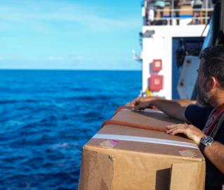
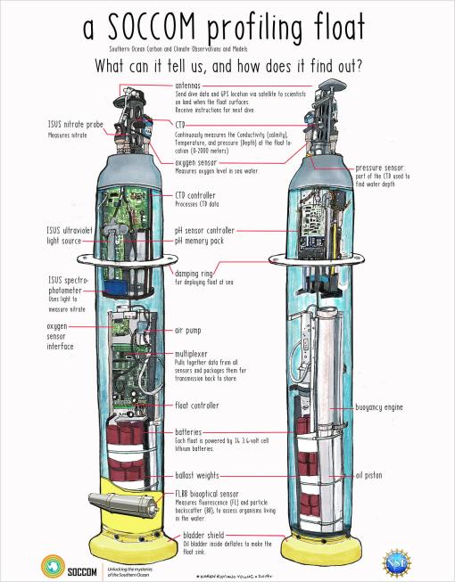
My name is Melissa Miller, and I’m excited to be joining E/V Nautilus for a mapping expedition between Guam and Solomon Islands. I work at Scripps Institution of Oceanography as part of the GO-BGC and SOCCOM programs to deploy robotic floats with biogeochemical sensors all over the world’s oceans. The six floats we deploy on this trip will join the larger Argo network, which has over 4,000 floats with temperature and salinity sensors reporting in to monitor global ocean health. Biogeochemical floats also report dissolved oxygen, pH, nitrate, and chlorophyll.
When explaining the float program, I often say that I am slowly replacing myself with robots. It is a joke, but also partially true. For much of my career, I did chemical analyses to report the nutrient, dissolved oxygen, and salinity values in seawater from the surface to the seafloor. As my career changed, I’ve left the lab and now work for programs that collect that data and more using autonomous instruments. This massive dataset is invaluable. After all, the floats work in all weather and sea conditions for years on end – something that people on research vessels just can’t do.
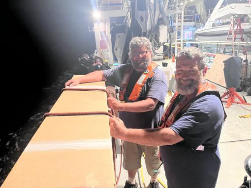
So far, we’ve deployed three floats during the transit and have three more to go. All were adopted and named by classrooms from around the world through our Adopt-a-Float program where you can see the data and track each float’s progress.
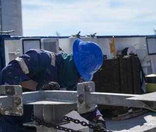
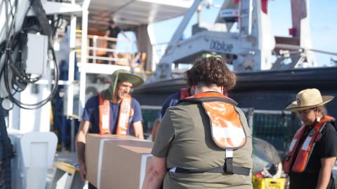
Since there are no other science operations that require us to stop, the crew slows down the ship to about 2 knots (from our transit speed of close to 10 knots) to make sure the float gets safely into the water. The float will sink down to 2,000 meters, or about 1.25 miles deep, collecting data as it rises back to the ocean surface. The journey back up takes about seven hours. Once the float sends all the information via satellite, it will “park” itself back at a depth of 1,000 meters. There it drifts with the current for 10 days before beginning the process again.
Floats deployed from ships collect data between the ocean surface and a depth of 2,000 meters, sending information via satellite.
The data is all open access and available to anyone who wants to use it. The data sets for pH, temperature, and other data have supported many publications to better understand climate change and ocean acidification, but also studies of the ocean currents, tracking where each float descends and pops up, and even a paper about penguin populations using information about chlorophyll blooms.
I have deployed dozens of the floats over my 15 years in oceanography and am excited to be aboard E/V Nautilus for the first time. Most of the time, I’m at my desk in San Diego, sending emails and updating spreadsheets. It’s always wonderful to be at sea, helping to get the floats into the water after so much planning.
Our program relies on ships of opportunity, meaning we piggyback on research vessels, cruise ships, and more that are traveling to interesting places and can spare a bit of time to slow the ship down and deploy our floats.
I’m part of a big interdisciplinary team from multiple institutions across the U.S., which in turn has counterparts in many other countries around the world. Everyone has a specialty – engineering, computer science, chemistry, data wrangling, and more – and it takes all of us to be successful. Working with the amazing team aboard Nautilus to get the floats safely in the water and reporting data is the next step!
Exploring the Offshore Marianas
Update: Ongoing mechanical repair of a ship system has changed operational plans for the NA172 expedition, postponing the water column exploration and remotely operated vehicles portion of this expedition within the Mariana Trench Marine National Monument.