Launching our 2025 Expedition Season to Survey Unexplored Areas of the Western Pacific Ocean

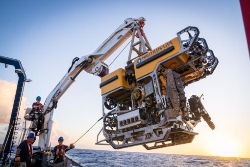
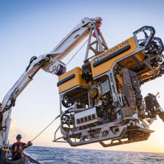
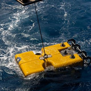
In 2025, Ocean Exploration Trust (OET) and its partners will explore deep-sea habitats in the Western Pacific using E/V Nautilus, its mapping sonars, ROV systems, and other exploration technologies brought aboard from the NOAA Ocean Exploration Cooperative Institute (OECI). Join us in characterizing deep-sea habitats in the Mariana Islands, the Republic of the Marshall Islands, the Solomon Islands, and the Pacific Islands Heritage Marine National Monument. The 2025 E/V Nautilus expeditions are primarily sponsored by NOAA Ocean Exploration via the Ocean Exploration Cooperative Institute.
“Ocean Exploration Trust is grateful to collaborate with NOAA’s OECI and its federal, public, and private partners within the broader ocean science community,” says Allison Fundis, OET COO. “OECI’s mission to map and characterize our vast ocean territory, develop new technologies, and inspire the next generation of ocean scientists and engineers is one we are proud to be a part of.”
Our five 2025 expeditions will build ocean knowledge supporting international scientific and U.S. governmental priorities, particularly understanding ocean changes, sharing that knowledge with others, and contributing new discoveries and data to inform future conservation and resource management decisions. The goals of these expeditions are co-developed with national exploration priorities and input from scientists, resource managers, and local community stakeholders in the regions where the expeditions will take place.
“With the vast majority of our ocean remaining completely unexplored, we need to be strategic in terms of where to focus our exploration efforts to have the biggest impact in terms of making new discoveries, as well as advancing science and resource management priorities,” says Daniel Wagner, OET Chief Scientist. “Over the last year, we have been working with numerous scientists, resource managers, educators, and other stakeholders to co-develop expedition plans that address priority needs.”
Through the open sharing of data collected during these expeditions, we will build upon decades of study, stewardship, and discoveries. Mapping and ROV operations will directly contribute to the US National Strategy for Ocean Mapping, Exploration, and Characterization, the Beyond the Blue: Illuminating the Pacific campaign, and other coordinated initiatives. The integration of different technologies, including landers and autonomous underwater vehicles, into operations on E/V Nautilus continues to advance national priorities for increasing the efficiency and sophistication of multi-vehicle ocean exploration.
“NOAA Ocean Exploration is looking forward to another season of exploration in the Pacific Ocean with our partners at OECI and OET,” says Dr. Aurora Elmore, NOAA Ocean Exploration Cooperative Institute Program Manager. “With the new and emerging technologies that will be used this year, we are excited to fill gaps in basic understanding of the deep-ocean environment, from learning more about previously unseen geological features and creatures to advancing the science that underpins resource management.”
From May to September 2025, E/V Nautilus expeditions will be streamed live on NautilusLive.org, a 24-hour platform that brings ocean exploration directly to viewers on shore. Telepresence technology allows viewers to engage with the team at sea, asking questions and receiving real-time behind-the-scenes updates via social media. Classrooms worldwide are invited to connect with the at-sea team of STEAM professionals via free educational Q&A interactions. Additionally, OET offers free STEAM educational resources for K-12 learners in English, Spanish, Palauan, Samoan, and ʻŌlelo Hawaiʻi, including national-standard aligned activities, engineering design challenges, and creative projects for learners in the classroom or at home.
Ocean Exploration Trust is committed to building connections with local communities in expedition regions through co-developing expedition plans, making data publicly accessible, and coordinating outreach with schools and community groups. As E/V Nautilus is a guest in the Western Pacific, we honor and acknowledge the many cultures that have a deep connection to this ocean region and continue to steward through generations the ocean, seas, coastlines, and lands. We welcome collaborative partnership inquiries at info@oet.org.
2025 EXPEDITION OVERVIEWS
Mariana Arc Volcanic Exploration | May 7 - 29, 2025
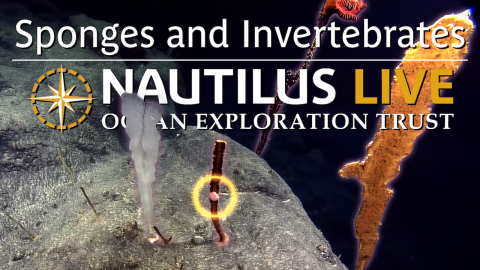
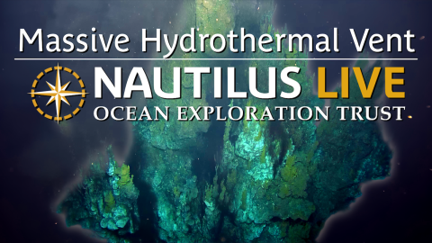
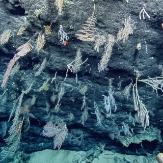
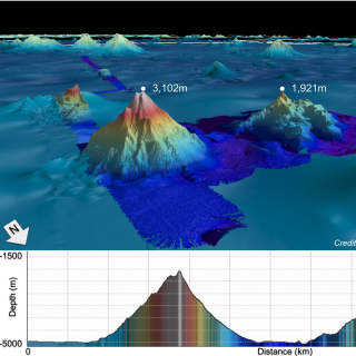
E/V Nautilus will begin the 2025 season exploring the ocean surrounding the Mariana Islands- one of the most tectonically and volcanically dynamic locations on the planet. This area is home to one of the most active arc volcanic systems on Earth, with more than 60 submarine volcanoes and a back-arc spreading center where new seafloor is created. This 22-day expedition will utilize the ROV and mapping systems of E/V Nautilus in combination with the Orpheus AUV to explore deep-sea areas identified by the local management and science community, including sites with signatures of active volcanism, abyssal plain habitats, and areas in and around the Mariana Trench Marine National Monument where new data can support resource management priorities. This expedition is funded by NOAA Ocean Exploration via the Ocean Exploration Cooperative Institute, including additional support from the Bureau of Ocean Energy Management in collaboration with the US Geological Survey.
Exploring Mud Volcanoes and the Mariana Trench | June 2 - 28, 2025
The westernmost portion of the United States, the Mariana Trench Marine National Monument, protects 246,608 square kilometers of submerged land around the Mariana Islands. The monument contains many unique habitats, including the deepest ocean areas and the largest known mud volcanoes on Earth. Yet, the majority of the seafloor inside the Monument has not been explored with modern technologies, with the overlying water column remaining virtually unexplored. This 26-day expedition will explore the seafloor and overlying water column around the Mariana Trench through the use of various technologies from partner institutions of the Ocean Exploration Cooperative Institute, including the University of Rhode Island’s Deep Autonomous Profiler, University of Hawaiʻi’s Hadal Water Column Profiler, OET’s ROVs, and Woods Hole Oceanographic Institution’s eDNA samplers integrated onto ROV Hercules. This expedition is funded by NOAA Ocean Exploration via the Ocean Exploration Cooperative Institute.
Maritime Archaeology of Guadalcanal: Iron Bottom Sound | July 2- 23, 2025
Located in the Solomon Islands between the islands of Guadalcanal, Savo, and Nggela, the Iron Bottom Sound was the stage of five major naval battles that occurred between August and December 1942, which resulted in the loss of over 20,000 lives, 111 naval vessels, and 1,450 planes. These underwater cultural heritage sites now rest on the seafloor offshore Honiara in a confined area less than 25 nautical miles wide, 40 nautical miles long, and 1,400 meters deep. To date, fewer than 100 of these U.S., Japanese, Australian, and New Zealand military ships and planes have been located. This 21-day expedition will utilize the remotely operated vehicle and telepresence systems of E/V Nautilus, in combination with the mapping capabilities of uncrewed surface vehicle DriX, to conduct non-invasive archaeological surveys of cultural heritage sites in the Iron Bottom Sound. This expedition is funded by NOAA Ocean Exploration via the Ocean Exploration Cooperative Institute.
Deep-Sea Habitats of the Marshall Islands | July 27 - Aug 17, 2025
The Republic of the Marshall Islands is an atoll-based country of over 1,200 islands surrounded by 2.13 million square kilometers of ocean, the vast majority of which has never been surveyed. Despite data gaps, it’s known that the deep sea of Aolepān Aorōkin Ṃajeḷ hosts rich and diverse marine resources, including over 300 unexplored seamounts, extensive deep-sea ridges and escarpments, and numerous historically significant underwater cultural heritage sites associated with World War II. This 21-day telepresence-enabled expedition will utilize the mapping, ROV, and telepresence systems of E/V Nautilus to collect critical ocean baseline information to support marine spatial planning in the Marshall Islands, as well as long-standing collaborations between the U.S. and the Marshall Islands on protecting fisheries and the environment and strengthening regional security. This expedition is funded by NOAA Ocean Exploration via the Ocean Exploration Cooperative Institute.
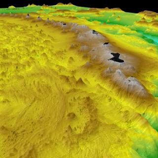
Mapping Around Wake Atoll | August 20 - September 11, 2025
For our final expedition of 2025, E/V Nautilus will explore the waters surrounding Wake Atoll, one of the most poorly surveyed ocean areas under US jurisdiction. Seafloor mapping data is urgently needed in this Western Pacific territory to support the priorities of the Pacific Islands Heritage Marine National Monument and the Wake Atoll National Wildlife Refuge, including follow-on surveys to better understand the deep-water natural and cultural resources of the region. This expedition will utilize the deep-water mapping capabilities of E/V Nautilus to map previously unsurveyed seafloor in the U.S. Exclusive Economic Zone surrounding Wake Atoll, as well as other unmapped areas along the transit route. This expedition is funded by NOAA Ocean Exploration via the Ocean Exploration Cooperative Institute.
Mattingan: Mariana Arc Volcanic Exploration
E/V Nautilus will begin the 2025 season exploring the ocean of the Mariana Islands- one of the most tectonically and volcanically dynamic locations on the planet. This area is home to one of the most active arc volcanic systems on Earth with more than 60 submarine volcanoes, and a back-arc spreading center where new seafloor is created.
Exploring the Offshore Marianas
Update: Ongoing mechanical repair of a ship system has changed operational plans for the NA172 expedition, postponing the water column exploration and remotely operated vehicles portion of this expedition within the Mariana Trench Marine National Monument.
Maritime Archaeology of Guadalcanal: Iron Bottom Sound
Located in the Solomon Islands between the islands of Guadalcanal, Savo, and Nggela, Iron Bottom Sound was the stage of five major naval battles between August and December 1942 which resulted in the loss of over 20,000 lives, 111 naval vessels, and 1,450 planes. These underwater cultural heritage sites now rest on the seafloor offshore Honiara in a confined area less than 25 nautical miles wide, 40 nautical miles long, and 1,400 meters deep.
Deep-Sea Habitats of the Marshall Islands
The Republic of the Marshall Islands is an atoll-based country of over 1,200 islands surrounded by 2.13 million square kilometers of ocean, the vast majority of which has never been mapped or surveyed.
Seafloor Mapping Offshore Howland & Baker Islands
During this expedition, E/V Nautilus explores the waters offshore Howland & Baker Islands. Located roughly midway between Hawaiʻi and New Zealand in the Central Pacific Ocean, the islands of Howland and Baker are some of the most isolated land masses on Earth.