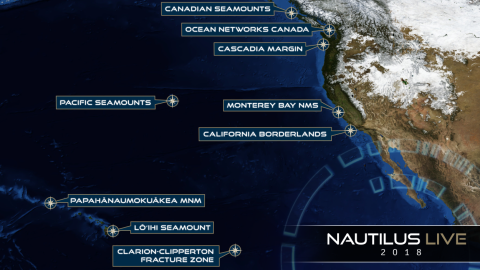
Launching the 2018 Nautilus Expedition Season, this short mapping expedition will transit from San Pedro to San Francisco, with seafloor mapping focused on completing gaps from previous mapping expeditions. Three areas have been identified for mapping with the Nautilus multibeam echosounder and sub-bottom profiler in the Channel Islands National Marine Sanctuary and adjacent waters. The purpose of these surveying efforts is for general bathymetric data collection, seafloor characterization, and as a secondary goal, seep detection.
Additionally, this expedition will map near the site of a recent earthquake south of Santa Cruz Island, the largest of the Channel Islands, where there may also be significant slides underwater. This may affect biological communities that were visited during previous Nautilus expeditions. Later expeditions have an opportunity to directly study the effects of a moderate undersea earthquake on the local fauna, and mapping will be undertaken in the area to evaluate changes from previous mapping.
Sponsored by: NOAA Office of Exploration and Research