2025 Expedition

Deep-Sea Habitats of the Cook Islands

October 1 – 21, 2025
NA176
Coral colony Credit Ocean Exploration Trust
Expedition Leader
Co-Lead Scientist
Co-Lead Scientist

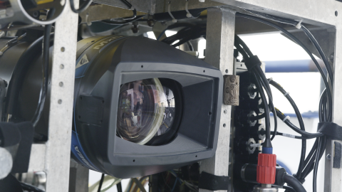
This 21-day expedition will utilize the ROV, mapping, and telepresence systems of E/V Nautilus to explore previously unsurveyed deep-sea priority areas identified by the management and science community in the Cook Islands.  

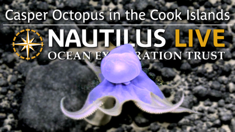
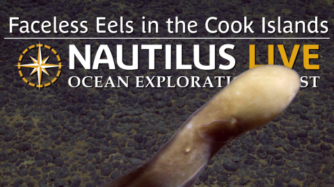
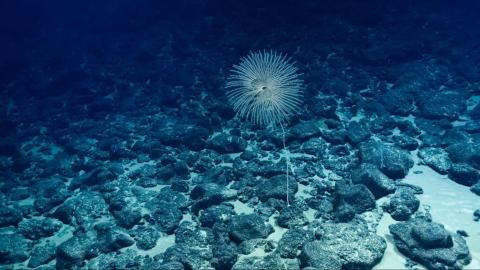
Located in the South-Central Pacific, the Cook Islands are comprised of 15 islands surrounded by over 770,000 square miles of ocean, the vast majority of which remains unmapped and unexplored. This deep-sea region contains extensive abyssal plains, seamounts, and volcanic ridges, making it one of the most geologically and biologically significant ocean areas in the Pacific. Together, these features form the foundation of Marae Moana, a large-scale marine managed area that extends over the entire EEZ of the Cook Islands, established to balance ocean conservation with sustainable resource use. 

This expedition will collect deep-sea data to support and inform resource management decisions, including improving the understanding of seabed environments and natural and mineral resources throughout the region. Together, the team will generate a rich foundation of data to stimulate further exploration, research, and management activities; data collected on this mission will be provided to the Cook Islands Government and archived in publicly available repositories. This expedition is supported by NOAA Ocean Exploration via the Ocean Exploration Cooperative Institute, in partnership with Ocean Exploration Trust and the Cook Islands Seabed Minerals Authority.

Expedition Partners

Meet the Team

Expedition Posts

Cook Islands geology map
Credit
Ocean Exploration Trust

The 15 islands that make up the Cook Islands are distributed across two broad groups with distinct geologic histories. The northern islands consist entirely of low-lying atolls. These features are within longer seamount chains and are often capped by thick coral carbonates that developed over millions of years as features drifted away from their volcanic sources. The southern islands are generally younger and include several volcanic islands. Rarotonga, the largest and youngest of the high islands, is believed to have formed independently from nearby hotspot tracks, instead representing a unique mantle plume not linked to regional chains.

ROV Little Hercules on E/V Nautilus
Credit
Ocean Exploration Trust

Making its first appearance of the 2025 season, the NA176 team will explore with ROV Little Hercules in tandem with ROV Atalanta to reach the depths of the Cook Islands, below what ROV Hercules can reach. Little Hercules will focus on visual surveys of abyssal plain habitats north of Aitutaki at depths below 4,500 meters, approaching 15,000 feet. Learn more about ROV Little Hercules here.
 

Cook Islands in Pacific Ocean
Credit
Ocean Exploration Trust

Located in the South-Central Pacific, the large ocean state of Cook Islands comprises 15 islands surrounded by nearly 2 million square kilometers of ocean, the vast majority of which remains unmapped and unexplored. This #deepsea region contains extensive abyssal plains, plateaus, and seamounts, and is one of the largest territories managed by a single Pacific nation. Together, these habitats are part of Marae Moana, a large-scale marine managed area that spans the entire Cook Islands Exclusive Economic Zone, established to balance conservation with economic development. The Cook Islands EEZ is one of the top 20 largest in the world- about the same size as Mexico!