Understanding the Cook Islands’ Deep Sea Through Science

As conversations about the deep sea make the news and public discourse, they often carry a mix of curiosity and concern. Recent public discussions around deep-sea mining have sparked important questions about anyone working in the depths — including scientific expeditions like ours aboard E/V Nautilus.
We welcome these questions and discussions. They reflect a growing global awareness that what happens far below the surface matters deeply to all of us. But it’s also important to clarify what scientific exploration means — and what it doesn’t. The mission of the Ocean Exploration Trust is about making discoveries, not extracting resources; gaining knowledge, not profit.
Scientific Understanding, Not Prospecting
Let’s start with the biggest question: Does Nautilus survey for mining?
No. The Ocean Exploration Trust and our partners aboard E/V Nautilus do not engage in mineral exploration, prospecting, or extraction. Our mission is solely scientific — to understand the composition, distribution, and health of deep-sea habitats, geological features, and submerged archaeological resources, how deep-sea systems function, and how life thrives in extreme environments. In other words, our mission is about understanding what is found in the deep sea and how that is connected to other parts of our planet.
During our Deep-Sea Habitats of the Cook Islands expedition, we focused on collecting rigorous data to expand the understanding of this region’s seafloor. As in all of our previous 175 expeditions aboard E/V Nautilus, our goal was to collect data in a transparent manner using the highest scientific standards and to make that data publicly available. Our data is collected and managed using meticulous, systematic, and disciplined methods to ensure it is accurate, trustworthy, and free from bias, as well as made publicly available for anyone interested to learn more, particularly from the geographies where expeditions take place. Our goal was to ensure that Cook Islanders have accurate data about their deep ocean, so they can make informed decisions about their future.
This expedition did not aim to evaluate, affirm, or contradict any management decisions made by the Cook Islands Government in regards to seabed minerals or other ocean resources. The Ocean Exploration Trust and its sponsors do not have any jurisdictional authority or role in decisions related to seabed mining or marine protection in the Cook Islands.
Why We Explore the Deep Sea
The deep sea remains Earth’s final frontier. Despite covering nearly three-quarters of the planet and containing 95% of the volume that is habitable to life, most of it remains unseen and unmapped. To date, only about 27% of the global seafloor has been mapped, and only 0.001% of it has been imaged.
Every ROV dive, every mapping survey, and every sample collected by E/V Nautilus contributes to filling the large knowledge gaps that remain across the largest and least known part of our planet, the deep sea. Over the last 17 years, E/V Nautilus has conducted scientific expeditions in over 40 countries, making numerous major scientific discoveries and providing transparent, open access to local communities during that time. Our mission is purely scientific, not an advocacy-based one. We strive to collect information to the highest scientific and integrity standards, and make it easily accessible.
By sharing our data widely, we strive to help others to better understand our planet, so we can all make informed, evidence-based decisions. Our data can be accessed by anyone, including scientists, traditional knowledge holders, educators, resource managers, and policy makers from government agencies, academic institutions, community-based organizations, non-governmental institutions, cultural groups, and private organizations.
A Journey In the Cook Islands’ Depths
For three weeks, the Deep-Sea Habitats of the Cook Islands expedition team used remotely operated vehicles (ROVs) and advanced mapping systems to explore deep-sea environments in areas that had no or inadequate scientific surveys in the past. Our expedition collected high-quality deep-ocean data using various state-of-the-art technologies.
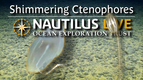
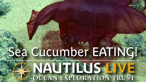
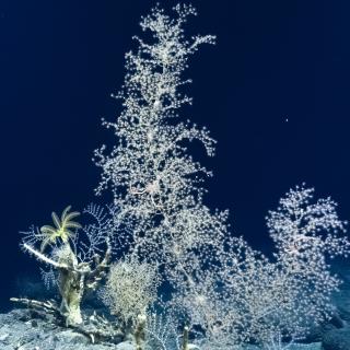
Over the course of seven dives and close to 200 hours in the water, our ROVs reached depths greater than 5,100 meters (17,000 feet), surveying over 50 kilometers of seafloor through abyssal plains, deep knolls, and seamount habitats. Along the way, our ultra-high-resolution camera captured footage of more than 400 different kinds of deep-sea animals, from delicate sponges to towering squids, predatory abyssal fish to carbon-cycling sea cucumbers in their home habitats.
Our mapping systems charted more than 14,000 square kilometers of seafloor — an area roughly 208 times the size of Rarotonga — including previously unsurveyed sections of the abyssal plain and Manihiki Plateau.
This wasn’t exploration behind closed doors. Through live streams and ship-to-shore education events, more than 150,000 people in the Cook Islands and around the world joined the expedition virtually in real time. And while the at-sea portion of the expedition has now concluded, its rich datasets will continue to be available for everyone who wonders what lies beneath the waves.
Where the Data Goes — and Why It’s Shared
The data collected during each Nautilus mission becomes part of the global commons. All maps, imagery, and environmental measurements from the Cook Islands expedition will be made publicly available through trusted repositories, including:
- NautilusLive website (expedition summary, background information, highlight imagery, and informational materials)
- YouTube (full-ROV dive videos archives and educational highlight videos)
- Rolling Deck to Repository (ship navigation, mapping, and weather data)
- Marine Geoscience Data System (seafloor mapping and ROV data)
- and locally, through the Cook Islands Seabed Data Repository, ensuring that Cook Islanders can directly access and manage the information about their ocean.
Transparency is the cornerstone of our mission. Open data enables collaboration across borders and disciplines, empowering local leaders, students, and scientists to use that information for research, education, and informed, responsible decision-making.
How the Data Can Be Used
There are many potential uses for the large amount of mapping, environmental, and imagery data that was collected during this expedition, including to further our scientific understanding of the biodiversity and geological context of the region. We hope that researchers from a wide variety of disciplines will use our data for many years to come, which is why we make all of this data publicly available.
By surveying previously unsurveyed areas, this expedition helps build upon a foundation for stewardship and future research activities — contributing to the science and management priorities of the Marae Moana Marine Park, its marine spatial planning process, the Cook Islands ecosystem-based management framework, as well as global initiatives like Seabed 2030 and the UN Decade of Ocean Science for Sustainable Development.
Collaboration at the Core
The Deep-Sea Habitats of the Cook Islands expedition was developed in close partnership with the Cook Islands Government in response to its request for US Government support with deep-sea scientific expertise. The expedition was funded by NOAA Ocean Exploration via the Ocean Exploration Cooperative Institute, a consortium of several world-leading oceanographic research institutions.
The expedition team included participants representing several government and academic organizations from the Cook Islands, including Cook Islands Seabed Minerals Authority, Cook Islands National Environmental Service, Cook Islands Ministry of Marine Resources, Ministry of Foreign Affairs and Immigration, in addition to researchers from the US, Canada, Latin America, Oceania, Europe, Asia, and Africa, who participated remotely through our scientists ashore program.
Exploration Underpins Stewardship
It’s easy to associate scientific exploration with mineral exploration and exploitation, but they are not the same. By studying the deep sea, amid ongoing human impacts and ahead of potential new industrial activities, we can help form a strong foundation of knowledge that can guide evidence-based decisions.
The Ocean Exploration Trust believes that responsible ocean stewardship begins with curiosity and learning. Our hope is that through open science, collaboration, and public engagement, we can all play a role in understanding this extraordinary, unseen world and inspiring generations to come.
Deep-Sea Habitats of the Cook Islands
This 21-day expedition will utilize the ROV, mapping, and telepresence systems of E/V Nautilus to explore previously unsurveyed deep-sea priority areas identified by the management and science community in the Cook Islands.