2019 Nautilus Expeditions
2019 Expedition Season
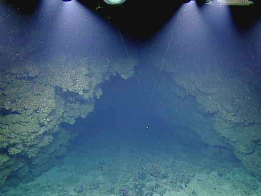
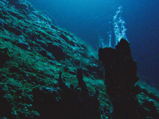
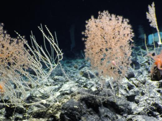
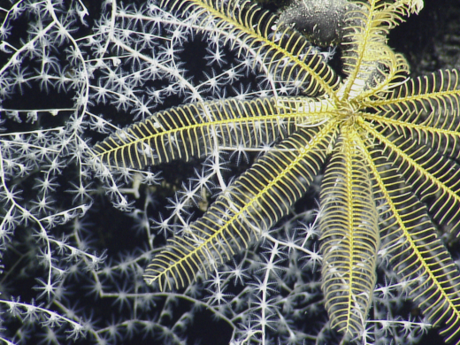
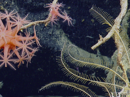
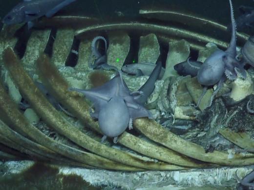
E/V Nautilus and its Corps of Exploration ventured further west and south than ever before in 2019, the fifth year of exploration in the Eastern Pacific Ocean. The nearly 200 day expedition season included mapping and ROV exploration in national marine sanctuaries along California, the second expedition of the multi-year NASA SUBSEA program, and sailing out to remote regions of the central Pacific to search for two maritime heritage sites and document deepwater coral communities. New research partners included the National Marine Sanctuary of American Samoa and the U.S. Fish and Wildlife Service within the Pacific Remote Islands National Marine Monument, both expansive protected areas about which comparatively little is known, in large part due to their remote locations.
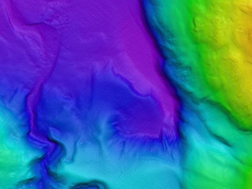
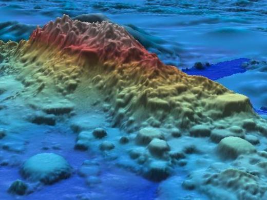
OET mapped more of the ocean’s seafloor this year than any on record, over 135,340 km2. This marks a major contribution to the Seabed 2030 effort to map the entire world’s seafloor by 2030, particularly since Nautilus surveyed remote US territories otherwise unlikely to be mapped. Continuing partnerships with groups including the National Geographic Society allowed comprehensive mapping and exploration within the Phoenix Islands Protected Area, particularly around Nikumaroro Island while searching for Amelia Earhart’s plane. This year also marked the first deployment of our mobile capabilities, as OET and the University of New Hampshire’s Center for Coastal and Ocean Mapping worked with the Thunder Bay National Marine Sanctuary to map lakebed habitat in northwestern Lake Huron.
2019 Nautilus Expeditions
Osborn Bank
Launching the 2019 Nautilus Expedition season, the Osborn Bank expedition is a continuation of a multi-year collaborative expedition to collect high-resolution mapping data and characterize submerged shorelines in the California Borderland region. The focus of this year’s exploration continues in the Channel Islands off Southern California where Nautilus has been working for the last four years.
Previous Nautilus expeditions in the area focused on locating and documenting a series of ancient or paleoshorelines that were formed when the sea stopped rising for periods lasting a few thousands of years, allowing the sea to cut caves into the newly exposed sea cliffs, much as it does today. One of these caves will serve as an underwater experimental laboratory to test 3D imaging system that will eventually be used to explore caves that are far deeper than divers can go, in a collaborative effort to gain information on coastlines of the ancient past.
This well-known stretch of the California coastline did not always look the way it does now. Within the California Borderland, the Channel Islands region has a complex geologic history, starting with a fiery formation by submarine volcanism 19-15 million years ago and subsequent millions of years of movement. While the foundations were shifting, changing uplift rates and glacial cycles also resulted in fluctuating sea levels eroding away the islands, leaving strands of sedimentary rocks both above and below the current sea level as evidence of ancient paleoshorelines.
Sponsored by: NOAA Office of Exploration and Research & Office of Naval Research
California Mapping
This expedition will continue previous years of mapping by Nautilus to provide the foundational seafloor mapping data set of a number of priority sites of Greater Farallones National Marine Sanctuary (GFNMS) and Cordell Bank National Marine Sanctuary (CBNMS). GFNMS protects 3,295 square miles, and the CBNMS encompasses 1,286 square miles of seafloor habitat, and achieving a better understanding of habitats in these regions helps to inform conservation and management.
Data collection of high resolution bathymetry and seafloor characterization will inform dive planning later in the year as E/V Nautilus returns in October 2019 to visually survey some of these regions using remotely operated vehicles (ROVs). Priority sites include the Point Area Biogenic Area South, particularly in areas that are proposed to be opened to bottom trawling and adjacent areas proposed to be closed in 2019. Data will also be used to identify areas for future research of deep-sea corals and sponge habitats that will serve as sentinel sites for ocean acidification monitoring and identification of impacts within an upwelling region.
Gorda Ridge
This expedition continues the multi-year SUBSEA (Systematic Underwater Biogeochemical Science and Exploration Analog) Research Program, a partnership between NASA, NOAA, and various academic research centers. Bringing together both ocean and space exploration teams aboard E/V Nautilus, SUBSEA blends ocean exploration with ocean worlds research to address knowledge gaps related to the exploration of our Solar System.
The SUBSEA team will conduct the second of its two field programs at the Gorda Ridge offshore of northern California and Oregon, building upon the work conducted during the first field program at Lō`ihi Seamount in 2018. This section of mid-ocean ridge is of interest to ocean researchers in that it hosts seafloor hydrothermal activity that departs from the convention of black smoker hydrothermal systems, instead emitting clear fluids from the seafloor.
The SUBSEA research team includes interdisciplinary teams focused on Science, Science Operations, and Technology. The SUBSEA Science team is using ROVs to observe, survey, gather instrument data, and collect samples from analog environments to potential volcanic hydrothermal systems on other Ocean Worlds, such as Enceladus, a moon of Saturn. The SUBSEA Science Operations research team focuses on the ethnographic study of the work practices, habits, communication and information flows necessary to conduct remote science and exploration, by observing both operations conducted by the SUBSEA team on the E/V Nautilus and located at the Inner Space Center, University of Rhode Island. Finally, the SUBSEA Technology research team will provide Exploration Ground Data Systems software to support integration and visualization of diverse data products relevant to future human exploration of deep space.
Sponsored by: NOAA Office of Exploration and Research and NASA Science Mission Directorate PSTAR Program
Pacific Seamounts
This mapping expedition will focus on unmapped areas of the Pacific between San Francisco and Honolulu as E/V Nautilus operations move out into the Pacific Ocean between the Hawaiian Islands and Samoa. The transit route will utilize the multibeam echosounder and sub-bottom profiler to fill in gaps in seabed mapping coverage across the Pacific, plus targeted mapping of a number of seamounts in the vicinity of the Murray Fracture zone. One targeted region is a series of linear seamounts known as the Moonless Mountains, and mapping will support the analysis of the geological structure and processes of the relationship of these seamounts to the adjacent fracture zone.
Systematic mapping of the seafloor by echosounder commenced nearly a century ago, however, more than 80% of the world’s seafloor is still not mapped, even at a resolution of 1km, and the eastern Pacific Ocean is no exception. The seafloor mapping by Nautilus plays an integral part with planning and successful execution of future ROV dives and other ocean observations. In addition to the direct value gained supporting Nautilus cruises, the seabed mapping data and products on this expedition directly contribute to international mapping efforts including the Nippon Foundation-GEBCO Seabed 2030 Project.
Sponsored by: NOAA Office of Exploration and Research
Kingman Reef, Palmyra Atoll, and Jarvis Island
Deep waters in the remote central Pacific remain some of the most poorly studied environments on Earth. This expedition will focus on exploring deep-water features in the vicinity of Kingman Reef, Palmyra Atoll, and Jarvis Island within the Pacific Remote Islands Marine National Monument. The waters of these remote Pacific territories are among the least explored U.S. holdings in the Pacific Ocean. Expedition objectives will focus on characterizing the seafloor using bathymetric mapping systems where no previous mapping has been conducted or significant gaps exist. Visual seafloor characterization will be conducted using ROV dives on features that can add to the knowledge of geological, biological, and oceanographic patterns and processes in the area.
The Pacific Remote Islands Marine National Monument (PRIMNM) is among the largest marine protected areas in the world, but remains poorly explored due in part to its spatial isolation. Shallow-water environments in PRIMNM contain biodiverse communities of fishes and coral species and terrestrial environments are important habitats for seabirds colonies. While the diversity of species in shallow waters is relatively well known, deeper waters are not. In recent years there have been a few but growing list of expeditions to explore deep-sea environments within the PRIMNM units of Kingman & Palmyra and Jarvis Island.
Seamounts are likely to be the most abundant features to be explored on this expedition, both to survey mineral crust zone regions and add to provide additional constraints on the complex volcanic/tectonic history of the Line Islands, as well as survey biological communities. Deep-sea corals and sponges are some of the most abundant large organisms observed on the deep seafloor, yet many questions remain about their distribution and diversity on seamounts, islands, and atolls in the central Pacific. Given the remoteness of these territories, and lack of previous exploration, it is expected that the chances of encountering new species is high. High-resolution seafloor mapping and characterization of vulnerable or sensitive habitats within these areas will greatly support management and conservation efforts in the area.
Sponsored by: NOAA Office of Exploration and Research
Search for the Samoan Clipper
Working with the Air/Sea Heritage Foundation, the objective of this expedition is to locate, identify, and document the wreckage of Samoan Clipper, a Pan American Airways Sikorsky S-42B flying boat lost off the northwest coast of Tutuila, American Samoa in January 1938. If successful, the resulting survey will characterize an archaeological site with major significance to aviation and American Samoan history, determine the final resting place of pioneering Captain Edwin C. Musick and his 6-man crew, plus investigate the wreckage for evidence as to what lead to their fate.
Throughout the 1920s and 30s, Pan American Airways lead the way in establishing aerial links between the USA and the rest of the globe that would ultimately help to define the modern air transport industry. Sikorsky S-42 type flying boats, developed exclusively for Pan Am, served as the workhorses for this audacious effort and Samoan Clipper was the first of three such aircraft designated to make special long-range survey flights. The plane was tasked to inaugurate service between the United States and New Zealand by way of Alameda, Honolulu, Kingman Reef, Pago Pago in American Samoa, and Auckland. The man charged with this difficult undertaking was Edwin C. Musick, Pan Am’s Chief Pilot, who at one time held more records and honors than any other active flier, including the 1935 Harmon Trophy which recognized him as “the world’s outstanding aviator.”
Samoan Clipper was one of the first serious losses suffered by seminal air carrier Pan American in its long and illustrious history, and today no example of the innovative Sikorsky S-42 type aircraft survives in a museum or private collection, nor are there any currently known wrecks. In fact, barely any trace of this trailblazing fleet of flying boats still exists above or below the water. This expedition searching for the sunken Samoan Clipper represents a unique opportunity to study one of the most consequential of these craft and to do so in context of its pioneering survey work and tragic loss.
Sponsored by: Air/Sea Heritage Foundation
National Marine Sanctuary of American Samoa
The main objective of this expedition is to acquire baseline information on deep-sea and mesophotic habitat in American Samoa, with a special focus on the National Marine Sanctuary of American Samoa (NMSAS). Within deep-sea habitats, seafloor geology and biological communities will be documented and potentially new species of deep-sea coral and subsamples of rocks will be collected. In addition to seafloor mapping with multibeam sonar, a Lagrangian float will be utilized to capture high resolution photographic images of the mesophotic zone and associated biota.
American Samoa is the southernmost U.S Territory in the South Pacific, with the National Marine Sanctuary of American Samoa composed of six protected areas covering 13,581 square miles of nearshore coral reef and offshore ocean waters across the Samoan Archipelago. American Samoa is an oceanic archipelago with a small insular shelf, with the steep slope of the seafloor quickly dropping into mesophotic and deep sea depths.
Previous expeditions within this region provided a glimpse into the deep-sea habitat and mesophotic ecosystems of American Samoa. Mesophotic coral ecosystems occur in low light ocean zones from 30m to over 150m and are one of the most understudied components of the coral reef ecosystem. Expedition objectives include conducting a biological census of deep-sea and mesophotic communities, exploring a volcanically active seamount, seafloor mapping, and targeted sampling for potential new species and further environmental analysis. Data collection on the Nautilus expedition will help validate and further expand scientific knowledge of diversity and distribution of biological community assemblages within American Samoa and NMSAS.
Sponsored by: NOAA Office of National Marine Sanctuaries
Nikumaroro Island
National Geographic is conducting an expedition focused on solving the mystery of the disappearance of Amelia Earhart with Explorer-At-Large Dr. Robert Ballard, the President of Ocean Exploration Trust. Aviation pioneer Earhart is considered one of the most intriguing and inspirational figures in history whose loss was so profound it has been felt for decades, spawning countless theories about how and where she disappeared. Following clues that have led to remote Nikumaroro Island in the Pacific Ocean, Dr. Ballard and the team aboard E/V Nautilus, equipped with the very latest in technology and scientific expertise, plan to explore the surrounding waters using remotely operated underwater vehicles and autonomous surface vessels. The expedition will be featured in a National Geographic documentary releasing October 20, 2019.
Sponsored by: National Geographic Partners and National Geographic Society
Baker and Howland Islands and Johnston Atoll
The main objective of this expedition is to collect deepwater baseline information to support science and management decisions in and around U.S. marine protected areas in the central Pacific. We will conduct seafloor mapping and acquire video, biological, chemical, and geological samples in deep-sea portions of the Pacific Remote Islands Marine National Monument in order to better understand marine habitats, biogeographic patterns, seafloor mineral distribution, and the geologic history of these areas.
The Pacific Remote Islands National Marine Monument (PRIMNM) is one of the largest marine conservation areas in the world, encompassing seven national wildlife refuges on coral islands, reefs, and atolls. The five regions of PRIMNM cover 490,343 square miles and span the Central Pacific Ocean from Wake Atoll in the northwest to Jarvis Island in the southeast.
This Nautilus expedition will build upon previous expeditions to this region and continue to gather information about the topography, geology, and biology of this important United States territory and the surrounding areas. Mapping operations will focus on adding coverage to existing mapping data, conducting surveys to support ROV dive site planning, and mapping uncharted areas during transits. Geological collections will help define substrate type and refine age estimates for the features explored in this geologically complex region. Biological specimens will help define biogeographic boundaries, depth distribution and diversity of species, and observe the basic biology and ecology of these ecosystems, compared to other regions. In addition, the video collected will be used for diversity estimates, frequency, and fidelity of coral-associated communities, knowledge critical to evaluating the impact of the Marine Protected Areas on deep-sea ecosystems over time.
Sponsored by: NOAA Office of Exploration and Research
Pacific Seamounts
The expedition will focus on mapping from Honolulu to San Francisco, as the E/V Nautilus’ operations move back east to the US West Coast, in addition to the first deep water test of a new mobile ROV system. The mapping route has been planned to utilize the multibeam echosounder and sub-bottom profiler to fill in gaps in seabed mapping coverage across the Pacific.
Systematic mapping of the seafloor by echosounder commenced nearly a century ago, however, more than 80% of the world’s seafloor is still not mapped, even at a resolution of 1km, and the eastern Pacific Ocean is no exception. The seafloor mapping by Nautilus plays an integral part with planning and successful execution of future ROV dives and other ocean observations. In addition to the direct value gained supporting Nautilus cruises, the seabed mapping data and products on this expedition directly contribute to international mapping efforts including the Seabed 2030 project.
In collaboration with the Woods Hole Oceanographic Institution and NOAA Office of Exploration & Research, OET has designed and built a sister ROV system to complement the Hercules and Argus ROVs. During this expedition, a variety of engineering tests will be conducted with ROVs Little Hercules, Atalanta, and supportive equipment.
Sponsored by: NOAA Office of Exploration and Research
Greater Farallones and Cordell Bank National Marine Sanctuaries
This is a joint project visiting two distinct national marine sanctuaries off the coast of California. The region of Greater Farallones National Marine Sanctuary (GFNMS) and Cordell Bank National Marine Sanctuary (CBNMS) comprises one of the world’s most productive and biologically rich ocean areas and protects over 700 species of fish and deep benthic species. NOAA’s national marine sanctuaries are responsible for protecting the biological and cultural resources within their boundaries.
GFNMS recently expanded to double in size and now protects 3,295 square miles, thus requiring further exploration of deep-ocean habitats. This project will visit unexplored deep-sea coral reefs, some of which lie in the deepest regions of the sanctuary and are areas that are proposed by the Pacific Fisheries Management Council to be newly opened or closed to bottom trawling. This project will better define the role of rocky substrate in the deep ocean ecosystem and aid in understanding types of habitats and the biodiversity within the sanctuary to effectively manage the area.
CBNMS is entirely offshore encompassing 1,286 square miles of seafloor habitat. This project will continue exploration of deep canyon and slope habitat begun by by previous Nautilus expeditions. Areas of focus include regions of Bodega Canyon that were not previously explored, as well as depth zones along the slope that have not been surveyed to continue an inventory of deep-sea species and habitat zonation, particularly hard substrate that may be suitable for deep-sea corals and sponges.
There are many functions deep-sea corals and sponge communities provide to the ocean ecosystem, and a goal of these surveys will be to document the associations between the corals and other organisms, as well as the environmental conditions deep sea communities are experiencing and how that may affect their distribution, abundance, and condition.
Sponsored by: NOAA Office of National Marine Sanctuaries
Monterey Bay National Marine Sanctuary
The main objectives of this expedition are to revisit and further characterize the “octopus garden,” an unexplored, deep-water region of basaltic rocky reef that resides southeast of Davidson Seamount, within the borders of Monterey Bay National Marine Sanctuary (MBNMS). In October 2018, Nautilus and MBNMS discovered extensive aggregations of over 1,000 brooding female octopuses (Muusoctopus robustus). This genus has an unusual ‘upside-down’ brooding posture, with the underside of the arms exposed and the mantle toward the eggs, which are cemented to bare rock. This area was not fully explored and will be the first objective of this cruise.
Davidson Seamount is an inactive volcanic undersea mountain habitat off the coast of central California, and is considered to be an area of special national significance. One of the largest known seamounts in U.S. waters, the seamount has been called "an oasis in the deep" in an otherwise flat seafloor, hosting large coral forests, vast sponge fields, crabs, deep-sea fishes, shrimp, basket stars, and high numbers of rare and unidentified benthic species. Recent research suggests that this pristine area may be necessary for maintaining healthy coastal populations in the MBNMS, and it is important to characterize the range of these populations on adjacent hard substrate habitat.
Although extensive previous ROV dives have occured on the seamount proper, there is deep rocky habitat southeast of the seamount that could harbor additional communities of corals and sponges. This area was previously mapped in better detail by E/V Nautilus, revealing ridge-like features and several domes comprised of volcanic rock. If time permits, the ROVs will be used to characterize an unexplored flank of Davidson Seamount from base to summit.
Sponsored by: NOAA Office of National Marine Sanctuaries
Expedition Map
