2016 Expedition Season
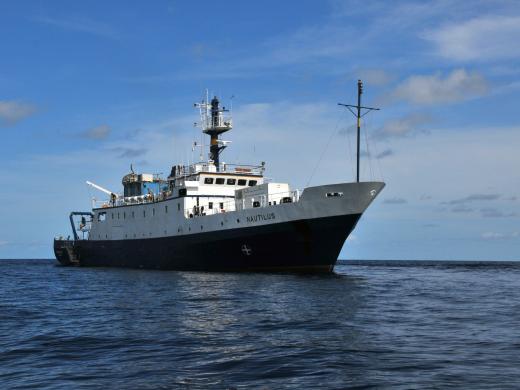
The Ocean Exploration Trust was founded in 2008 by Titanic-discoverer and National Geographic Explorer-in-Residence Dr. Robert Ballard to engage in pure ocean exploration. Our international programs center on scientific exploration of the seafloor and many of our expeditions are launched from aboard Exploration Vessel (E/V) Nautilus, a 64-meter research vessel operated by the Ocean Exploration Trust. In addition to conducting scientific research, we offer our expeditions to explorers on shore via live video, audio, and data feeds from the field. We also bring educators and students of all ages aboard during E/V Nautilus expeditions, offering them hands-on experience in ocean exploration, research, and communications.
2016 Nautilus Expeditions
Ocean Networks Canada
E/V Nautilus will begin her second season in the Pacific Ocean exploring Canadian waters with Ocean Networks Canada (ONC). ONC operates world leading cabled ocean observatories that supply continuous power and Internet connectivity to a broad suite of subsea instruments. The ONC observatory installations span one of the widest ranges of ocean environments found anywhere in the world.
The observatories allow scientists to operate instruments remotely and receive data at their home laboratories anywhere on the globe in real time. By co-locating instruments of different types, researchers can study interactions among geological, chemical, physical, and biological processes that drive the dynamic earth-ocean system. These long-term observations have wide-ranging policy applications in the areas of climate change, earthquakes and tsunamis, port security and shipping, sovereignty and security, and ocean sound management.
Nautilus will visit four sites along the NEPTUNE observatory off Vancouver Island’s west coast including: Barkley Canyon, Clayoquot Slope, Cascadia Basin and Endeavour. The primary objectives of the cruise will be to conduct dual-ship operations with cable ship Wave Venture to deploy and recover subsea fiber-optic cables used to power and transmit data across the NEPTUNE observatory. Along with these coordinated ship operations, Nautilus will also conduct seafloor mapping surveys, ROV surveys and sampling, and will deploy new instruments associated with the observatory in these diverse ocean environments.
Seeps and Ecosystems of the Cascadia Margin
Methane is a powerful greenhouse gas and an important commercial resource that fuels many elements of our lives on land. Scientists are beginning to understand the complex and varied ways methane fuels life beneath the sea as well. Nautilus will study methane seep habitats along the length of the Cascadia Subduction Zone, from southern British Columbia to northern California. Several sites along the Washington coast are well-studied ecosystems fueled by gas hydrate - a crystalline, consolidated chemical ice made of methane. Oceanographic and geologic conditions suggest gas hydrate and methane seep habitats should stretch all along the Cascadia Subduction Zone, but a comprehensive study of the region has never been done. Advanced mapping technology, like the Kongsberg multibeam system on Nautilus, allows scientists to detect methane bubble plumes in the water column and describe the extent of these habitats.
On this expedition, Nautilus and her Corps of Exploration will use mapping tools to survey the extent of methane seeps along the Pacific Northwest coastline. As habitats are identified, the ROVs will dive on these targets to investigate the structure and communities they support.
Current research indicates warming oceans will rapidly change the stability of these seafloor gaseous reserves, which may in turn have large effects on oceanic dissolved gas concentrations and the release of greenhouse gases into the atmosphere. A well-explored baseline understanding of this dynamic ecosystem will be essential for understanding changes as they occur.
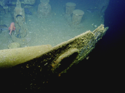
During this cruise, Nautilus will also explore the wreck of the World War II freighter SS Coastal Trader. The ROVs will conduct the first visual survey of this cultural heritage site as well as assess its condition and remaining vessel stability.
Central California Basic Exploration
Beneath the waves, the California coastline shares the same rugged topography as its shoreside parallel. Many submarine canyons cut across the continental slope, carrying shallow water life and shorebased nutrients efficiently into the deep sea. A stark contrast from the steady, sloping topography of the continental shelf, deep sea canyons provide steep gradients that provide a unique way to study biological communities and geochemical processes.
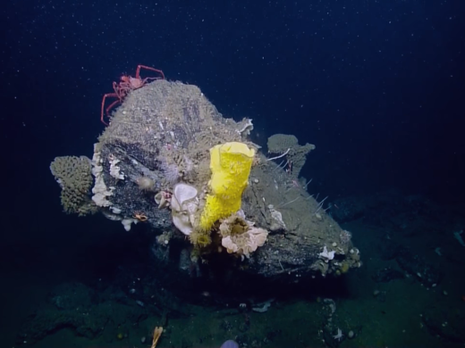
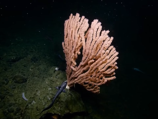
Many California seafloor canyons have been sampled and explored in depths shallower than 500m but little exploration has occurred deeper. Nautilus will explore the hardground communities from Bodega Canyon south to the Point Dume diving on canyons, rocky banks, terraces, and seamounts to survey the unique corals, sponges and sea life that inhabit these zones.
A component of this expedition will be to explore oxygen minimum zones along the Santa Barbara Basin and Channel Islands coastlines. These naturally hypoxic basins are home to significantly fewer infaunal organisms who normally drive sediment recycling. Exploring areas like these offers a unique opportunity to study paleo-climate at a high resolution by sampling lesser disturbed ocean sediments. Organisms adapted to these ecosystems are of special interest due to their success living in more acidic and less oxygenated water.
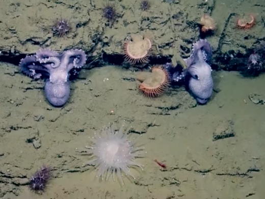
During this cruise, Nautilus will revisit a very large methane seep site initially mapped and characterized by the Corps of Exploration during the 2015 expedition. The ROVs discovered extensive orange, white, and grey bacterial mats, clam beds, and seeps within the oxygen minimum zone last year. The team will return to use sensors to geochemically map the seep site.
Channel Islands National Marine Sanctuary
The deep-water biological habitat and geological character of the seafloor around the Channel Islands are poorly understood despite considerable research in the area and a number of special designations in place to protect these regions. Less than 50% of the seafloor within the boundaries of the Channel Islands National Marine Sanctuary (CINMS) has been mapped by high-resolution sonar. Although CINMS is one of the agencies tasked with protection of deep-water habitats and deep sea corals around the islands, it lacks sufficient data on seafloor character, spatial locations of coral gardens and information on emerging threats on deep habitats such as climate change and ocean acidification.
Nautilus will use a high resolution mapping system to collect sonar bathymetry and sub-bottom profiling data to characterize the seafloor in these unmapped areas. Following mapping operations, Nautilus will utilize the ROVs to make observations, collect high-definition video imagery, collect biological and geological samples, and ground truth the newly collected multibeam data.
Nautilus will survey geological and geophysical aspects of the region, make new observations about the structure and nature of tectonic faults, ridges, seamounts, and basins, and potentially identify, characterize, and sample unmapped and unexplored features such as oxygen minimum zones, gas seeps, marine terraces, paleoshorelines, hardbottom habitats, and their associated benthic ecosystems.
Southern California Margin
In late summer, E/V Nautilus will be offshore Los Angeles to explore some of the most tectonically active (as well as densely populated) areas offshore California. The team will investigate the Southern California Margin, a broad area that fits entirely within the US Exclusive Economic Zone but that still remains largely unexplored. The margin is a heavily trafficked area and has been investigated for over 50 years, by the academic community, federal agencies, military, and petroleum and fisheries industries. However, high-resolution multibeam bathymetric coverage of the seafloor here remains less than 50% complete, leaving much to be discovered.
The California Borderland has an unusually rugged topography linked to the complex tectonic history of the west coast of the United States and includes prominent faults which lie closer than the San Andreas Fault to important centers of urban population. As well as contributing to an improved understanding of the offshore extent of these local geohazards, this cruise will also explore important biological ecosystems that have been found where active fluid flow has been located along such fault systems.
The Ocean Exploration Trust will also be partnering with the MIT Media Lab during this cruise to provide a test platform for research projects. MIT Media Lab students will deploy and test a new type of origami-based folding coral habitat structure. They will also be testing data visualization processes to introduce new open source technology and tools for Nautilus and the team. OET’s Honors Research Program students will deploy four oceanographic drifters to document the complexities of California’s surface currents.
Mapping the California Borderland
For the final leg of the 2016 expedition, Nautilus will work along the California Borderland region offshore San Diego to San Francisco. In this complex margin within America’s Exclusive Economic Zone, few areas of the seafloor have been extensively mapped. E/V Nautilus will utilize its hull-mounted multibeam echosounder to survey these zones and create maps to show the acoustically-derived bathymetry of the seafloor.
Although only about 10% of our world’s oceans have been acoustically mapped at, satellites equipped with altimetry sensors have been used to derive the bathymetry of the entire seafloor. The altimeters sense gravity anomalies of the sea surface that can be linked to topography (e.g. dip in the surface of the ocean over a trench). There is a tradeoff between bathymetry derived from altimetry versus shipboard acoustic sensors: multibeam systems map the seafloor at a high resolution and are accurate, but ships move slowly only having mapped about 1/10th of the seafloor. While there is global coverage from satellite altimetry-derived maps, the resolution of these maps is low, and the correlation between depth and a gravity anomaly is non-linear (meaning there is more room for error deriving bathymetry from satellite measurements).
Central California
Nautilus will return to the rugged Central California coastline for a short expedition to revisit sites which were unsurveyable during previous expeditions due to weather conditions. Beneath the waves, the California coastline shares the same rugged topography as its shoreside parallel. Many submarine canyons cut across the continental slope, carrying shallow water life and shore-based nutrients efficiently into the deep sea. This expedition includes dives at Partington Canyon. A stark contrast from the steady, sloping topography of the continental shelf, deep sea canyons provide steep gradients that provide a unique way to study biological communities and geochemical processes.
Many California seafloor canyons have been sampled and explored in depths shallower than 500m but little exploration has occurred deeper. Nautilus will explore these hardground communities to survey the unique corals, sponges and sea life that inhabit these zones.
Greater Farallones National Marine Sanctuary
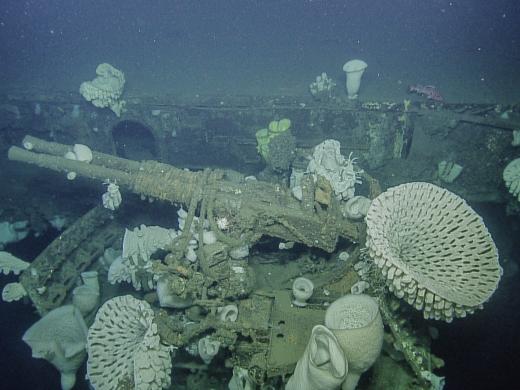
Nautilus will return northward along the California coastline for a cruise to study the cultural heritage and natural wildlife in the Greater Farallones National Marine Sanctuary (GFNMS). Recently expanded to protect 3,295 square miles, GFNMS contains over 400 shipwrecks and is largely unexplored in the deepest portions. Nautilus will survey the USS Independence, a World War II-era naval ship and former aircraft carrier, once used in the atomic tests at Bikini Atoll in the Pacific. Independence was scuttled offshore of San Francisco in 1951, rediscovered as the deepest shipwreck in GFNMS, and acoustically mapped by NOAA in 2015 using autonomous underwater vehicles. Nautilus will conduct the first visual survey of Independence since her sinking as well as image the ship for photomosaic and microbathymetry data. Two other shipwrecks, the Ituna, which was a historic steam yacht from 1886, and the freighter Dorothy Windermote will also be explored. In addition to documenting and mapping these wrecks, the shipwrecks’ roles as artificial marine habitat for fish and invertebrates will be assessed.
While in GFNMS, an additional goal of the cruise will be to characterize habitat of deep-sea coral and sponges. These zones will be prioritized for future research as they serve as sentinel sites for ocean acidification monitoring and identification of impacts within an upwelling region. The expedition will collect biological samples of deep-sea corals and sponges and associated species for species identification and growth rate studies. This expedition will contribute to the baseline understanding of fish, deep-sea coral and rocky substrate communities within GFNMS.
Expedition Map