2018 Expedition Season
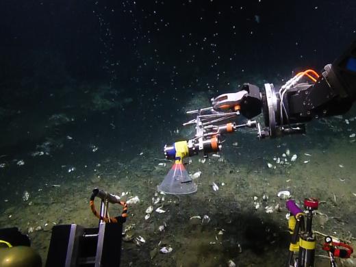
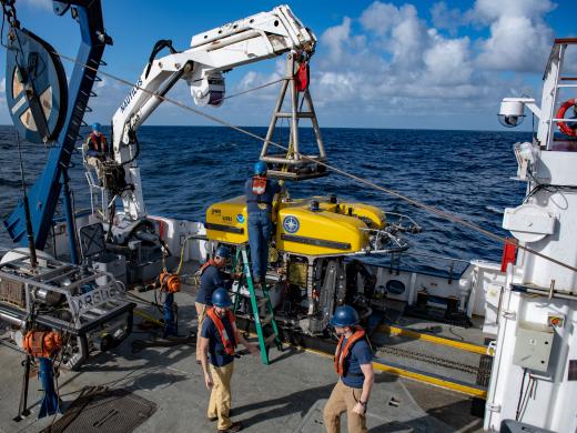
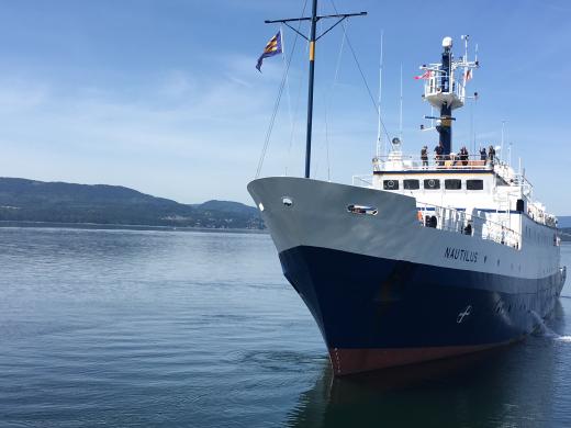
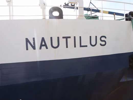
The Ocean Exploration Trust was founded in 2008 by Dr. Robert Ballard—best known for his discovery of RMS Titanic’s final resting place and as a National Geographic Explorer in Residence—to engage in pure ocean exploration. Our international programs center on scientific exploration of the seafloor with expeditions launched from Exploration Vessel (E/V) Nautilus, a 64-meter research vessel operated by the Ocean Exploration Trust. In addition to conducting scientific research, we offer our expeditions to explorers on shore via live video, audio, and data feeds from the field. We also bring educators and students aboard during E/V Nautilus expeditions, offering them hands-on experience in ocean exploration, research, and communications.
The 2018 Nautilus Expedition will launch the fourth year of exploration in the Eastern Pacific Ocean, and will be one of the most extensive seasons to date. From June to November, Nautilus will document and survey unexplored regions from British Columbia, Canada, along the West Coast of the United States, and for the first time, west to the Hawaiian Islands.
2018 Nautilus Expeditions
Southern California Mapping
Launching the 2018 Nautilus Expedition Season, this short mapping expedition will transit from San Pedro to San Francisco, with seafloor mapping focused on completing gaps from previous mapping expeditions. Three areas have been identified for mapping with the Nautilus multibeam echosounder and sub-bottom profiler in the Channel Islands National Marine Sanctuary and adjacent waters. The purpose of these surveying efforts is for general bathymetric data collection, seafloor characterization, and as a secondary goal, seep detection.
Additionally, this expedition will map near the site of a recent earthquake south of Santa Cruz Island, the largest of the Channel Islands, where there may also be significant slides underwater. This may affect biological communities that were visited during previous Nautilus expeditions. Later expeditions have an opportunity to directly study the effects of a moderate undersea earthquake on the local fauna, and mapping will be undertaken in the area to evaluate changes from previous mapping.
Sponsored by: NOAA Office of Exploration and Research
Cascadia Margin
The main objectives of this expedition are to explore for methane seeps and hydrate sites and to characterize their associated ecosystems along the U. S. Cascadia Margin. Gas hydrates and gas-filled pockets present in sedimentary deposits provide large reservoirs for methane in the Earth’s crust, and the importance of methane as a potent greenhouse gas has been recognized in recent years. Establishing a baseline by documenting and characterizing these sites is timely because geological events, such as earthquakes or submarine landslides, could result in important environmental impacts due to sudden methane release.
The Cascadia Margin, located offshore Washington, Oregon, and northern California, is of particular interest because high volumes of methane gas and hydrate are stored within this zone. Methane seepage from the Cascadia Margin is widespread, but the number of known sites has dramatically increased in recent years as modern multibeam sonar systems, like the system on E/V Nautilus, have been used to detect methane bubble streams in the water column in addition to collecting seafloor bathymetry and acoustic backscatter. A coordinated water column mapping and data mining effort by our research team in the past two years has resulted in the discovery of over 2700 new bubble streams at over 1000 individual sites on the Cascadia Margin, and this expedition will add to that ongoing research.
Sponsored by: NOAA Office of Exploration and Research
Cascadia Margin & Washington Mapping
This short expedition will transit from Astoria, Oregon to Sidney, British Columbia and will include seafloor mapping with the E/V Nautilus multibeam echosounder and sub-bottom profiler. Surveys will occur along the route on an opportunity basis to fill in gaps in high resolution mapping in the Olympic Coast National Marine Sanctuary for general bathymetric data collection and seafloor characterization. While transiting north, Nautilus will also attempt to locate and recover fragments of a rare, large meteorite fall that was observed off the coast of Washington in March 2018.
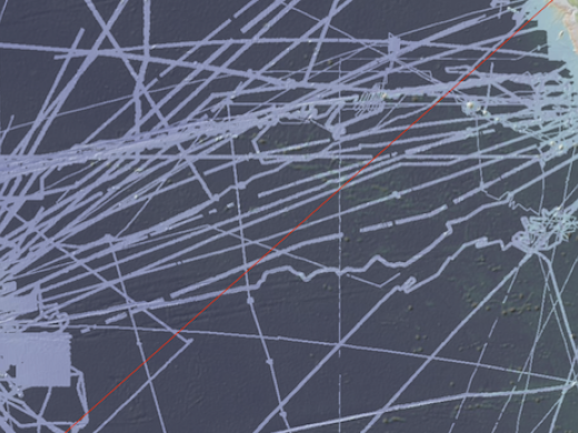
Systematic mapping of the seafloor by echosounder commenced nearly a century ago, however, more than 80% of the world’s seafloor is still not mapped, and the eastern Pacific Ocean is no exception. E/V Nautilus is equipped with a multibeam sonar and sub-bottom echosounder to collect bathymetric, surface sediment characteristic, subsurface geology and water column data. These types of seafloor mapping data are useful for identifying areas or features of interest, creating bathymetric charts for ROV dive planning and situational awareness, and locating hydrothermal vents and gas or oil seeps.
Sponsored by: NOAA Office of Exploration and Research
Northeast Pacific Seamounts
During this expedition, E/V Nautilus will visually survey three offshore Pacific seamounts with Fisheries and Oceans Canada in partnership with Ocean Networks Canada, Oceana Canada, and the Haida Nation. Seamounts are important for the resilience of biodiversity and fisheries, and Canada identifies them as Ecologically and Biologically Significant Areas. Current Canadian seamount conservation areas include the SGaan Kinghlas-Bowie Seamount Marine Protected Area and the large Offshore Pacific Seamount and Vents Closure, both of which will be surveyed by ROV and multibeam sonar during this expedition.
The SGaan Kinghlas-Bowie Seamount MPA encompasses a complex of three offshore submarine volcanoes active during the last ice age, forming the shallowest seamount in Canada. It is a rare habitat in the northeast Pacific Ocean and it is a biologically rich submarine volcano. The overall goals of this expedition are to increase knowledge of the distribution of Vulnerable Marine Ecosystems by providing the first baseline data and observations of environmental variability and species within this region to inform conservation and management objectives.
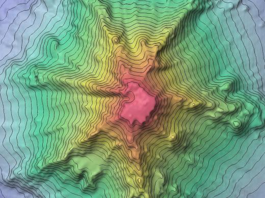
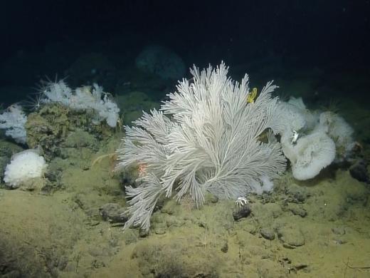
The expedition’s broad-scale survey activities will produce multibeam bathymetry maps of the seamounts, and provide information on the depth and topographic distribution of Vulnerable Marine Ecosystems, in particular sponge and deep-sea corals. At a selected sponge and coral site on Dellwood Seamount, the team will deploy an Autonomous Offshore MPA Monitoring System to acquire environmental data, including temperature, salinity, depth, dissolved oxygen, and currents. The resulting year-long time series will provide insight into seamount habitat variability over time, and establish a baseline for evaluating long-term change.
Sponsored by: Northeast Seamount Expedition Partners
Cette expédition verra le navire d’exploration Nautilus effectuer des relevés visuels de trois monts sous-marins extracôtiers du Pacifique avec Pêches et Océans Canada, en partenariat avec Ocean Networks Canada, la nation haïda et Oceana Canada. Les monts sous-marins sont importants pour la résilience de la biodiversité et des espèces visées par les pêches. Le Canada les désigne comme des zones d'importance écologique et biologique. Les actuelles zones canadiennes de conservation des monts sous-marins comprennent la zone de protection marine du mont sous-marin SGaan Kinghlas-Bowie et la grande Fermeture des zones de pêche des monts sous-marins et des évents hydrothermaux du Pacifique, qui feront toutes deux l’objet d’un relevé par VTG et sonar multifaisceau pendant cette expédition.
La ZPM du mont sous-marin SGaan Kinghlas-Bowie englobe un complexe de trois volcans sous-marins extracôtiers actifs dans la dernière ère glaciaire, formant le mont sous-marin le moins profond du Canada. Il s'agit d'un habitat rare dans le nord-est de l'océan Pacifique et de l'un des volcans sous-marins les plus riches sur le plan biologique. Cette expédition vise principalement à augmenter les connaissances sur la répartition des écosystèmes marins vulnérables en fournissant les premières données et observations de référence sur la variabilité environnementale et les espèces dans cette région afin d’éclairer les objectifs de conservation et de gestion.
Les activités de relevé à grande échelle de l’expédition produiront des cartes de bathymétrie par levés multifaisceaux des monts sous-marins, et fourniront des renseignements sur la répartition par profondeur et topographie des écosystèmes marins vulnérables, en particulier des éponges et des coraux qui vivent en eaux profondes. Dans un site particulier occupé par des éponges et des coraux du mont sous-marin Dellwood, l’équipe déploiera un système de surveillance des ZPM autonome afin d’obtenir des données environnementales, notamment la température, la salinité, la profondeur, le taux d’oxygène dissous et les courants. Il en résultera une série chronologique d’une année qui donnera un aperçu de la variabilité des habitats des monts sous-marins au fil du temps, et établira des données de référence sur l’évaluation du changement à long terme.
Ocean Networks Canada
This expedition marks the fourth season of E/V Nautilus exploring Canadian waters in partnership with Ocean Networks Canada. The main objective of this expedition is to provide maintenance and support of Ocean Networks Canada’s NEPTUNE observatory located off the west coast of Canada. This 800 km loop of fiber optic cable supplies continuous power and Internet connectivity to a broad suite of subsea instruments, enabling scientists to operate instruments remotely and receive data at their home laboratories anywhere on the globe in real time.
The NEPTUNE observatory spans one of the widest ranges of ocean environments found anywhere in the world, ranging from the outer coast of Vancouver Island to a mid-ocean ridge. Five observatory nodes collect data on physical, chemical, biological, and geological aspects of the ocean over long time periods, supporting research on complex Earth processes in ways not previously possible. These long-term observations have wide-ranging policy applications in the areas of climate change, earthquakes and tsunamis, port security and shipping, sovereignty and security, and ocean sound management.
This expedition will include work at four NEPTUNE observatory sites including Barkley Canyon, Clayoquot Slope, Cascadia Basin, and Endeavour Vent Field. In addition to deploying, recovering, and providing maintenance for various observatory sensors and instruments, Nautilus will also conduct seafloor mapping surveys, ROV surveys, and sampling.
Sponsored by: Ocean Networks Canada & University of Victoria
Pacific Seamount Mapping
This expedition is primarily a transit mapping leg from Sidney, British Columbia to Hilo, Hawai'i as the E/V Nautilus’ operations move for the first time to areas around Hawai'i. The transit route has been planned to fill in gaps in seabed mapping coverage across the Pacific, plus targeted mapping of a number of seamounts in the vicinity of the Murray Fracture zone.
Systematic mapping of the seafloor by echosounder commenced nearly a century ago, however, more than 80% of the world’s seafloor is still not mapped, and the eastern Pacific Ocean is no exception. E/V Nautilus is equipped with a multibeam sonar and sub-bottom echosounder to collect bathymetric, surface sediment characteristic, subsurface geology and water column data.
The route will commence with passage to cross the Mendocino Fracture zone, to complete a line of mapping in support of the U.S. Extended Continental Shelf Project and further illuminate the complex geologic processes in this region. A series of linear seamounts to the south of the Murray Fracture Zone will also be mapped to support analysis of the geological structure and processes of the relationship of the seamounts to the adjacent fracture zone. Potential mapping targets also include North Pacific seamounts with shallow summits that may be potential targets for deep-sea bottom fishing.
Sponsored by: NOAA Office of Exploration and Research
Kamaʻehuakanaloa (formerly Lō`ihi Seamount)
This expedition marks the beginning of the multi-year SUBSEA (Systematic Underwater Biogeochemical Science and Exploration Analog) Research Program, a partnership between NASA, NOAA, and various academic centers. Bringing together both ocean and space exploration teams aboard E/V Nautilus, SUBSEA blends ocean exploration with ocean worlds research to address knowledge gaps related to the habitability potential of other planets in our Solar System.
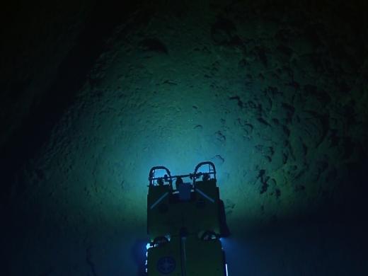
The SUBSEA team will be conducting telerobotic science to observe, survey, gather instrument data, and collect samples from fluid venting locations at isolated seamounts in the deep ocean as analog environments to hydrothermal systems on other ocean worlds, or planets with water. The submarine volcano Kamaʻehuakanaloa (formerly called Lō`ihi Seamount) is part of a volcanic system detached from Earth’s plate tectonic boundaries, with geologic history and current hydrothermal venting that makes it a relevant analog environment to other ocean worlds.
The SUBSEA team will also test approaches and protocols developed to apply ocean exploration techniques to space exploration. Operations will include constraining the telepresence operation onboard Nautilus with artificial low latency, demonstrating an analogous model where an astronaut might guide robots deployed on Mars while in orbit around that world. These operations will significantly contribute to the state of knowledge of methods for productively and safely conducting long duration telerobotic missions with visual observation, instrument data, and sample collection under time delay.
Sponsored by: NOAA Office of Exploration and Research & NASA Science Mission Directorate PSTAR program
Papahānaumokuākea Marine National Monument
This expedition will involve mapping and subsequent ROV dives on enigmatic seamounts located in a poorly explored area of the Papahānaumokuākea Marine National Monument (PMNM). The objectives are to determine how and when these seamounts formed and to document the biological communities that presently live on them. The PMNM is the largest contiguous marine protected area in the United States. Deepwater research has been conducted for decades within the original boundaries of the monument, with areas within recently expanded boundaries remaining almost completely unexplored.
Mapping data and rocks collected during the dives will be used to test the hypothesis that these seamounts were formed by the poorly understood process of arch volcanism. The ROV dives will survey these seamounts for the present of deep high density coral and sponge communities similar to those found in the Musicians seamounts and on rift zone ridges on some of the Hawaiian banks.
From a biological standpoint, these two seamount groups are located between the Hawaiian Ridge and the Musicians seamounts, where large scale high density deep-sea coral and sponge communities have been recently discovered. Such communities are hot-spots of biological diversity in the deep sea and have become primary targets for deep-sea conservation in U.S. waters and internationally. Findings from this expedition will help inform management efforts related to protecting deepwater habitats, commercial mining, and sustainable fisheries in the Central Pacific.
Sponsored by: NOAA Office of Exploration and Research
Clarion-Clipperton Fracture Zone
The expedition is primarily a transit mapping leg from Honolulu to San Francisco, as the E/V Nautilus’ operations move back east from the Hawaiian Archipelago to the US West Coast. The initial phase of the transit has been planned to transit southeast from Honolulu to map a section in the Clarion Clipperton Fracture Zone (CCFZ) that is adjacent to areas designated for seabed mining of polymetallic nodules under the International Seabed Authority. The remainder of the transit route is planned to utilize the multibeam echosounder and sub-bottom profiler to fill in gaps in seabed mapping coverage across the Pacific.
Systematic mapping of the seafloor by echosounder commenced nearly a century ago, however, more than 80% of the world’s seafloor is still not mapped, and the eastern Pacific Ocean is no exception. E/V Nautilus is equipped with a multibeam sonar and sub-bottom echosounder to collect bathymetric, surface sediment characteristic, subsurface geology and water column data. These types of seafloor mapping data are useful for identifying areas or features of interest, creating bathymetric charts for ROV dive planning and situational awareness, and locating hydrothermal vents and gas or oil seeps.
Sponsored by: NOAA Office of Exploration and Research
Monterey Bay National Marine Sanctuary
The main objective of this expedition is to characterize an unexplored, deep-water region of basaltic rocky reef that resides southeast of Davidson Seamount, within the borders of Monterey Bay National Marine Sanctuary (MBNMS) to characterize habitat, species, and communities. Although extensive previous ROV dives have occured on the seamount proper, there is deep rocky habitat southeast of the seamount that could harbor additional communities of corals and sponges. This area was previously mapped in better details by EV Nautilus, revealing ridge-like features and several domes comprised of volcanic rock.
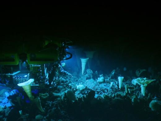
Davidson Seamount is an inactive volcanic undersea mountain habitat off the coast of central California, and is considered to be an area of special national significance. One of the largest known seamounts in U.S. waters, the seamount has been called "an oasis in the deep" in an otherwise flat seafloor, hosting large coral forests, vast sponge fields, crabs, deep-sea fishes, shrimp, basket stars, and high numbers of rare and unidentified benthic species. Recent research suggests that this pristine area may be necessary for maintaining healthy coastal populations in the MBNMS, and it is important to characterize the range of these populations on adjacent hard substrate habitat.
Sponsored by: National Marine Sanctuary Foundation
Submerged Shorelines of California Borderland
The primary focus of this expedition is the identification and characterization of submerged shorelines associated with offshore banks in the southern California Borderland region. This is a continuation of the effort by Nautilus over the last four years to acquire high-resolution mapping data of submerged shorelines and characterize primarily with remotely operated vehicles. This year’s expedition will focus on offshore banks, as those do not receive sediment from land which obscures shoreline features like caves from view.
Within the California Borderland, the Channel Islands region has a complex geologic history, starting with a fiery formation by submarine volcanism 19-15 million years ago and subsequent millions of years of movement. While the foundations were shifting, changing uplift rates and glacial cycles also resulted in fluctuating sea levels eroding away the islands, leaving strands of sedimentary rocks both above and below the current sea level as evidence of ancient paleoshorelines.
This expedition will aid in understanding the complex sea level change and tectonic history of the Northern Channel Islands. Visual exploration of sub-surface marine terraces and targeted sampling may help identify the age of paleoshorelines, determine vertical uplift rates, and improve both local tectonic and sea level models. In addition, the bathymetric and backscatter maps and benthic characterization using ROVs provides information that will help inform resource protection issues including incident response and restoration, protected resource and fisheries management, navigational safety, and conservation.
Sponsored by: NOAA Office of Exploration and Research & Office of Naval Research
Expedition Map