2015 Expedition Season
In 2015, Dr. Robert Ballard’s Exploration Vessel E/V Nautilus and its Corps of Exploration will embark on their most ambitious expedition season yet, exploring sites ranging from the Gulf of Mexico to British Columbia through late September. Over six weeks of the six-month expedition will be dedicated to exploration and mapping of the Galapagos Rift and the site of the first hydrothermal vent discovery in 1977. The six-month-long 2015 season marks the transition of the vessel and operations of the Ocean Exploration Trust (OET) to the west coast of the United States and the Pacific Ocean, concluding over two years of research in the Gulf and Caribbean regions.
The Ocean Exploration Trust was founded in 2008 by Titanic-discoverer and National Geographic Explorer-in-Residence Dr. Robert Ballard to engage in pure ocean exploration. Our international programs center on scientific exploration of the seafloor and many of our expeditions are launched from aboard Exploration Vessel (E/V) Nautilus, a 64-meter research vessel operated by the Ocean Exploration Trust. In addition to conducting scientific research, we offer our expeditions to explorers on shore via live video, audio, and data feeds from the field. We also bring educators and students of all ages aboard during E/V Nautilus expeditions, offering them hands-on experience in ocean exploration, research, and communications.
2015 Nautilus Expeditions
GISR: Natural Gas Seeps in Gulf of Mexico
What impact do natural hydrocarbon seeps have on the ocean and atmosphere? This is one of the key questions we’ll be investigating on this leg of the expedition. This expedition is part of the Gulf Integrated Spill Response (GISR) Consortium, funded by the Gulf of Mexico Research Initiative (GoMRI). The vision of the GISR Consortium is to understand and predict the fundamental behavior of petroleum fluids in the ocean environment. This capability is critical to inform decisions during response to oil spills and for development of mitigation plans, ultimately yielding significant environmental and financial savings. The mission of the currently funded activities is to develop a multi-scale modeling system validated by field and laboratory experiments to track the pathways of transforming hydrocarbons released from deep oil seeps in the oceans. Scientists will acoustically and visually map the bubble/droplet plume through the water column at several different times (about once or twice per day) while on-site.
ECOGIG
The ECOGIG group, funded as a part of the Gulf of Mexico Research Initiative (GoMRI), is looking at both natural oil and gas seepage into the Gulf of Mexico and ecosystem responses and effects directly attributable to the Deepwater Horizon oil spill of 2010. On this cruise, we will focus on deep-sea corals, their associated communities, and their response to the oil spill. We will also be collecting corals for laboratory experiments and for analyses of coral and microbe response to natural oil seepage. To do so, we will re-image as many as possible of the same corals that we have been following over the last 4 years and collect corals for laboratory experiments and for analyses of coral and microbe response to natural seepage. Our plan is to return to a number of sites where we have documented impacts of the oil spill to deep-sea corals and continue our monitoring of these sites. The 2015 ECOGIG cruise is a continuation of a 3-year partnership with OET to study the ecosystem-level response to oil and gas in the Gulf of Mexico. This is part of a larger research program by a group called the Ecosystem Impacts of Oil and Gas Inputs into the Gulf of Mexico (ECOGIG) Consortium, which is made up of scientists from a wide variety of disciplines studying current flow, ocean chemistry, microbial activity, deep-sea coral communities, and everything in between.
Cold Methane Seeps in the Gulf of Mexico
On this leg of the expedition, we will return to cold methane seeps and brine pools investigated during the 2014 season to continue an examination of the symbiosis between the mussels that live at the seeps and the bacterial symbionts that they host. Previous work has shown that different species of Bathymodiolus mussels have different combinations of symbionts that allow them to survive under varied conditions at the seeps. The symbionts utilize hydrogen sulfide or methane. Sulfide-oxidizing symbionts use the energy from sulfide to grow using CO2 as their sole carbon source. In the case of methane-oxidizing symbionts, the methane is their carbon and energy source. We will collect the mussels and their surrounding water and sediment to characterize the microbial populations in each using next-generation sequencing technologies.
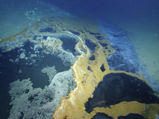
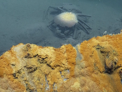
In order to collect these samples, we will visit some of the most impressive cold seep habitats of the Gulf of Mexico: tubeworm fields, outcropping methane hydrate structures, and brine habitats. The brine is formed from the interaction of water with subsurface salt deposits. As the sediments are compressed, the brine fluid migrates up to the surface, where it comes out on the seafloor. It may form distinct pools, or flow downhill like a river. Because it is saturated in methane, and typically very low in oxygen, the symbiotic mussels are some of the only organisms that can survive around it. We hope to learn more about how they make a living there.
Gulf of Mexico Technology Exploration
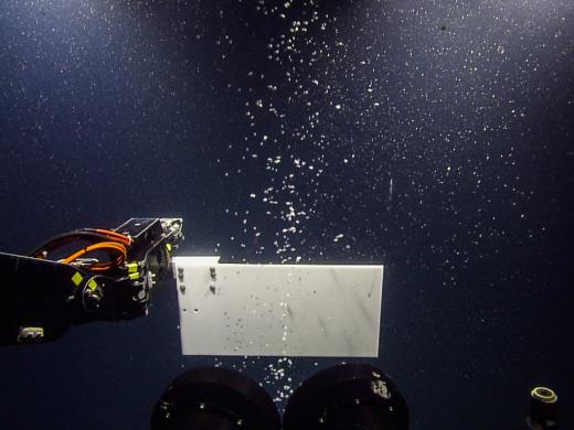
This cruise continues our exploration throughout the Gulf of Mexico region, investigating biologic, geologic, and archaeological sites. We will explore and characterize a variety of seafloor habitats across upper slope, mid-slope and lower slope depths, including hard substrate coral habitats, hydrocarbon seeps, brine pools and, time permitting, mud volcanoes. The overarching goal of this cruise is the exploration of biological communities and associated geochemical and isotopic records of carbon cycling. A primary approach will involve the deployment of an in situ laser spectrometer platform integrated with the ROV Hercules for chemical and stable isotopic exploration focusing on sites of hydrocarbon flux and active carbon cycling. The laser spectrometer is capable of in situ analysis both fluids and bubbles. More specifically, this unique instrument will allow us to make measurements of the carbon isotopes of methane and carbon dioxide at a variety of sites that we explore (e.g. brine pools, hydrocarbon seeps and mud volcanoes) providing important details about (bio)geochemical processes in these environments. We will also visit a side-scan sonar target from an oil survey provided by BOEM that has high potential to be an 1800’s-era shipwreck.
Panama Canal Crossing & Transit to the Galapagos
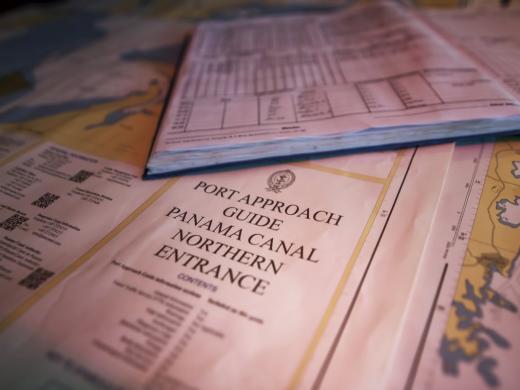
Following our work in the Gulf of Mexico, the E/V Nautilus will transit from Galveston, TX to Panama and then transit through the Panama Canal, a historic crossing that signals the entry of Nautilus to its future work in the East Pacific region. The Panama Canal officially opened on August 15, 1914, one of the largest and most difficult engineering projects ever undertaken. The shorter, faster, and safer route to the U.S. West Coast and to nations in and around the Pacific Ocean allowed those places to become more integrated with the world economy.
After crossing the Panama Canal, the E/V Nautilus will transit to the Galapagos Islands. This transit will include a mapping survey at the site in the Galapagos Rift at 86°W where hydrothermal vents and chemosynthetic organisms were first discovered. The US Navy first mapped the area in 1976 with their brand new mapping technology, the Sonar Array Sounding System (SASS) on the USS Bowditch. The maps made by this formerly classified, cutting-edge technology (and a precursor to modern multibeam mapping systems), led scientists to one of the most revolutionary discoveries in science-- chemosynthetic life-forms. Their 12 kHz system produced 60 discrete depth points. By comparison the Nautilus multibeam echosounder, a 30 kHz system, can collect up to 864 soundings per ping and create far more detailed maps of the seafloor. In 2011 the NOAA ship Okeanos Explorer remapped the vent site and found evidence of other unexplored vents, which Nautilus may visit on a following cruise leg. We will compare the original 1976 map, 2011 Okeanos map, and the new data to see what changes have occurred in the spreading axis over the last 38 years.
Galapagos Rift Exploration
The E/V Nautilus will spend several weeks exploring the Galapagos Rift region. The Galápagos Islands have been instrumental in the establishment of the biological theory of evolution, gaining insights to our knowledge of the chemistry of the Earth’s interior, and understanding the plate tectonic evolution of the eastern Pacific seafloor. In 1835 Charles Darwin visited the islands aboard the HMS Beagle and made fundamental biological and geological observations in the area. E/V Nautilus will return to the area with new tools to explore the undersea part of the islands that were out of Darwin’s view. The main objectives will be to explore the biological diversity and geological structure of the foundation of the Galapagos Islands and the adjacent deep-sea spreading center to the north.
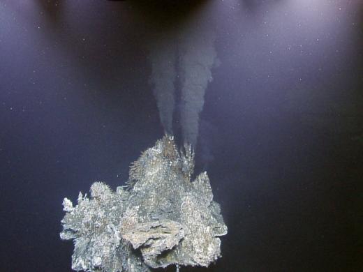
The discovery of hydrothermal vents and chemosynthetic organisms in the volcanic ridges in the rift in 1977 was a revolutionary discovery in science that changed our understanding of life processes. For the first time, scientists found evidence that life could be sustained from chemicals coming out of the Earth’s crust, rather than the light of the sun. Chemosynthetic bacteria, which derive energy from seawater-rock interactions at the vent sites form the base of the food chain for a host of organisms including clams, mussels, and tubeworms. The early studies at the Rose Garden vent site provided the foundation for our understanding the complexities of chemosynthetic communities including details of symbiosis, competition, and displacement. We will revisit this historic site and others in the area.
The Galapagos archipelago is a group of volcanic islands lying about 900 km off the coast of Ecuador in the central eastern Pacific Ocean. They have formed as a result of a deep-seated mantle hotspot supplying excess magma to the seafloor in this region. The last recorded eruption occurred in 2009 from the La Cumbre volcano on the island of Fernandina. The Galapagos Rift is an east-west trending spreading center between the Cocos and Nazca plates. Here the Earth’s plates are moving apart at a rate of 5-6 cm per year, creating a 2-4 km wide rift valley in the seafloor.
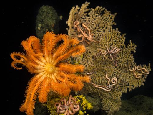
In addition to hydrothermal vents, an important habitat for biological communities are the steep volcanic slopes of the Galapagos Islands and nearby seamounts. Deep sea corals can be large (in excess of several meters in height) and offer shelter and habitat space for many other associated organisms.
Galapagos Rift
The E/V Nautilus will spend several weeks exploring the Galapagos Rift region. The Galápagos Islands have been instrumental in the establishment of the biological theory of evolution, gaining insights to our knowledge of the chemistry of the Earth’s interior, and understanding the plate tectonic evolution of the eastern Pacific seafloor. In 1835 Charles Darwin visited the islands aboard the HMS Beagle and made fundamental biological and geological observations in the area. E/V Nautiluswill return to the area with new tools to explore the undersea part of the islands that were out of Darwin’s view. The main objectives will be to explore the biological diversity and geological structure of the foundation of the Galapagos Islands and the adjacent deep-sea spreading center to the north.
The discovery of hydrothermal vents and chemosynthetic organisms in the volcanic ridges in the rift in 1977 was a revolutionary discovery in science that changed our understanding of life processes. For the first time, scientists found evidence that life could be sustained from chemicals coming out of the Earth’s crust, rather than the light of the sun. Chemosynthetic bacteria, which derive energy from seawater-rock interactions at the vent sites form the base of the food chain for a host of organisms including clams, mussels, and tubeworms. The early studies at the Rose Garden vent site provided the foundation for our understanding the complexities of chemosynthetic communities including details of symbiosis, competition, and displacement. We will revisit this historic site and others in the area.
The Galapagos archipelago is a group of volcanic islands lying about 900 km off the coast of Ecuador in the central eastern Pacific Ocean. They have formed as a result of a deep-seated mantle hotspot supplying excess magma to the seafloor in this region. The last recorded eruption occurred in 2009 from the La Cumbre volcano on the island of Fernandina. The Galapagos Rift is an east-west trending spreading center between the Cocos and Nazca plates. Here the Earth’s plates are moving apart at a rate of 5-6 cm per year, creating a 2-4 km wide rift valley in the seafloor.
In addition to hydrothermal vents, an important habitat for biological communities are the steep volcanic slopes of the Galapagos Islands and nearby seamounts. Deep sea corals can be large (in excess of several meters in height) and offer shelter and habitat space for many other associated organisms.
Galapagos Platform
The E/V Nautilus will spend several weeks exploring the Galapagos Rift region. The Galápagos Islands have been instrumental in the establishment of the biological theory of evolution, gaining insights to our knowledge of the chemistry of the Earth’s interior, and understanding the plate tectonic evolution of the eastern Pacific seafloor. In 1835 Charles Darwin visited the islands aboard the HMS Beagle and made fundamental biological and geological observations in the area. E/V Nautiluswill return to the area with new tools to explore the undersea part of the islands that were out of Darwin’s view. The main objectives will be to explore the biological diversity and geological structure of the foundation of the Galapagos Islands and the adjacent deep-sea spreading center to the north.
The discovery of hydrothermal vents and chemosynthetic organisms in the volcanic ridges in the rift in 1977 was a revolutionary discovery in science that changed our understanding of life processes. For the first time, scientists found evidence that life could be sustained from chemicals coming out of the Earth’s crust, rather than the light of the sun. Chemosynthetic bacteria, which derive energy from seawater-rock interactions at the vent sites form the base of the food chain for a host of organisms including clams, mussels, and tubeworms. The early studies at the Rose Garden vent site provided the foundation for our understanding the complexities of chemosynthetic communities including details of symbiosis, competition, and displacement. We will revisit this historic site and others in the area.
The Galapagos archipelago is a group of volcanic islands lying about 900 km off the coast of Ecuador in the central eastern Pacific Ocean. They have formed as a result of a deep-seated mantle hotspot supplying excess magma to the seafloor in this region. The last recorded eruption occurred in 2009 from the La Cumbre volcano on the island of Fernandina. The Galapagos Rift is an east-west trending spreading center between the Cocos and Nazca plates. Here the Earth’s plates are moving apart at a rate of 5-6 cm per year, creating a 2-4 km wide rift valley in the seafloor.
In addition to hydrothermal vents, an important habitat for biological communities are the steep volcanic slopes of the Galapagos Islands and nearby seamounts. Deep sea corals can be large (in excess of several meters in height) and offer shelter and habitat space for many other associated organisms.
Seamount Mapping
For this leg of the expedition we will transit from Baltra to an area 1000 nm west of Colima, Mexico to international waters, where there are two sites of interest for seafloor mapping. E/V Nautilus will use its hull-mounted multibeam echosounder to survey each site and create a map to show the acoustically-derived bathymetry of the area.
Although only about 10% of our world’s oceans have been acoustically mapped, satellites equipped with altimetry sensors have been used to derive the bathymetry of the entire seafloor. The altimeters sense gravity anomalies of the sea surface that can be linked to topography (e.g. dip in the surface of the ocean over a trench). There is a tradeoff between bathymetry derived from altimetry versus shipboard acoustic sensors: multibeams map the seafloor at a high resolution and are accurate, but ships have only mapped about 10% of the seafloor. Whereas there is global coverage of altimetry-derived maps, but the resolution of these maps is low, and the correlation between depth and a gravity anomaly is non-linear (meaning there is more room for error in deriving bathymetry from these measurements).
Small seamounts are often not resolved using altimetry technology, and can pose a hazard to navigation. In 2005, the USS San Francisco struck an uncharted seamount in the Pacific Ocean, which was indicated in altimetry data. The Navy has identified locations where altimetry data suggests there is a seamount and has requested that these areas be mapped with multibeam sonars.
California Borderlands: Our Unknown Backyard
This cruise will explore the ocean floor in previously unstudied portions of the California Borderlands, offshore from some of the most tectonically active (as well as densely populated) areas of California, using a combination of high resolution multibeam mapping, sonar surveys and targeted ROV dives.
The California Borderlands area displays an unusually rugged topography linked to the complex tectonic history of the west coast of the United States including important faults that lie closer to important centers of urban population than the San Andreas Fault. As well as contributing to an improved understanding of the offshore extent of these local geohazards, there will also be an important biological component to our exploration. Wherever active fluid flow has been found along such fault systems in the past, cold seep ecosystems have also been found.
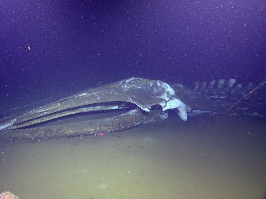
Nautilus will visit known and several possible cold seeps off San Diego and Santa Monica, associated with gas hydrate dissociation and methane seepage. The team will examine a 3-year-old fin whale carcass to examine the changes that occur over one year to a “whale fall.”
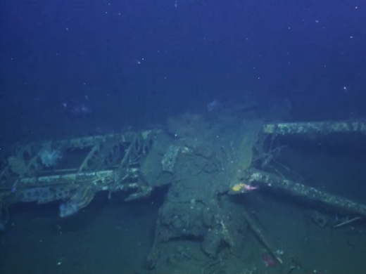
The final day of the expedition will conduct exploration and high resolution mapping operations at the wreck site of USS Macon within the Monterey Bay National Marine Sanctuary. Macon was a rigid airship, built in 1933 by the US Navy to function as a flying aircraft carrier. The dirigible had four F9C Sparrowhawk planes in internal hangers that it could launch while in flight and these biplanes are still present on the wreck. This expedition will spend a day at the Macon wreck site to document its condition, as it has not been visited since 2006, conduct high resolution mapping of the whole site for photomosaic and microbathymetry maps, and collect a piece of the aluminum frame for corrosion studies.
South/Central California Margin
The team of E/V Nautilus explores the USS Macon, a US Navy dirigible aircraft carrier that sank off the central California coast in 1935. The team finds parts of the ship as well as the Sparrowhawk biplanes it carried.
The 2015 USS Macon survey is a joint-organizational project led by co-principal investigators from three of the stakeholder institutions in this project: NOAA’s Office of National Marine Sanctuaries, the U.S. Naval History & Heritage Command and Ocean Exploration Trust in collaboration with OceanGate Foundation with funding provided by the Edward E. and Marie L. Matthews Foundation. The USS Macon site was first discovered by the Monterey Bay Aquarium Research Institute in 1990.
Ocean Networks Canada
The E/V Nautilus will transit up the west coast of the United States to explore Canadian waters for the first time. The mission is to install and connect the Internet to the deep sea the west coast of Canada in the northeast Pacific.
Ocean Networks Canada (ONC) operates world leading cabled ocean observatories that supply continuous power and Internet connectivity to a broad suite of subsea instruments. The ONC observatory installations span one of the widest ranges of ocean environments found anywhere in the world.
The observatories allow scientists to operate instruments remotely and receive data at their home laboratories anywhere on the globe in realtime. By co-locating instruments of different types, researchers can study interactions among geological, chemical, physical, and biological processes that drive the dynamic earth-ocean system. These long-term observations have wide-ranging policy applications in the areas of climate change, earthquakes and tsunamis, impacts, port security and shipping, sovereignty and security, and sound ocean management.
The Nautilus will conduct dual-ship operations with the R/V Thompson and use undersea robot (remotely operated vehicles) to conduct ONC observatory operations in these remote and diverse ocean environments.
Expedition Map