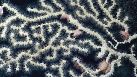

This 20-day expedition will involve multibeam and sub-bottom profiler mapping on Liliʻuokalani Seamounts, located in an expansion area of the Papahānaumokuākea Marine National Monument (PMNM). PMNM encompasses 582,578 square miles of the Pacific Ocean, an area larger than all the United States’ national parks combined, and is one of the largest marine conservation areas in the world.
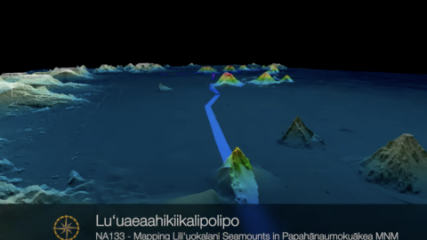
The expedition name -- Luʻuaeaahikiikalipolipo (Luʻu-a-ea-a-hiki-i-kekai-lipolipo) -- represents the journey to and the work in the kai lipolipo, or the deep blue ocean, that includes the mapping of the Liliʻuokalani Seamounts. This name references the Kumulipo, or Native Hawaiian origin chant that speaks to the birth of the universe, the earth, and all earthly things. The inclusion of Native Hawaiian language and practice to the Ocean Exploration Trust expeditions to Hawaiʻi or Papahānaumokuākea is the first of its kind, thus the name reflects the birth of new relationships and collaborative ways of practicing that are inclusive of Kānaka (Native Hawaiians) worldview.
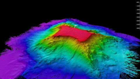
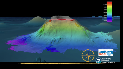
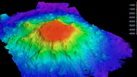
Since scientific exploration has not been conducted in this expansion region, we must first map the seamounts to provide detailed visualization of the targeted features. Information collected during this expedition will help to determine summit depths and pinpoint future dive sites for our team when we will conduct ROV dives at Liliʻuokalani Seamounts in 2022. Satellite and nautical chart data suggest that at least two seamounts in this area reach surprisingly shallow depths given their assumed Cretaceous origin between 66 and 145 million years ago. This expedition contributes to the National Ocean Mapping, Exploration, and Characterization Council (NOMEC) and GEBCO Seabed 2030 seafloor mapping priorities. Both efforts to build complete maps of the seafloor require dedicated surveying efforts, particularly in remote areas to meet these goals within the next decade. 97% of the seafloor >3000 m depth in the PMNM and Pacific Remote Islands is currently unmapped (Westington et al, 2019).
As we visit Papahānaumokuākea, the ancestral homeland of the Native Hawaiian people and the largest marine conservation area in the US, we gratefully acknowledge generations of indigenous Hawaiians and today’s stewards of these waters. OET is working closely with PMNM collaborators to inform research priorities at sea and from shore, ensure culturally-grounded collection protocols, and connect with local communities through ship-to-shore connections, a virtual role model speaker series, and development of education resources in ‘Ōlelo Hawaiʻi (Hawaiian language). All of these efforts support opportunities to work with Native Hawaiians and to perpetuate the cultural values, knowledge, and practices of their cultural heritage while advancing modern science and exploration together.
This expedition is sponsored by NOAA Ocean Exploration through the Ocean Exploration Cooperative Institute and the National Oceanographic Partnership Program.