2017 Nautilus Expeditions
2017 Expedition Season
The Ocean Exploration Trust was founded in 2008 by Dr. Robert Ballard—best known for his discovery of RMS Titanic’s final resting place and as a National Geographic Explorer in Residence—to engage in pure ocean exploration. Our international programs center on scientific exploration of the seafloor with expeditions launched from Exploration Vessel (E/V) Nautilus, a 64-meter research vessel operated by the Ocean Exploration Trust. In addition to conducting scientific research, we offer our expeditions to explorers on shore via live video, audio, and data feeds from the field. We also bring educators and students aboard during E/V Nautilus expeditions, offering them hands-on experience in ocean exploration, research, and communications.
The 2017 Nautilus Expedition will launch the third year of exploration in the Eastern Pacific Ocean, and will be one of the most extensive seasons to date. From May to November, Nautilus will document and survey unexplored regions from British Columbia, Canada, along the West Coast of the United States, to Baja California, Mexico.
2017 Nautilus Expeditions
Seafloor Mapping the National Marine Sanctuaries
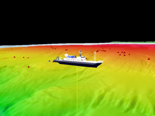
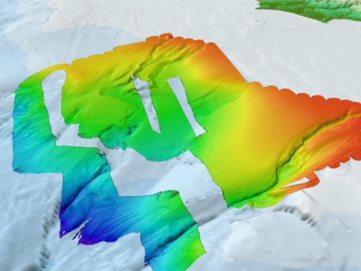
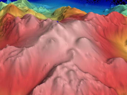
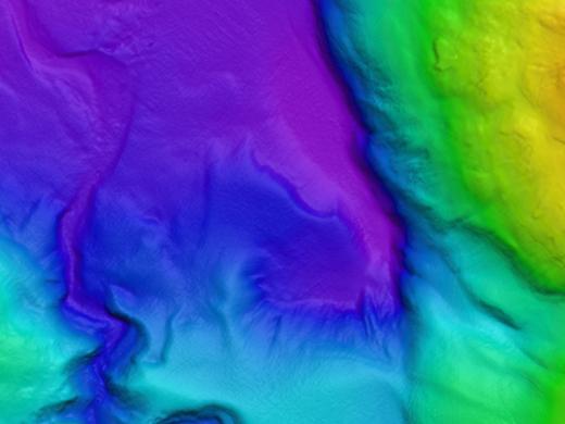
Only about 13% of our world’s oceans have been acoustically mapped. E/V Nautilus is equipped with a multibeam sonar and sub-bottom echosounder to collect bathymetric, surface sediment characteristic, subsurface geology and water column data. Satellites equipped with altimetry sensors have also been used to derive the bathymetry of the entire seafloor by sensing gravity anomalies of the sea surface that can be linked to topography (e.g. dip in the surface of the ocean over a trench). These types of seafloor mapping data is useful for identifying areas or features of interest, creating bathymetric charts for ROV dive planning and situational awareness, and locating hydrothermal vents and gas or oil seeps.
The Corps of Exploration will map unsurveyed areas and areas with low resolution data with our partners at the National Oceanic and Atmospheric Administration (NOAA). For this expedition, priority areas for seafloor mapping include Channel Islands National Marine Sanctuary, Monterey Bay National Marine Sanctuary, Greater Farallones National Marine Sanctuary, Cordell Bank National Marine Sanctuary, and Olympic Coast National Marine Sanctuary.
Ocean Networks Canada
E/V Nautilus will launch her third season in the Pacific Ocean exploring Canadian waters with Ocean Networks Canada (ONC). ONC operates world-leading cabled ocean observatories that supply continuous power and Internet connectivity to a broad suite of subsea instruments. The ONC NEPTUNE observatory installation, off Vancouver Island’s west coast, spans one of the widest ranges of ocean environments found anywhere in the world.
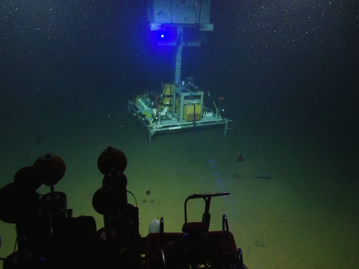
The observatories allow scientists to operate instruments remotely and receive data at their home laboratories anywhere on the globe in real time. Each of the NEPTUNE observatory’s five nodes are instrumented with a diverse suite of sensors that enable researchers to study interactions among geological, chemical, physical, and biological processes that drive the dynamic earth-ocean system over a broad spectrum of oceanic environments. These long-term observations have wide-ranging policy applications in the areas of climate change, earthquakes and tsunamis, port security and shipping, sovereignty and security, and ocean sound management.
Nautilus will visit all five nodes along the NEPTUNE observatory: Strait of Juan de Fuca, Barkley Canyon, Clayoquot Slope, Cascadia Basin, and Endeavour Vent Field. The main objectives of this expedition are to provide maintenance and support of the 800 km loop of fiber optic cable that connects nodes along the observatory. In addition to deploying and recovering various observatory sensors and instruments, Nautilus will conduct dual-ship operations with cable ship (C/S) Cable Innovator to repair a damaged and inoperable cable at Clayoquot Slope. Nautilus will also conduct seafloor mapping surveys and ROV surveys and sampling.
Seafloor Mapping the US EEZ
Only about 13% of our world’s oceans have been acoustically mapped. E/V Nautilus is equipped with a multibeam sonar and sub-bottom echosounder to collect bathymetric, surface sediment characteristic, subsurface geology and water column data. Satellites equipped with altimetry sensors have also been used to derive the bathymetry of the entire seafloor by sensing gravity anomalies of the sea surface that can be linked to topography (e.g. dip in the surface of the ocean over a trench). These types of seafloor mapping data is useful for identifying areas or features of interest, creating bathymetric charts for ROV dive planning and situational awareness, and locating hydrothermal vents and gas or oil seeps.
Priority areas for seafloor mapping will be determined between San Pedro, CA and the Pacific Northwest focusing on areas within the US Exclusive Economic zone.
Channel Islands National Marine Sanctuary
The Channel Islands National Marine Sanctuary (CINMS) is one of the agencies tasked with the protection of deep-water habitats, commercially important species, and deep sea coral ecosystems around the islands, yet lacks a detailed understanding of the distribution, abundance, and condition of the resources within the Sanctuary. Less than 50% of the seafloor within the CINMS boundaries has been mapped by high-resolution sonar, and the 2016 Nautilus expedition to the same region worked to cut this knowledge gap nearly in half.
The 2017 expedition will continue this exploration by using a high resolution mapping system to collect sonar bathymetry and sub-bottom profiling data to characterize the seafloor in these unmapped areas. Following mapping operations, Nautilus will utilize ROVs to undertake visual surveys, collect high-definition video imagery, collect biological and geological samples, and ground truth the newly-collected multibeam data.
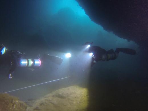
This cruise will also be part of a larger initiative to understand sea level history and locate, map, and document submerged paleo-shorelines in the Channel Islands region. This region has a complex geologic history following its initial volcanic formation, later being shaped by uplift, sinking, and fluctuating sea levels, and resulting in a submerged shoreline of boulders, spires, caves, and arches.
Developing maps of the seafloor and characterizing biological habitat and geological character of the seafloor using ROVs provides detailed information that will help guide CINMS resource protection issues including incident response and restoration, protected resource and fisheries management, navigational safety, and conservation.
Central California Technology Testing
E/V Nautilus will move north along Central California’s shoreline, renowned for natural rugged beauty that parallels underwater features. In the deep waters off the coast, numerous submarine canyons cross-cut the continental slope, some of which feature exposed canyon walls rich in methane and other chemicals that support unique microbial and animal communities. Sediments carried by longshore currents also often end up in these canyons, transporting organic matter into the deep sea. As such, distinct filter-feeding communities such as deep-sea corals can be abundant in these canyons.
Key features of this region potentially include deep-sea corals and other 3-D benthic habitats, tectonic activity, hydrocarbon repositories, chemosynthetic ecosystems, and anthropogenic impacts from agricultural runoff and associated activities. One component of this expedition will be to explore and sample unusual and novel features, fauna, sediments and authigenic rocks to expand our knowledge of the canyons off Central California.
The southern extent of California’s central coast is also home to well-developed oxygen minimum zones as well anoxic basins such as the Santa Barbara basin, ecosystems which are dominated by microbes. These regions offer an opportunity to study what Earth’s ocean was like in past, not only because sediments are well preserved and harbor a record that goes back thousands of years, but also because Earth was a microbial world well before animals came onto the scene.
This diversity of habitats offers an opportunity to study the critical role that microbes play in supporting animal communities and influencing ocean chemistry. This expedition will include launching and testing a new deep sea microbial and chemical sensor and sampler to study microbial processes in low-oxygen environments.
Cordell Bank National Marine Sanctuary
Continuing north along the California coast to Cordell Bank National Marine Sanctuary (CBNMS), offshore the San Francisco Bay Area, Nautilus will visually survey deep-water habitat that has never been explored and characterize habitat, species, and communities. Recently expanded to protect 1,286 square miles of offshore habitat including continental shelf, Cordell Bank, and Bodega Canyon, as well as smaller canyons along the continental slope, most newly added areas of CBNMS have not been explored.
CBNMS lies within the California Current and the combination of ocean conditions and undersea topography creates a rich and diverse marine community in the sanctuary. Submarine canyons and shelf-break regions are known as areas of high coral abundance and diversity due to their rocky habitats and higher slope environments as well as localized upwelling and hydrographic properties associated with these bathymetric features. The critical first step to protect and manage this area is to characterize this habitat so that CBNMS can best manage and protect this area, and understand how it contributes to the ecosystem, biodiversity, and maritime history of the region. This baseline information will inform marine resource management, policy decisions, and new research.
The main objectives of this expedition will be to collect high-resolution multibeam sonar data to identify hard substrate areas, utilize ROVs to complete initial surveys of new newly-added regions, and collect biological specimens and environmental data. This data collection will help CBNMS to characterize habitats and document distribution and abundance of deep water corals, sponges, and fishes, and contribute to understanding how these communities may be affected by changes in carbonate saturation and dissolved oxygen.
Quinault Canyon & Olympic Coast National Marine Sanctuary
Returning to the Pacific Northwest, Nautilus will launch an expedition with dual objectives in Olympic Coast National Marine Sanctuary, covering 3,189 mi2 of coastal and offshore waters along one of the least developed coastlines of the continental US. Though mapping efforts have helped to characterize seafloor substrates in some portions of the sanctuary, only very small portions of the sanctuary have been visited or photographed. Quinault and Quileute Canyons have never been explored by ROV or AUV, but are areas of high interest to expedition scientists from NOAA's Northwest Fisheries Science Center and Olympic Coast National Marine Sanctuary as well as to the Quinault Indian Nation and Quileute Tribe, two of the four native American tribes that have protected treaty rights to marine resources in this region.
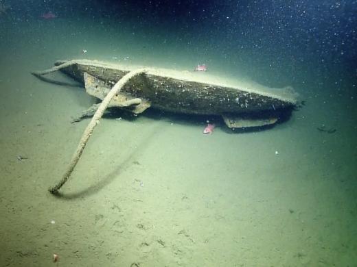
Overall, the objectives are to explore and characterize seafloor resources and features of the Olympic Coast National Marine Sanctuary that are associated with three prominent submarine canyons: Quinault Canyon, Quileute Canyon, and Juan de Fuca Canyon. Resources to be explored through AUV and ROV deployment include biogenic, habitat-forming (deep sea coral and sponge) benthic communities and associated species, and possibly methane seeps, hundreds of which were found along the Washington and Oregon shelf break during the 2016 Nautilus expedition. This expedition may also visit and document the wreck of submarine USS Bugara, a maritime heritage site, and conduct multibeam mapping of various priority areas that were identified through a collaborative spatial prioritization process involving more than 15 partner agencies.
The Olympic Coast is also notable as the northern reach of the California Current ecosystem, where deep oceanic water is seasonally upwelled onto the shelf, bringing nutrient-rich, waters nearshore. This process supports the region’s highly productive ecosystem, but due to ocean acidification, is increasingly delivering corrosive low-pH, and often hypoxic, waters onto the shelf that produce detrimental effects to organisms, including ecologically, culturally, and commercially important species. This expedition will be conducted near the end of the upwelling season and will involve collection of biological and deep water samples with the ROV, push cores of the seafloor as a historical record of OA exposure, and plankton samples from shelf break locations near the canyon rims. As an ocean acidification (OA) sentinel site, the Olympic Coast region is focused on understanding the physical, chemical and biological impacts from OA as well as piloting management approaches for monitoring and addressing OA impacts.
Heceta Bank
Returning south along the coast of Oregon, this expedition will conduct geophysical surveys near Heceta Bank in order to search for late Pleistocene-aged remnant landforms and possible archaeological sites. This is a multidisciplinary problem that requires data generated by Earth scientists and archaeologists to answer questions about past coastal environments and prehistoric human migration.
The question of how and when humans migrated from northeastern Asia into North America is currently a significant archaeological topic. Archaeologists hypothesize the earliest archaeological sites in the New World may be found along the northeastern Pacific Ocean’s coastal margin where they are buried in submerged terrestrial landforms that were once part of exposed ancient coastal landscapes. Coastal migration theory may be tested by searching for, locating and extracting samples of submerged archaeological sites positioned along past coastlines. Nautilus will search for evidence of the first North Americans by exploring areas of Oregon’s Pacific outer continental shelf that were above sea level.
Nautilus will conduct offshore research activities in two study areas positioned along Oregon’s central coast, including the lower reach of the ancient Umpqua River–one of Oregon’s largest coastal drainages. This project will use recent geophysical surveys to collect further baseline multibeam sonar data and subbottom surveys on seafloor morphology and stratigraphy and collect digital imagery to inform when and how Oregon’s past coastal environment evolved toward its modern form.
Seafloor Mapping the US EEZ
Only about 13% of our world’s oceans have been acoustically mapped. E/V Nautilus is equipped with a multibeam sonar and sub-bottom echosounder to collect bathymetric, surface sediment characteristic, subsurface geology and water column data. Satellites equipped with altimetry sensors have also been used to derive the bathymetry of the entire seafloor by sensing gravity anomalies of the sea surface that can be linked to topography (e.g. dip in the surface of the ocean over a trench). These types of seafloor mapping data is useful for identifying areas or features of interest, creating bathymetric charts for ROV dive planning and situational awareness, and locating hydrothermal vents and gas or oil seeps.
Priority areas for seafloor mapping will be determined between the Pacific Northwest and San Pedro, CA focusing on areas within the US Exclusive Economic zone.
Mapping Revillagigedo Archipelago
Moving south along the Baja California Peninsula, Nautilus will continue multibeam mapping operations in three areas to facilitate later explorations in the Revillagigedo Archipelago. The largest and highest priority area encompasses the island of Socorro and extends southwards along the Mathematician Ridge. The second and third areas encompass the islands of San Benedicto and Roca Partida, extending down their submarine slopes.
The submarine parts of these islands remain largely unexplored despite the occurrence of active volcanism and their importance as gathering and breeding places for large pelagic fish, reptiles, and marine mammals, such as humpback whales, that migrate along the west coast of the United States. Multibeam mapping data are critical to the assessment of habitat characteristics over a wide range of water depths, and are essential for the management and preservation of this unique marine environment and newly-designated UNESCO World Heritage Site.
Gulf of California
Moving closer to shore, Nautilus will begin to explore the Gulf of California (GOC), one of the most notable bodies of water on Earth. Thanks to the nutrient-rich waters that once flowed from the Colorado, the GOC was among the most productive of seas and is diverse in its geography, geology, oceanography, and biology. The GOC is an area of active seafloor spreading directly linked to the San Andreas Fault System. It is well known as an area of basaltic magmatism in a young, continental rift filled with organic-rich sediments, thought to be a potential source of carbon dioxide that is vented into the oceans with implications for marine chemistry and climatic effects.
There have been several previous studies in the Guaymas Basin of the central Gulf of California. These have provided background bathymetry of well-defined spreading axes bounded by transform faults and the locations of numerous hydrothermal vents, with different vent characteristics, fauna and fluid temperatures. Hydrothermal vents in this environment are distinctly different from those of typical mid-ocean ridge vents with very different fluid chemistry and ecosystems.
A multidisciplinary study of the GOC will provide rich information on the dynamic environment of a young, diverse, and evolving ocean basin. Particular areas of interest for this Nautilus expedition include the interaction between hydrothermal fluids, organic-rich sediments, and magma, and their impact on seafloor biological communities at a prominent spreading center in the Guaymas Basin. Nautilus will use ROVs, specialized instruments, and acoustic mapping systems to map and explore new vent study sites, collect biological, mineralogical, and geological samples, and collect high-resolution video.
Pescadero Basin
In 2015, the deepest high-temperature hydrothermal vents in the Pacific Ocean were discovered in the Pescadero Basin of the Gulf of California. Initial observations revealed enigmatic aspects of this vent system, including unique mineralogical composition and fluid geochemistry, suggesting that there is much to be learned about deep ocean carbon dynamics in this system.
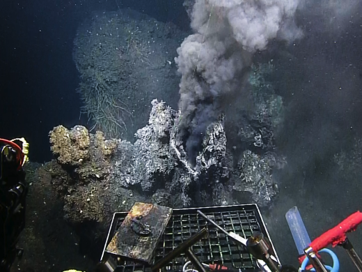
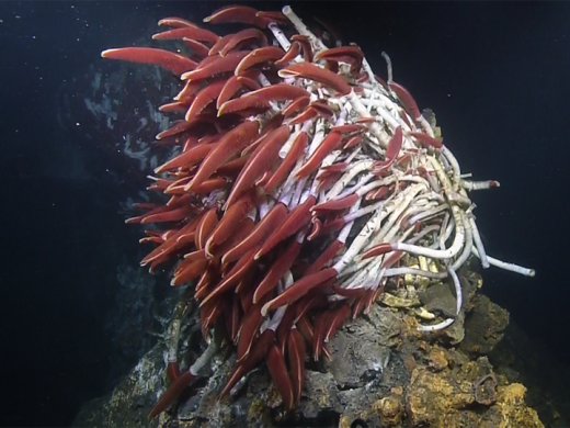
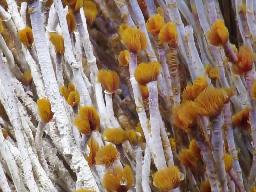
High-temperature hydrothermal vents at mid-ocean ridges typically produce chimneys dominated by sulfide minerals. In contrast, the Pescadero Basin vents host delicate structures composed of light colored carbonate minerals. The Pescadero Basin vents also host deep-sea biological communities thriving among carbonate chimney structures, including communities dominated by tubeworms. The striking differences between these vents and other regional hydrothermal systems offer a unique opportunity to explore the influence of tectonic setting on the nature of seafloor vent sites, the fundamental geochemical controls on biological colonization in the deep ocean, and the role of fluid venting on global-scale ocean chemistry and climate.
The main objective of this expedition will be to conduct an integrated biogeochemical exploration of the Pescadero Basin Vents. Nautilus will measure and collect vent fluid, rocks, sediment and biological samples to work to answer key questions about geologic processes, biogeochemistry, and biogeography, in the unique geological context of Pescadero Basin.
Revillagigedo Archipelago
Again moving offshore from the Baja California Peninsula, Nautilus will return for deeper exploration of the Revillagigedo Archipelago, consisting of the islands of Socorro, Clarion, San Benedicto, Roca Partida and numerous associated seamounts. Oceanic seamounts are critical features of the ocean basins that focus biological activity by providing hard substrates coupled with upwelling currents, are potential sites of seafloor mineralization, and pose hazards to benthic communities and human populations as a result of active volcanism. In this part of the eastern Pacific there is a pronounced oxygen minimum zone that is likely to play a key role in the distribution of benthic and pelagic fauna. The submarine parts of these islands remain largely unexplored despite the occurrence of active volcanism and their importance as gathering and breeding places for large pelagic fish, reptiles, and marine mammals, such as humpback whales, that migrate along the west coast of the United States.
During this expedition Nautilus will conduct multidisciplinary explorations of the island flanks and seamounts of the Revillagigedo Archipelago and nearby Mathematician Ridge. The work will focus on unusual styles of shallow water volcanism and searching for hydrothermal activity using new laser-based imaging technology, ROVs to characterize benthic biological communities, and ROV-deployed sensors and ultra low-light bioluminescence camera to collect baseline water column data.
The new data will shed light on both the deep and shallow geologic structure of seamounts. In particular, this exploration will provide insights into unusual processes of shallow water volcanism and how these contribute to seamount evolution, volcanic hazards, impacts on biological communities, and potential economic mineralizations. These types of baseline data are also critical to the assessment of species diversity and habitat characteristics over a wide range of water depths, and are essential for the management and preservation of this unique marine environment and newly-designated UNESCO World Heritage Site.
Expedition Map