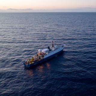
OET’s 2023 Expedition Season Exploring the Central and Eastern Pacific

In 2023, E/V Nautilus will spend over 200 days at sea during our eight-month expedition season in the Central and Eastern Pacific to map and explore deep-sea habitats, as well as integrate emerging exploration technologies. Expeditions will be planned and executed around priorities of the science and resource management community to close knowledge gaps. Mapping and ROV operations will primarily be conducted in unexplored areas, thus contributing directly to the US National Strategy for Ocean Mapping, Exploration, and Characterization, Seabed 2030, and the UN Decade of Ocean Science for Sustainable Development.
As E/V Nautilus works in the Pacific, we acknowledge the indigenous and local communities of Oceania — including those known as Polynesians, Melanesians, Micronesians, Papuans, and other Pasifika peoples — who have stewarded through generations the ocean, seas, coastlines, and lands of what is known as the Pacific Ocean. We honor and respect the enduring deep relations and interconnections between these peoples, the ocean, and the environment. We are committed to building connections with local communities in expedition regions through co-developing expedition plans, making data publicly accessible, and coordinating outreach with schools and community groups. We welcome collaborative partnerships to include, amplify, and make space for more Black, Indigenous, Latinx, Asian, Pacific Islander, Native Hawaiian, LGBTQIA+, and historically marginalized voices in the deep sea and STEAM communities.
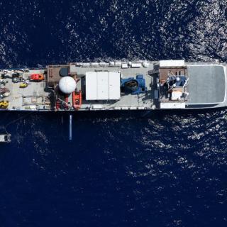
With our brand signature engagement and interactive exploration model, OET invites global audiences to participate in deep sea exploration, meeting inspiring role models from the onboard team and developing a passion for our ocean through the excitement of discovery. We believe in providing publicly-accessible data to enable follow-up work and promote international collaboration on ocean exploration and science objectives. The 2023 Nautilus expedition is sponsored by NOAA Ocean Exploration via the Ocean Exploration Cooperative Institute (OECI), Ocean Networks Canada, the Office of Naval Research, and the Bureau of Ocean Energy Management. Starting with two shakedown cruises launched from port in Honolulu, we’ll be testing ROV systems, the ship’s sonar and telepresence systems, and partner technologies to prepare them for the rest of the season.
Our first broadcast expedition launches in May as we head back to Kingman Reef and Palmyra Atoll as part of our ongoing effort to explore the deep ocean near the Pacific Remote Islands Marine National Monument. This year we will integrate the University of Rhode Island’s deep-sea Raman spectrometer into ROV operations to collect high-fidelity chemical composition data on materials, including rocks, sediments, and biological samples, working toward a future with limited need for physical seafloor samples. Collecting and studying rock samples will help us understand the complex geological history of the seamounts of the Line Islands.
Next, we travel north, bringing Nautilus from the Central to the Eastern Pacific Ocean. This nine-day expedition will start in Honolulu and end in Sidney (British Columbia), and utilize the deep-water mapping capabilities of E/V Nautilus to map previously uncharted seafloor during the transit route. This expedition also welcomes aboard partners from A-STEP — Ambassadors for STEM Training to Enhance Participation — a National Science Foundation-funded program that provides at-sea training experiences for students and elevates interest and sense of belonging in geosciences and geoscience-related careers.
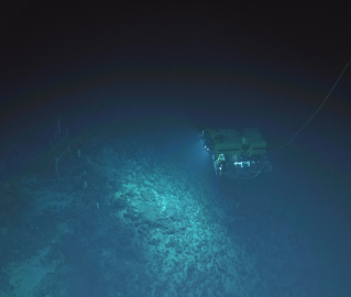
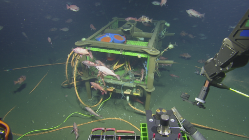
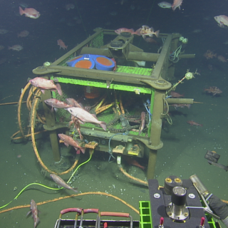
On our third expedition, we will support Ocean Networks Canada’s wired seafloor observatory off the west coast of British Columbia, where deployed technologies gather thousands of observations about dynamics across an entire tectonic plate. In addition to deploying, recovering, and providing maintenance for various observatory sensors and instruments via ROV dives, the team will also assist in scientific seafloor surveys with biological and geological sampling, including revisiting the spectacular Endeavour hydrothermal vent field.
Returning to the tropics, our next expedition spotlights the partnerships that make exploration possible. As OET works closely with organizations to advance global exploration goals, the comparability of data is key. Near the Hawaiian Islands, E/V Nautilus will conduct a mapping calibration exercise to allow future and past data comparisons among different oceanographic vessels.
Then it’s back down to the Central Pacific for exploration in the Johnston Atoll region of the Pacific Remote Islands Marine National Monument (PRIMNM). Complimenting exploration achievements from last season, the ship will now explore a region of ancient seamounts northwest of Johnston Atoll utilizing ROV dives and mapping surveys. Adding upon exploration conducted in this protected area last year, this year, we’ll be acquiring additional high-resolution bathymetric data of this previously poorly explored ocean region.
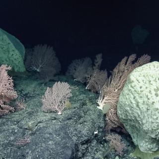
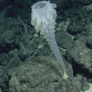
In September, we voyage to the Papahānaumokuākea Marine National Monument (PMNM) to explore unseen deep-sea habitats using our ROV technology with our Ala ‘Aumoana Kai Uli expedition. We’ve had the privilege of exploring here with expeditions across four years, working with the PMNM Native Hawaiian Cultural Working Group to appropriately incorporate Hawaiian culture into expedition activities. This expedition will take us to the far northwest corner of the monument - west of the Lili’uokalani Seamount chain to help characterize the biodiversity of this remote open ocean wilderness space.
Over the last three years, OET has been working with partners from the OECI to integrate emerging exploration technologies to enhance ocean exploration. In September, Nautilus will load the working deck with technologies including the University of New Hampshire’s DriX, the University of Rhode Island’s Deep Autonomous Profiler (DAP), and Woods Hole Oceanographic Institution’s Mesobot, each of which offers complementary capabilities to explore the ocean from the seafloor through the entire water column. to keep bounding ahead with technology development for coordinating teams of underwater tools.
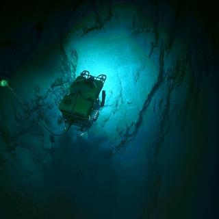
In October, we return to ROV dives continuing our work to advance technology use in the deep sea. Experimenting with deploying a new camera technology, we will explore using a new wide-field camera array on ROV Hercules to capture three-dimensional stereoscopic imagery from the seabed. One of the modern challenges of ocean exploration is processing and reviewing the high volume of data generated from each expedition. On this voyage, we will also experiment with and test a Rapid Automatic Image Categorization artificial intelligence software to quickly annotate video in near real-time.
Next, we spend ten days utilizing the deep-water mapping capabilities of E/V Nautilus to survey previously unmapped seafloor in the U.S. EEZ south of the Main Hawaiian Islands. In addition to deep-sea mapping operations, the expedition will also include deployments of the DAP to collect visual, environmental, and eDNA data to enable baseline characterizations of the deep-water environments of this region. While nearshore waters surrounding the Main Hawaiian Islands have been relatively well surveyed, many offshore areas remain completely unmapped, hindering efforts to manage the resources of this unique region and compare surrounding regions effectively.
Traveling to the southern hemisphere, our last expedition of the season takes the team to Jarvis Island, one of the most poorly mapped areas under US jurisdiction. Our high-resolution bathymetric seafloor mapping will add to the world’s baseline knowledge of this area of PRIMNM, reflecting on the historical importance of this island to many Pacific communities. High-resolution seafloor mapping will help identify unique and interesting features for future ROV exploration and supports management and conservation efforts within one of the largest marine protected areas in the world.
Join us this year as we expand ocean exploration throughout the Pacific Ocean, work with new partners and technology, and continue to bring the deep sea to classrooms and homes around the globe. We can’t wait to get started and hope you’ll join us.
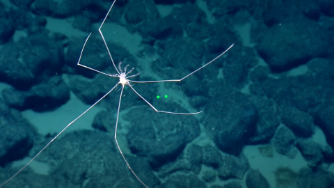
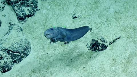
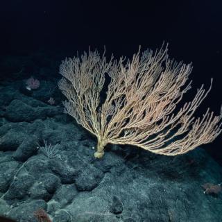
Exploring Deep Sea Habitats Near Kingman Reef & Palmyra Atoll
Our first live expedition of 2023 brings us back to the region of Kingman Reef and Palmyra Atoll as part of our ongoing effort to explore the deep ocean in and around the Pacific Remote Islands Marine National Monument (PRIMNM) through the Ocean Exploration Cooperative Institute.
Mid-Pacific Mapping Northbound
This expedition is a seafloor mapping transit that brings the E/V Nautilus from the Central to Eastern Pacific Ocean. This nine-day cruise will start in Honolulu and end in Sidney (British Columbia), and utilize the deep-water mapping capabilities of E/V Nautilus to map previously uncharted seafloor during the transit route.
Ocean Networks Canada Maintenance and Exploration
For this expedition, we take a trip north to provide support to Ocean Networks Canada’s (ONC) wired seafloor observatory off the west coast of British Columbia where deployed technologies gather thousands of observations about dynamics across an entire tectonic plate.
Mid-Pacific Mapping Southbound
This expedition is a seafloor mapping transit to bring the E/V Nautilus from British Columbia back to the Central Pacific where the ship will operate for the remainder of the 2023 field season. This 12-day transit route will fill gaps in seabed mapping within and beyond the U.S. EEZ and thereby support priorities of Seabed 2030 and the US National Strategy for Mapping, Exploration, and Characterization.
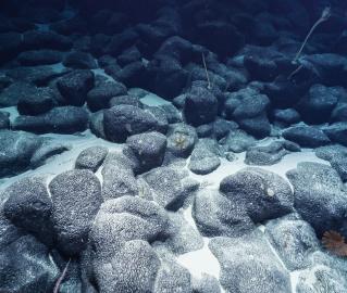
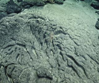
Deep Sea Biodiversity & Ancient Seamount Exploration near Johnston Atoll
In August 2023, we will return to the Central Pacific for 27 days of exploration within the Johnston Atoll Unit of the Pacific Remote Islands Marine National Monument (PRIMNM), starting and ending in Honolulu.
OECI Multi-vehicle Exploration
Over the last three years OET has been working with partners from Ocean Exploration Cooperative Institute (OECI) to integrate emerging exploration technologies to enhance ocean exploration.
Ala ʻAumoana Kai Uli in Papahānaumokuākea Marine National Monument
Ocean Exploration Trust and partners will conduct a telepresence-enabled expedition to explore unseen deep-sea habitats aboard E/V Nautilus with ROV and seafloor mapping operations in the Papahānaumokuākea Marine National Monument (PMNM) focused on the largely unexplored northwestern section of the Monument.
Ocean Exploration through Advanced Imaging
In October, we return to ROV dives continuing our work to advance technology use in the deep sea. Experimenting with deploying a new camera technology, we will explore using a new wide-field camera array on ROV Hercules to capture three-dimensional stereoscopic imagery from the seabed.

Hawaiʻi Mapping
This ten-day expedition will start and end in Honolulu and utilize the deep-water mapping capabilities of E/V Nautilus to survey previously unmapped seafloor in the U.S. EEZ south of the Main Hawaiian Islands.
Jarvis Island Mapping
Traveling to the southern hemisphere, this expedition takes the team to Jarvis Island, one of the most poorly mapped areas under US jurisdiction, where our high-resolution bathymetric seafloor mapping will add to the world’s baseline knowledge of this poorly studied part of the Pacific Remote Islands Marine National Monument (PRIMNM).