E/V Nautilus 2026 Season Summary

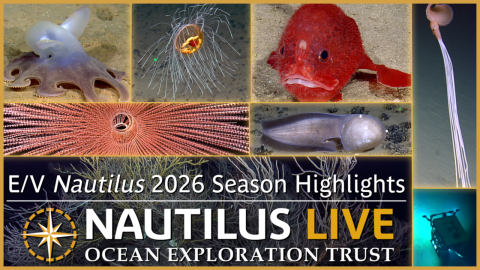
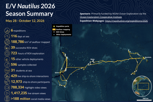
The 2026 E/V Nautilus season consisted of six multidisciplinary expeditions that explored the Central and Western Pacific for a total of 116 days at sea. The season began with a shakedown expedition in Hawaiʻi to prepare for the fieldwork ahead, followed by others centered on mapping and exploring previously unsurveyed deep-sea habitats around the Mariana Islands, Wake Atoll, and the Hawaiian Islands. Although the ship had to alter its planned operating areas to evade major storms on multiple occasions, 2026 expeditions mapped over 188,786 km2 of seafloor, completed over 723 hours of successful ROV surveys, conducted 15 deployments of other vehicles and instruments, and engaged hundreds of millions of viewers worldwide.
Download the 2026 Expedition Summary PDF.
2026 Shakedown (NA177)
Between May 28 - June 6, E/V Nautilus conducted its annual shakedown expedition to prepare for the 2026 season. During this 9-day expedition around the Main Hawaiian Islands, the team successfully completed annual quality assurance tests of E/V Nautilus’ mapping and navigation systems, including a multibeam patch test, speed noise testing, accuracy surveys over a variety of depths, calibration of the subsea acoustic positioning system, and calibration of the acoustic Doppler current profiler. The mission also included successful sea acceptance trials of the new EM 304 multibeam sonar installed during the off-season, made possible by an Office of Naval Research grant to the University of New Hampshire Center for Coastal and Ocean Mapping. The shakedown expedition also included three test ROV dives for a total dive time of over 16.2 hours to get the vehicles ready for the fieldwork ahead.
Pacific Mapping (NA178)
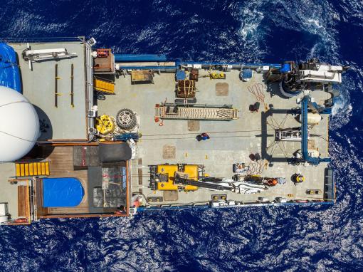
From June 10 - 24, 2026, E/V Nautilus conducted an expedition to map the seafloor during the transit from Hawaiʻi to Guam. The expedition mapped 55,129 km2 of seafloor, including 18,994 km2 in the US Exclusive Economic Zone around Wake, Hawaiʻi, and the Mariana Islands. Mapping focused on filling data gaps along the transit route, which mostly consisted of abyssal plains but also included passage over the Mariana Trench, as well as several unmapped seamounts explored via ROVs later in the 2026 season. Three senior KONGSBERG engineers sailed on the mission, during which they tested new software for the EM 304 MKII system, providing a unique opportunity to improve system performance for the benefit of the scientific community. In addition to mapping operations, the expedition included topside surveys on the abundance and diversity of marine fauna, which documented over 3,900 individual birds across 37 species, including 30 seabird species.
Exploration of Deep-Sea Habitats Around the Mariana Islands- Part I (NA179)
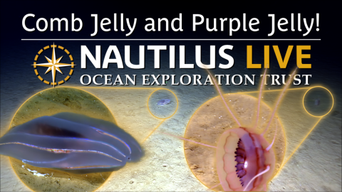
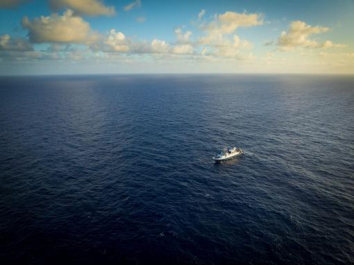
From June 28 - July 21, E/V Nautilus conducted the first of two back-to-back expeditions focused on exploring deep-sea habitats around the Mariana Islands using the ship’s ROV, mapping, and telepresence systems in combination with Woods Hole Oceanographic Institution’s AUV Sentry, with its participation funded by the Bureau of Ocean Energy Management. The expedition mapped 27,343 km2 of seafloor using E/V Nautilus’ sonars, all within the US Exclusive Economic Zone around the Commonwealth of the Northern Mariana Islands. The expedition also included four successful AUV Sentry dives that collectively surveyed over 128 km of seafloor to depths of 5,855 meters, collecting high-resolution bathymetry, sidescan sonar, and video data during 60.5 hours of dive time. Seven successful ROV dives were also conducted for a total dive time of 136.2 hours, surveying depths between 2,376 - 5,796 meters. Three of these ROV dives surveyed abyssal plain habitats, where substrates consisted mostly of heavily-sedimented seafloor, with limited nodules in some areas, and discovered a potentially new species of tripod fish, pancake urchin, and sponge. The other four ROV dives explored seamounts east of the Mariana Trench, where substrates primarily consisted of steep, unconsolidated slopes of sand and boulders, and documented numerous large sponges and fossilized glass sponge skeletons.
Exploration of Deep-Sea Habitats Around the Mariana Islands- Part II (NA180)
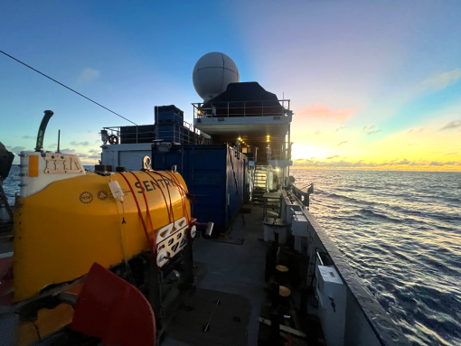
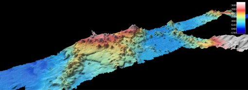
From July 25 - August 15, E/V Nautilus conducted a second expedition to the Mariana Islands focused on using the ship’s ROV, mapping, and telepresence systems in combination with Woods Hole Oceanographic Institution’s AUV Sentry. While the original goal was to explore abyssal habitats in the US Exclusive Economic Zone around the Commonwealth of the Northern Mariana Islands, the team only spent a week in this area before the ship had to divert to the Federated States of Micronesia to avoid major storms. Despite these challenges, the expedition mapped over 37,069 km2 of seafloor, including over Ruby and NW-Rota 1 Seamounts, where significant seafloor changes were detected since these active underwater volcanoes were last surveyed. The expedition also included four successful AUV Sentry dives that collectively surveyed over 83 kilometers of seafloor to depths of 5,262 meters during 39.3 hours of dive time. The team also conducted seven successful ROV dives that explored depths between 300 - 5,334 meters over 78.5 hours of dive time. Among many other things, the ROVs documented rich biodiversity and volcanic activity at Ruby Seamount, as well as spectacular pillow and lobate basalt flows, multiple records of the rare Magnapinna bigfin squid, a new lizardfish species, and coral gardens, all within the Federated States of Micronesia. Finally, the expedition deployed and retrieved an acoustic mooring west of Saipan to support cetacean monitoring efforts by the NOAA Pacific Islands Fisheries Science Center.
Exploration of Deep-Sea Habitats Around Wake (NA181)
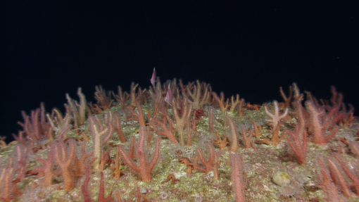
From August 18 - September 18, E/V Nautilus conducted an expedition to explore deep-sea habitats in the US Exclusive Economic Zone around Wake Atoll, focusing on abyssal plain habitats, seamounts, and potential maritime heritage sites associated with the World War II Battle of Wake. A total of 65,350 km2 of seafloor were mapped using ship-based sonars, the most of any E/V Nautilus expedition to date, in addition to 5 km2 mapped around Wake down to centimeter-scale using a ROV-mounted Norbit WBMS multibeam sonar. The expedition also included 13 successful ROV dives exploring depths between 793 - 5,807 meters over more than 280 hours of dive time. Noteworthy ROV observations included expansive nodule fields and heavily-sedimented areas on abyssal plain habitats, numerous fossilized shark teeth, World War II-era ordnance, potential cabling from the Sound Surveillance System, and a sunken military barge. During transits, the expedition deployed six biogeochemical floats from the Global Ocean Biogeochemistry Array and collected 104 eDNA samples using the Quokka eDNA sampler, an autonomous underway sampling system recently developed by Australia’s National Science Agency.
Exploration of Deep-Sea Habitats Around the Hawaiian Islands (NA182)
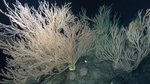
From September 22 - October 12, E/V Nautilus conducted an expedition to explore deep-sea habitats around the Hawaiian Islands, with a focus on abyssal plain habitats and submerged banks. The team mapped 42,887 km2 of seafloor and completed eight successful ROV dives exploring depths between 322 - 5,606 meters over 128 hours of dive time. ROV dives included four focused on abyssal plain habitats, which documented expansive nodule fields and heavily-sedimented areas inhabited by a wide diversity of benthic organisms, including a potentially new species of isopod and sea slug. The other four ROV dives surveyed offshore banks inside the Papahānaumokuākea National Marine Sanctuary and found high densities or high diversities of benthic organisms on all dives, including fields of solitary hydrozoans and dense fish communities off Ōnūnui and Ōnūiki, many different species of octopods on St. Rogatien Bank, extensive fields of sea pens interspersed with a potentially new species of Muriceides octocoral off Nīhoa, and diverse assemblages at Middle Bank that included scleractinian coral reefs, gold corals, pink corals, and black corals hosting a wide diversity of associated organisms. The expedition collected 183 physical samples to support studies on the region’s biodiversity and geological context, including 79 biological samples, 5 geological samples, and 99 eDNA samples.
Education and Outreach
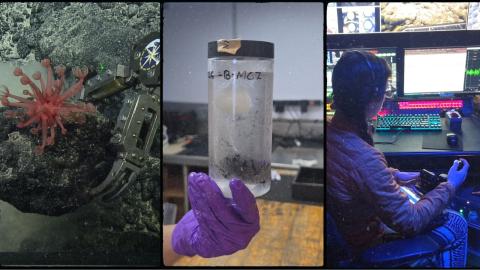
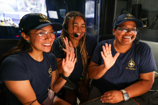
Throughout the 2026 field season, the excitement of exploration and discovery was shared with people of all ages via many different avenues, collectively reaching many millions of people around the world. Live-stream video feeds received over 1.4 million views, as the team fielded over 17,000 questions from explorers via telepresence. ROV highlight videos and educational behind-the-scenes videos garnered over 788,000 views by the time these missions concluded. Expedition content on OET’s social media channels attracted over 188 million impressions. While at sea, the team created 49 new highlight videos, 37 new blogs, and 11 new photo albums, and hosted 429 live ship-to-shore interactions with schools, community events, and professional meetings, reaching close to 13,000 people across 38 US States, 4 US Territories, and 12 other countries. Expedition participants’ stories and early season results appeared in 1,234 media stories, published in 90 countries and 42 languages. A total of 31 students and 22 professional educators sailed on 2026 expeditions as local contributors and via OET’s at-sea internship and fellowship programs.
Data Access
With the exception of datasets that include position information of maritime heritage sites that are protected from public release by federal regulations, data collected by E/V Nautilus systems will be sent to repositories for archiving and public distribution, links to which can be found on the OET data page. These datasets are also available from OET upon request. OET encourages the science and management community to make use of these rich datasets, and requests that appropriate acknowledgment is provided in accordance with OET’s publication policy.
Broader Impacts
E/V Nautilus expeditions surveyed extensive ocean habitats across the Pacific and successfully integrated numerous emerging technologies while sharing the excitement of discovery with millions of people around the world. Expeditions were executed around priorities of the science and resource management community, and contributed directly to the UN Decade of Ocean Science for Sustainable Development, US National Strategy for Ocean Mapping, Exploration and Characterization, and Seabed 2030. Expedition activities also advanced NOAA mission priorities, particularly in terms of understanding ocean changes, sharing that knowledge with others, and managing marine ecosystems. Finally, the data collected on these missions is an essential precursor for future explorations, which will undoubtedly lead to many more discoveries. To this end, data and samples collected on these missions have been deposited in publicly-available repositories to enable follow-on science and management activities.
Acknowledgements
Thanks to the captain and crew of E/V Nautilus, the Nautilus Corps of Exploration, and all who supported the expeditions from shore. 2026 expeditions were funded primarily by NOAA Ocean Exploration via the Ocean Exploration Cooperative Institute. OET program sponsors and partners in 2026 also included LeeWay Marine, Office of Naval Research, Flying Fish, National Center for Education & the Economy, QPS, Philip Stephenson Foundation, Ocean Census, ESRI, Woods Hole Oceanographic Institution, University of Rhode Island, University of New Hampshire, University of Southern Mississippi, Bureau of Ocean Energy Management, and US Geological Survey.