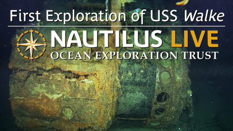
New Details of USS DeHaven Shipwreck in Iron Bottom Sound
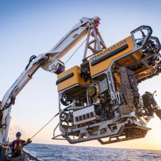
Explore with us the highest resolution archaeological survey of the 106-meter long Fletcher-class destroyer USS DeHaven. This wreck was surveyed in its final resting place in Iron Bottom Sound, Solomon Islands using a Norbit multibeam sonar before completing a visual survey with ROVs Hercules and Atalanta. Together these data sets will create models for a historians and a resource managers to understand this site's history and future.
USS DeHaven was one of the last ships sunk in the decisive battles of the Solomon Island campaign. In February 1943, during the Imperial Japanese Navy's Operation Ke withdrawal from Guadalcanal, DeHaven was escorting a convoy of supply ships through Iron Bottom Sound when it was attacked by Japanese aircraft. The ship was hit by three bombs and further damaged by a near miss. DeHaven sunk with the loss of 167 of its crew.
During the exploration, the team identified various features of the heritage site, including propellers, artillery and torpedo mounts, and found multiple torpedo warheads remaining around the wreckage. Of note, the aft torpedo mount was found pointing skyward, a change from the horizontal position seen in the 1992 survey, indicating further deck collapse in the last 30 years. With expert spotting of viewers to NautilusLive streaming footage, the team was able to locate the ship's bell - a very unique sighting. After eighty years, the ship is becoming colonized by marine life including white Cladorhizidae black corals, squat lobsters, king crabs, and clusters of gooseneck barnacles.
During the Maritime Archaeology of Guadalcanal: Iron Bottom Sound (NA173) expedition, our international team utilized the remotely operated vehicle and telepresence systems of E/V Nautilus, in combination with the mapping capabilities of uncrewed surface vehicle DriX, to conduct non-invasive archaeological surveys of cultural heritage sites in the Iron Bottom Sound. This expedition is supported by NOAA Ocean Exploration via the Ocean Exploration Cooperative Institute. This exploration is made possible by the expertise, support, and collaboration of many partners, including NOAA Ocean Exploration, U.S. Naval History and Heritage Command, Solomon Islands government, University of New Hampshire Center for Coastal and Ocean Mapping/Joint Hydrographic Center, University of Rhode Island, and Japanese, Australian, and New Zealand archaeological colleagues.
Maritime Archaeology of Guadalcanal: Iron Bottom Sound
Located in the Solomon Islands between the islands of Guadalcanal, Savo, and Nggela, Iron Bottom Sound was the stage of five major naval battles between August and December 1942 which resulted in the loss of over 20,000 lives, 111 naval vessels, and 1,450 planes. These underwater cultural heritage sites now rest on the seafloor offshore Honiara in a confined area less than 25 nautical miles wide, 40 nautical miles long, and 1,400 meters deep.