First Ever Exploration of USS Walke
Join our team for the first ever comprehensive video survey of the seafloor resting place of the USS Walke. Each of the twelve ships visited during our Maritime Archaeology of Guadalcanal (NA173) expedition has a unique story. This is the USS Walke, Sims-class destroyer that was sunk southwest of Savo Island during the Second Naval Battle of Guadalcanal. Located by a subsea operations team of Paul Allen’s company, Vulcan Inc. in 2015, Walke had never had a complete archaeological survey before this dive. With the location confirmed by University of New Hampshire’s USV DriX, our team was able to image the ship which lays how in three pieces on the seabed, a detached bridge, approximately 50-meters of the hull length, and a shaft strut missin the propellor.
In the Second Naval Battle of Guadalcanal, Walke was part of a task force screening the American battleships Washington and San Francisco. On November 15, 1942 in close-range full darkness fighting, the USS Walke fired approximately 300, 5 in. shells on the Japanese cruiser Nagara and destroyers Ayanami and Uranami. Shortly after, Japanese shells surrounded it, followed by a Type 93 “Long Lance” torpedo that struck its starboard side and blew up its bow. Once lit on fire, the ship became a target for salvos of shells. As fire spread, the command was given to abandon ship. Sadly, while Walke sank, some of its depth charges exploded, killing more survivors in the water. The vessel sank in pieces off Savo Island in Iron Bottom Sound taking the lives of 84 crew members.
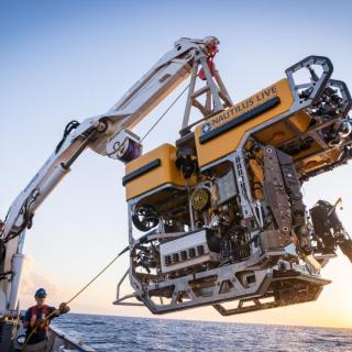
During this expedition, our international team utilized the remotely operated vehicle and telepresence systems of E/V Nautilus, in combination with the mapping capabilities of uncrewed surface vehicle DriX, to conduct non-invasive archaeological surveys of cultural heritage sites in the Iron Bottom Sound. This expedition is supported by NOAA Ocean Exploration via the Ocean Exploration Cooperative Institute. This exploration is made possible by the expertise, support, and collaboration of many partners, including NOAA Ocean Exploration, U.S. Naval History and Heritage Command, Solomon Islands government, University of New Hampshire Center for Coastal and Ocean Mapping/Joint Hydrographic Center, University of Rhode Island, and Japanese, Australian, and New Zealand archaeological colleagues.
Maritime Archaeology of Guadalcanal: Iron Bottom Sound
Located in the Solomon Islands between the islands of Guadalcanal, Savo, and Nggela, Iron Bottom Sound was the stage of five major naval battles between August and December 1942 which resulted in the loss of over 20,000 lives, 111 naval vessels, and 1,450 planes. These underwater cultural heritage sites now rest on the seafloor offshore Honiara in a confined area less than 25 nautical miles wide, 40 nautical miles long, and 1,400 meters deep.