IJN Destroyer Teruzuki Discovered
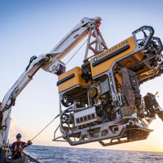
For the first time, a team of scientists and explorers aboard OET’s E/V Nautilus has located the World War II Imperial Japanese Navy destroyer Teruzuki (照月). Using ROVs Hercules and Atalanta, we explored the wreck after University of New Hampshire’s USV DriX’s targeted mapping identified a site consistent with the sinking location of the destroyer. Lying on the seabed at over 800 meters in the Solomon Islands, this is the first time anyone has laid eyes on Teruzuki since it was sunk in WWII’s naval battles off Guadalcanal.
Commissioned in 1942 for the Japanese Imperial Navy, Teruzuki (照月; "Shining Moon" or "Illuminated Moon") was a 134-meter-long Akizuki-class destroyer. In the early hours of December 12, 1942, as Teruzuki protected supply ships off Cape Esperance on Guadalcanal’s northern coast, American patrol boats raced out to intercept the convoy. The fast attack boats struck Teruzuki in the stern with a pair of Mk-8 torpedoes. The detonation broke the rudder, disabling the ship, and lighting fires. While most of her crew were rescued or swam to shore, nine men were killed as Teruzuki sank beneath the waves. Watch this highlight video to witness the ship and hear how our Corps of Exploration including Japanese archaeological experts and teammates Hiroshi Ishii of the Center for Southeast Asian Area Studies at Kyoto University and Dr. Jun Kimura of Tokai University confirmed the identification.
During the Maritime Archaeology of Guadalcanal expedition (NA173), the international team utilized the remotely operated vehicle and telepresence systems of E/V Nautilus, in combination with the mapping capabilities of University of New Hampshire’s uncrewed surface vehicle DriX, to conduct non-invasive archaeological surveys of maritime heritage sites in the Iron Bottom Sound. This expedition is supported by NOAA Ocean Exploration via the Ocean Exploration Cooperative Institute. This exploration is made possible by the expertise, support, and collaboration of many partners, including NOAA Ocean Exploration, U.S. Naval History and Heritage Command, Solomon Islands government, University of New Hampshire Center for Coastal and Ocean Mapping/Joint Hydrographic Center, University of Rhode Island, and Japanese, Australian, and New Zealand archaeological colleagues.
Maritime Archaeology of Guadalcanal: Iron Bottom Sound
Located in the Solomon Islands between the islands of Guadalcanal, Savo, and Nggela, Iron Bottom Sound was the stage of five major naval battles between August and December 1942 which resulted in the loss of over 20,000 lives, 111 naval vessels, and 1,450 planes. These underwater cultural heritage sites now rest on the seafloor offshore Honiara in a confined area less than 25 nautical miles wide, 40 nautical miles long, and 1,400 meters deep.