New Tech on Nautilus - Norbit Sonar
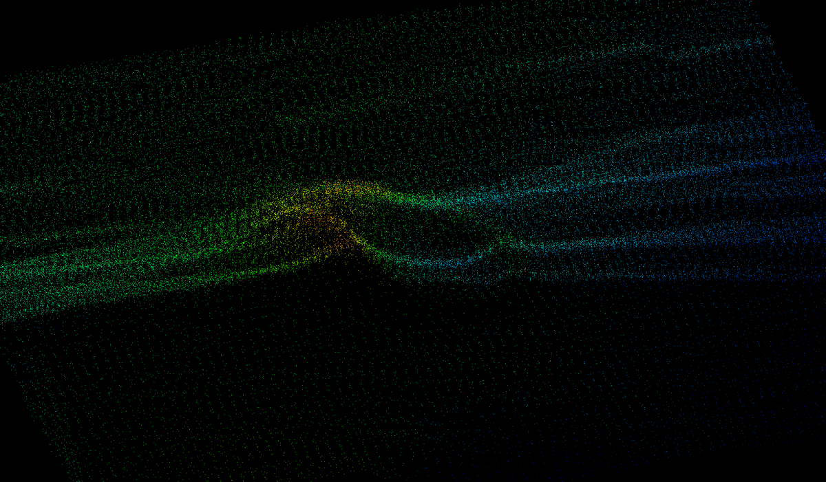
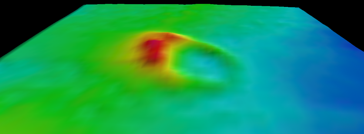
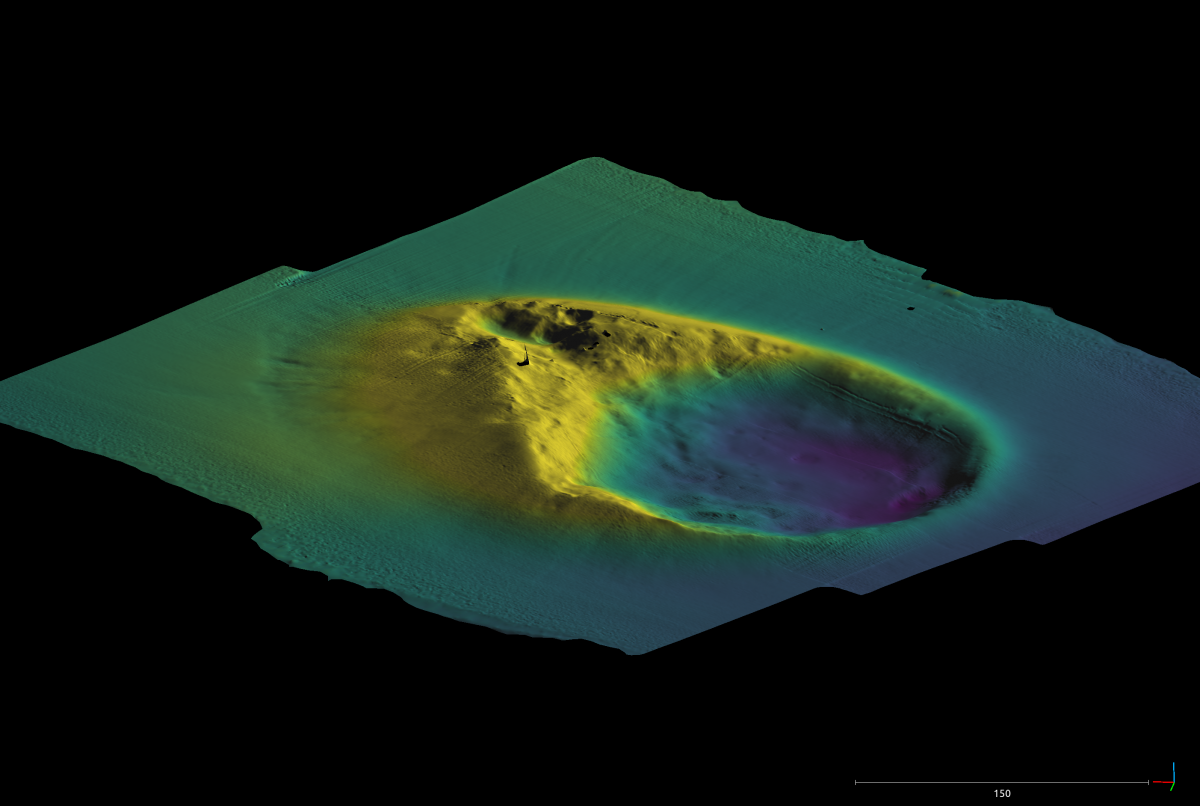
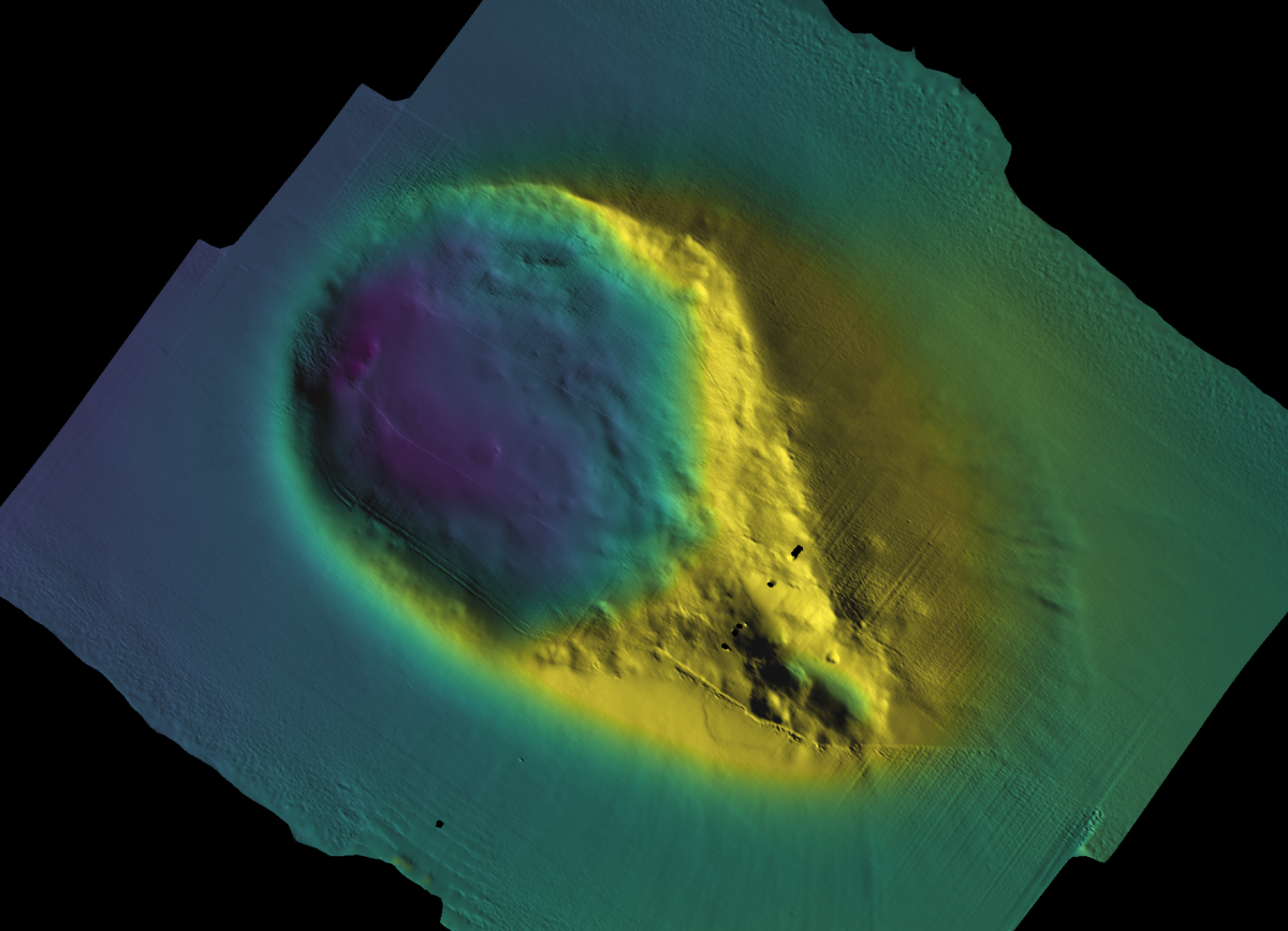
Always pushing to develop and test innovative technology, the newest addition to ROV Hercules is a Norbit multibeam sonar that can be mounted forward-facing to help ROV pilots search for water column features like bubble plumes or downward-facing as a mapping tool. Corps of Exploration Mapping Specialist and Navigator, Dr. Kristopher Krasnosky wrote a software package to turn this stock sonar into a sophisticated mapping tool by integrating navigation data and post-processing the ping returns. He describes the software's role to "take the raw sonar data, figure out where in the world it is looking, and fuses it into something you can view as a model or a map".
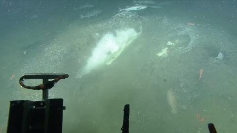
During the Cascadia Margin expedition, the team tested the Norbit sonar by mapping an expulsion crater near Kulm Ridge, offshore Oregon in high-resolution. This seafloor crater feature appears to be related to methane gas and/or fluid seepage from the subsurface resulting in uplift, deformation, and ultimately seafloor collapse, possibly catastrophically. This crater sits at a depth of 1600m and at 230m wide and 350m long is larger than Michigan Stadium - the largest football stadium in the United States. Check out these images to explore the feature and resolution of two different mapping technologies now part of the exploration toolkit aboard E/V Nautilus.
Cascadia Margin Seep Exploration
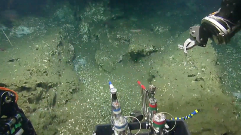
For two weeks, E/V Nautilus will return to the Cascadia Margin, a geologically active region located offshore of Washington, Oregon, and northern California, where we have mapped and explored many methane seeps and cold seeps.