Exploring the Deep Sea of the Marshall Islands

OET's NA174 expedition will explore deep-sea habitats throughout the Republic of the Marshall Islands (RMI) in collaboration and consultation with the Marshall Islands Marine Resources Authority (MIMRA) and other partners. Funded by NOAA Ocean Exploration via the Ocean Exploration Cooperative Institute, this expedition will map and explore poorly known deep-sea habitats to support science and management priority needs in RMI and engage students and the public in telepresence-based exploration.
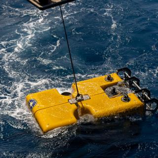
This 21-day telepresence-enabled expedition will utilize the mapping, remotely operated vehicles (ROVs), and telepresence systems of E/V Nautilus to collect critical baseline information to support the Marshall Islands Marine Spatial Planning process, as well as long-standing collaborations between the U.S. and the Marshall Islands on surveying critical fishery habitats.
“The Marshall Islands host an incredible wealth of marine biodiversity, yet much of its ocean lies in deep waters that remain unexplored,” says Expedition Leader and OET Science Coordinator Noelle Helder. “These waters are both culturally and biologically rich, and we’ll be exploring many of their deep-sea habitats for the first time. Alongside our partners at MIMRA, we’ve been planning this expedition for over a year, and it’s an honor to bring our ROV and mapping systems here to share the deep sea with the public.”
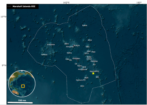
The Republic of the Marshall Islands is an atoll-based country comprising over 1,200 islands, surrounded by 2.13 million square kilometers of ocean —the vast majority of which has never been mapped or surveyed. Despite data gaps, it’s known that the deep sea of Aolepān Aorōkin Ṃajeḷ hosts rich and diverse marine resources, including over 300 unexplored seamounts and extensive deep-sea ridges.
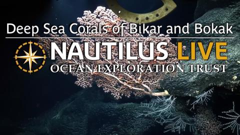
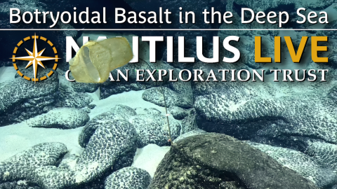
This expedition is being led by four talented lead scientists. Dr. Steve Auscavitch from the National Museum of Natural History will lead community ecology research, in collaboration with Dr. Fanny Girard from the University of Hawai'i at Mānoa, focusing on deep-sea corals. Dr. Val Finlayson from the University of Maryland will oversee the expedition’s geology and geochemistry efforts. OECI partner Dr. Annette Govindarajan from the Woods Hole Oceanographic Institution will use the Aquatic Labs’ Multipuffer environmental DNA (eDNA) sampler, as well as Niskin bottles mounted on ROV Hercules, to collect samples that will be used to study biodiversity and carbon transport in the deep ocean.
“It’s a rare and exciting opportunity to bring together such a diverse and interdisciplinary group of scientists, explorers, and resource managers to study the unexplored and unmapped deep ocean in the central Pacific,” says Dr. Steve Auscavitch, Co-Lead Scientist, and marine genomics specialist at the National Museum of Natural History, Smithsonian Institution. “The combined expertise on Nautilus and ashore will definitely yield novel insights to the Pacific deep-sea environment and its living biological resources in the Marshall Islands and the region for years to come.”
Joining the Corps of Exploration for this expedition are local scientists and resource managers from the Marshall Islands. OET is committed to building connections with local communities in expedition regions through co-developing expedition plans, making data publicly accessible, and coordinating outreach with schools and community groups. On April 15, OET, in collaboration with the MIMRA, hosted a workshop at the Marshall Islands Resort to discuss deep-sea science and ocean outreach needs of the community. The workshop was attended by over 25 people, including stakeholders from these various government agencies and community organizations.
This E/V Nautilus expedition is part of an exciting 2025 field season where six expeditions will build ocean knowledge supporting international scientific and U.S. governmental priorities, particularly understanding the deep sea, sharing that knowledge with others, and contributing new discoveries and data to inform future resource management decisions. Expeditions are co-developed with national exploration priorities and input from scientists, resource managers, and local community stakeholders in the regions where the expeditions will take place.
Through the open sharing of data collected during these expeditions, we will build upon decades of study, stewardship, and discoveries. Mapping and ROV operations will directly contribute to the US National Strategy for Ocean Mapping, Exploration, and Characterization, the Beyond the Blue: Illuminating the Pacific campaign, and other coordinated initiatives. The integration of different technologies into operations on E/V Nautilus continues to advance national priorities for increasing the efficiency and sophistication of ocean exploration.
From May to September 2025, E/V Nautilus expeditions will be streamed live on NautilusLive.org, a 24-hour platform that brings ocean exploration directly to viewers on shore. Telepresence technology allows viewers to engage with the team at sea, asking questions and receiving real-time behind-the-scenes updates via social media. Classrooms worldwide are invited to connect with the at-sea team of STEAM professionals via free educational Q&A interactions. Additionally, OET offers free educational resources for K-12 learners in English, Spanish, Palauan, Samoan, and ʻŌlelo Hawaiʻi, including national-standard aligned activities, engineering design challenges, and creative projects for learners in the classroom or at home.
As E/V Nautilus operates in the Western Pacific, OET recognizes and respects the deep cultural connections many have to this region. OET's expeditions are planned in consultation with local communities to ensure mutual respect and collaboration. We welcome partnership inquiries at info@oet.org.
Deep-Sea Habitats of the Marshall Islands
The Republic of the Marshall Islands is an atoll-based country of over 1,200 islands surrounded by 2.13 million square kilometers of ocean, the vast majority of which has never been mapped or surveyed.