Teaching Animation or Graphic
Seafloor Mapping Teaching Animation
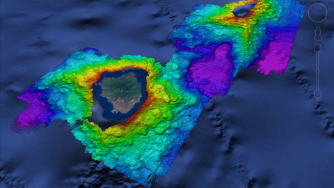
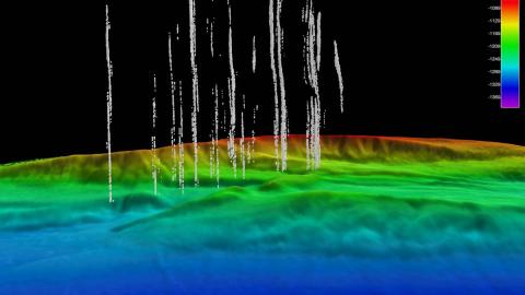
When exploring little-known regions of the ocean, we often need to create our own maps to plan efficient and safe operations. Nautilus is equipped with an acoustic echosounder that simultaneously collects bathymetric, seafloor backscatter, and water column backscatter data to enable identification of areas or features of interest and the production of high-quality seafloor maps at depths to 7,000 meters (23,000 feet).
Whether focused on a canyon, seamount, or shipwreck, creating a map allows us to identify potential targets, cutting down exploration time and boosting our mission efficiency.
Clips used in public presentations should be credited “Courtesy of Ocean Exploration Trust/ Nautilus Live.”
Disciplinary Core Ideas
Disciplinary Core Ideas
Find more resources
Resource type
Themes
Topics
Disciplinary Core Ideas
Related content
STEM Learning Module:
Seafloor Mapping Simulation
Activity or Mini-Lesson:
Seafloor Mapping Classroom Warm Up
Video: