Beyond Boundaries: Seafloor Mapping and Avian Biology in the South Pacific

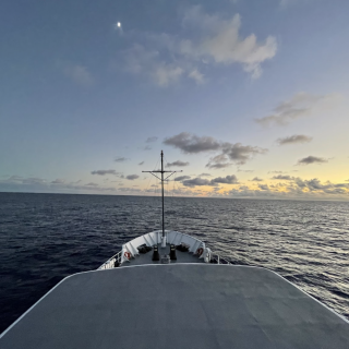
E/V Nautilus has set sail on our NA166 expedition to map the seafloor offshore Howland and Baker Islands, in an area that is being considered for the designation of a new National Marine Sanctuary. The 26-day telepresence-enabled expedition departs from Pago Pago, American Samoa, and ends in Koror, Palau. This expedition will sail across over 4,400 miles of open ocean, a similar distance than between Washington DC and Hawaiʻi, passing through waters under the jurisdiction of six countries: US Territories of American Samoa, Howland and Baker, Tokelau (Dependent Territory of New Zealand), Kiribati, the Republic of the Marshall Islands, the Federated States of Micronesia, and Palau.
All data collected in the region will be shared to support the island nation’s management of the marine environments in their surrounding ocean. As E/V Nautilus visits the Western Pacific Ocean for the first time, we honor the Indigenous people and local communities of Oceania who have stewarded the ocean for generations. Ocean Exploration Trust is committed to building community connections through scientific collaboration and engaging outreach, including 24-hour-a-day streaming and live ship-to-shore interactions with schools and community groups.
During the expedition, the team aboard E/V Nautilus will conduct dedicated seafloor mapping operations in the US Exclusive Economic Zone around the islands of Howland and Baker to acquire high-resolution seafloor mapping data in areas with no or poor data quality. Additionally, E/V Nautilus will map the seafloor between Kosrae Island and the Ontong Java Plateau to support a request by the Federated States of Micronesia. During transits, E/V Nautilus will optimize a route that covers previously unmapped seafloor across this large stretch of the Pacific Ocean.
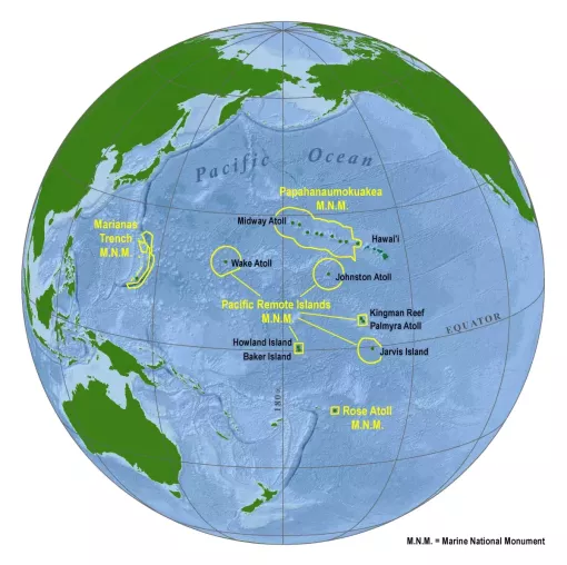
Located roughly 1,800 miles southwest of Hawaiʻi; Howland and Baker are two uninhabited atolls in the Central Pacific. These atolls are administered by the US Fish and Wildlife Service, which established National Wildlife Refuges around both Howland and Baker in 1974. However, today over 90% of the submerged territory in the EEZ still lacks high-resolution mapping data. In 2023, NOAA's Office of National Marine Sanctuaries initiated the process for the proposed designation of a Pacific Remote Islands National Marine Sanctuary. If established, this new Sanctuary would add another layer of protection to the submerged lands and waters out to the full 200 nautical mile limit of the US Exclusive Economic Zone.
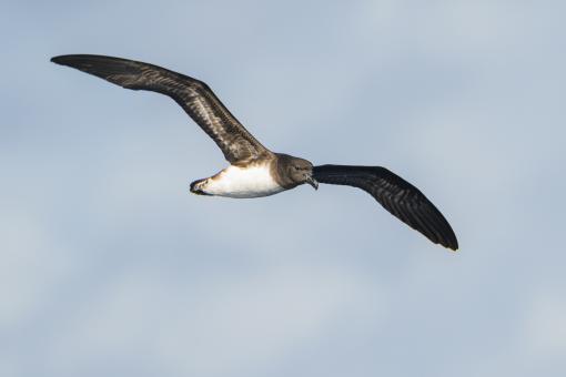
Complementing the expedition’s extensive seafloor mapping operations, this expedition will include topside surveys on the diversity and abundance of seabirds and other surface marine megafauna and activity in support of biodiversity surveys by the Secretariat of the Pacific Regional Environment Programme (SPREP). During daytime hours, trained observers will conduct surveys from the observation deck of E/V Nautilus, using binoculars and cameras, and log all sightings and activity. Gaining a better understanding of how seabirds, including migratory seabird species which use this open ocean pathway, will help all nations inform their conservation actions since oceans have no boundaries. Of approximately the 11,000 species of birds worldwide, only 370 are ‘seabirds’ that spend most of their lives at sea. Of those, 42 are known to breed within Oceania, with 17 unique to our region. Other species breeding outside the region will also pass through the areas that the expedition will cover.
“We at SPREP are super excited to partner with the Ocean Exploration Trust for the first time and join this mapping expedition. Venturing out into essentially unknown waters for marine species will provide us the opportunity to document marine megafauna which is found in these waters, including seabirds, whales, and dolphins, and share our discoveries with our Members and partners," says Karen Baird, Threatened and Migratory Species, Advisor, SPREP.
SPREP's participation in the voyage is supported by the Pacific BioScapes Programme. The Programme is a European Union funded action, managed and implemented by the Secretariat of the Pacific Regional Environment Programme. It includes 30 focused activities taking place across a diversity of ecosystems in 11 Pacific island countries that are addressing critical issues concerning coastal and marine biodiversity, and ecosystem-based responses to climate change adaptation.
The NA166 expedition is funded by NOAA Ocean Exploration via the Ocean Exploration Cooperative Institute and planned and executed around priorities of the science and resource management community to close knowledge gaps. Mapping operations will contribute to advancing the US National Strategy for Ocean Mapping, Exploration, and Characterization, and global initiatives Seabed 2030, and the UN Decade of Ocean Science for Sustainable Development. Seabird survey data will support priorities of the Pacific Islands Regional Marine Species Programme including the Pacific Seabird Action Plan.
Seafloor Mapping Offshore Howland and Baker Islands
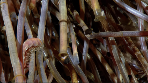
Howland and Baker Islands lie just north of the equator, about 1,800 miles southwest of Hawaiʻi. The islands are low-lying, sandy coral islands ringed by narrow fringing reefs and surrounded by the deep ocean. The US exclusive economic zone around Howland and Baker represents one of the least explored regions under US jurisdiction.