Hayley Drennon on Seafloor Mapping with OET and Seabed2023

OET’s NA166 expedition is focused on filling important seafloor mapping gaps in the Pacific Ocean, including the US exclusive economic zone around Howland and Baker Islands. This seafloor mapping data is foundational to understanding the region, which is protected within 50 miles of the islands within the Pacific Remote Islands Marine National Monument (PRIMNM). In addition to transit mapping (one of the strategies identified by GEBCO to be easiest to implement to contribute to advancing global mapping coverage), NA166’s targeted mapping efforts include international waters as well as the jurisdiction of six countries.
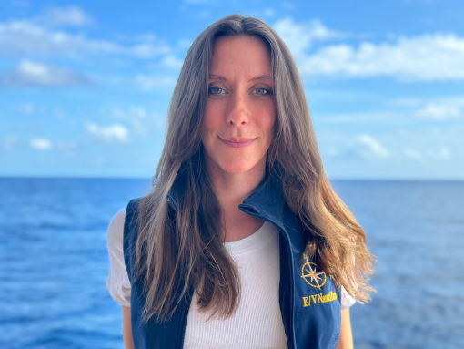
One of the Corps of Exploration members during this expedition is mapping watch lead Hayley Drennon. As a research assistant to Senior Research Scientist Dr. Vicki Ferrini, Hayley works at Lamont-Doherty Earth Observatory on various projects such as Global Multi-Resolution Topography (GMRT), Seabed2030, and other seafloor mapping and data initiatives. Hayley has been with OET since 2021, which is coincidentally the same year that we’ve been partnering with Seabed2030.
When asked about the Seabed 2030 initiative, Hayley says, “Seabed 2030 is a collaborative story, written by a global community of data scientists, researchers, hydrographers, and communicators all working toward a common goal. By bringing together diverse perspectives and expertise, we're not just creating a map, but unlocking the ocean's mysteries for the benefit of everyone. A complete ocean map is essential to understanding our planet’s past, present, and future, and it’s a story we’re all helping to tell.”
Below, Hayley answers some questions from our team about seafloor mapping and Seabed 2023.
What are your key takeaways from the Seabed2030 initiative?
One of my biggest takeaways from this initiative is that creating a global map of the ocean floor truly takes a global community. No single organization or country can achieve this alone—it’s a shared effort, requiring the expertise, resources, and collaboration of diverse stakeholders around the world.
Adaptability and accessibility have been key lessons. As we work in international waters and with a variety of communities, it's crucial to remain flexible and responsive to their needs and input. Equally important is making sure that everyone, from scientists to local communities, has access to the data we collect and can use it to make informed decisions.
Can you point out strengths and weaknesses, particularly as we’re moving into the second half of this goal?
In terms of strengths, it’s the passion for the mission. Whether it's the diverse expertise of our team or the desire to listen to what local communities need, we are driven by the same goal. We’re not just mapping for the sake of science, but also contributing to a broader understanding of how the ocean impacts all of us.
However, there are challenges too. One of the weaknesses we've identified is the difficulty in making such a large-scale project comprehensible to everyone. It’s a complex mission, and we are continually endeavoring to improve how we connect with local stakeholders, so they understand how Seabed 2030 ties into their story. It’s not just about encouraging new mapping efforts, but also about making existing maps more accessible, even at lower resolutions, so that we don’t duplicate efforts.
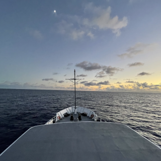
Transit mapping is one of the strategies identified by GEBCO to be easiest to implement to contribute to advancing global mapping coverage. Can you speak to the importance of transit mapping and how it informs other mapping objectives?
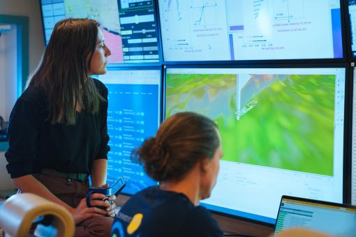
Transit mapping is incredibly important! Whenever we're moving between targeted research areas, we ask that sonar systems remain on, provided we have permission in the waters we traverse. This strategy allows us to collect valuable data in areas where we may not have mapped before. What's exciting is that we sometimes detect features of interest to the scientific community—things we weren’t actively searching for but are noteworthy nonetheless. This helps guide more focused mapping efforts later on.
Transit mapping is particularly helpful because it contributes to the overall coverage of unmapped regions, filling in gaps while complementing the more detailed feature mapping that happens in priority areas. It’s a way to maximize every moment we spend at sea and to gather data that could lead to new discoveries or inform future expeditions.
OET always transit maps. In addition to the targeted mapping efforts at Howland and Baker Islands, NA166 will map across international waters and the jurisdiction of six countries. In what areas do global mapping initiatives work well, and in what areas is there room for improvement?
That’s an excellent question. Global mapping initiatives work well in regions where there’s ready access to technology and training. When stakeholders are well-resourced and see the value of mapping for the scientific community, the process is relatively smooth. These regions tend to have more infrastructure and investment, which allows them to take full advantage of Seabed 2030’s tools and capabilities.
However, there’s still significant room for improvement, especially at the local level. In smaller communities, resources are often limited, making it hard to participate fully in a global project. That’s why it’s so important for us to provide open-source tools, software, and training, enabling these communities to contribute to and benefit from the initiative. Bridging this gap between those with resources and those who can most benefit from the data is critical to the project's success. The ocean affects everyone, so access to this data should be as equitable as possible.
Seafloor Mapping Offshore Howland and Baker Islands
Howland and Baker Islands lie just north of the equator, about 1,800 miles southwest of Hawaiʻi. The islands are low-lying, sandy coral islands ringed by narrow fringing reefs and surrounded by the deep ocean. The US exclusive economic zone around Howland and Baker represents one of the least explored regions under US jurisdiction.