Exploring WWII Shipwreck USS Vincennes
Thanks to a team of scientists, archaeologists, and pilots, the OET-led expedition to explore the maritime archaeology of Guadalcanal surveyed the New Orleans-class heavy cruiser: USS Vincennes. From the control van on #EVNautilus (and live-streamed around the world), we examined the wreck, approximately 1,000 meters deep, northeast of Savo Island in Iron Bottom Sound of Solomon Islands. The Vincennes was attacked and sank in the early hours of August 9, 1942, during the Battle of Savo Island, the first naval battle of the Solomons campaign. Caught by surprise by a powerful Japanese naval force, Vincennes received more than 50 artillery hits as well as a torpedo hit on the portside.
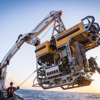
In the exploration, the team mapped the entire wreck using an ultra-high-resolution multibeam sonar mounted on ROV Hercules, then surveyed with high-resolution video surveys, to understand the wreck's condition and gather imagery to model the site. Watch as we explore this 175-meter-long cruiser, which provides a glimpse into the realities of this pivotal moment in history. Watch the video and learn more from our Corps of Exploration, including Frank Thompson, Director of the Collection Management Division at the Naval History and Heritage Command.
The Maritime Archaeology of Guadalcanal expedition (NA173) utilizes the remotely operated vehicle and telepresence systems of E/V Nautilus, in combination with the mapping capabilities of uncrewed surface vehicle DriX, to conduct non-invasive archaeological surveys of maritime heritage sites in the Iron Bottom Sound. This expedition is supported by NOAA Ocean Exploration via the Ocean Exploration Cooperative Institute. This exploration is made possible by the expertise, support, and collaboration of many partners, including NOAA Ocean Exploration, U.S. Naval History and Heritage Command, Solomon Islands government, University of New Hampshire Center for Coastal and Ocean Mapping/Joint Hydrographic Center, University of Rhode Island, and Japanese, Australian, and New Zealand archaeological colleagues.
Maritime Archaeology of Guadalcanal: Iron Bottom Sound
Located in the Solomon Islands between the islands of Guadalcanal, Savo, and Nggela, Iron Bottom Sound was the stage of five major naval battles between August and December 1942 which resulted in the loss of over 20,000 lives, 111 naval vessels, and 1,450 planes. These underwater cultural heritage sites now rest on the seafloor offshore Honiara in a confined area less than 25 nautical miles wide, 40 nautical miles long, and 1,400 meters deep.