Teaming Up for Dual-Technology Seafloor Mapping
What's better than one efficient mapping tool? Two!
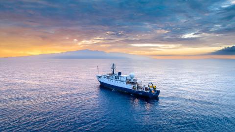
During our 24-day Luʻuaeaahikiikawawāapalaoa expedition, OET teamed up with our partner the University of New Hampshire Center for Coastal and Ocean Mapping to test how ship-based seafloor mapping can be supplemented with new mapping technologies to expand the types of habitats we can gather data from and boost the efficiency of future expeditions.
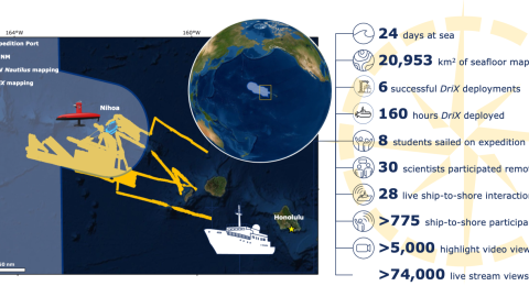
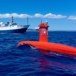
Together E/V Nautilus and Uncrewed Surface Vehicle DriX collected bathymetry across over 20,000 square kilometers from near coastal to deep ocean habitats near Nihoa Island in Papahānaumokuākea Marine National Monument. New seafloor maps will equip monument managers with a better understanding of the formation of deep-water and shallow-water terrain of the Northwestern Hawaiian Islands, contribute to high-resolution nautical charts, and improve safe navigation in the area. Every chance to work together improves operational planning and coordination of new technologies. This work also contributes to the National Ocean Mapping, Exploration, and Characterization Council and GEBCO Seabed 2030 seafloor mapping campaigns. Both efforts to build complete maps of the seafloor require dedicated surveying efforts, particularly in remote areas to meet these goals within the next decade.
Learn more about this expedition funded by NOAA Ocean Exploration via the Ocean Exploration Cooperative Institute and the NOAA Office of Coast Survey.
Luʻuaeaahikiikawawāapalaoa: Dual-Technology Seafloor Mapping
This expedition focuses on high-resolution mapping areas of Papahānaumokuākea Marine National Monument (PMNM) currently lacking data using ship-based mapping surveys in deep waters as well as deploying the uncrewed surface vessel DriX for nearshore mapping.