How Seafloor Mapping Data Guides ROV Exploration
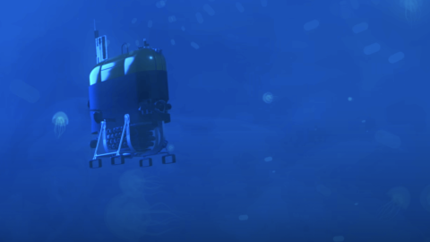
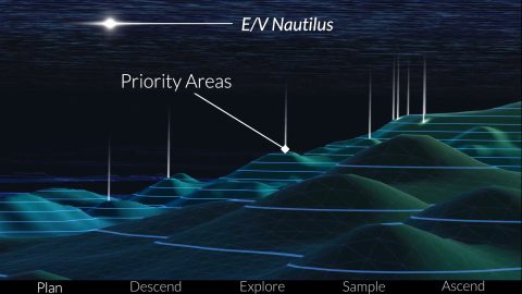
Our current expedition to Johnston Atoll uses the mapping information gathered on our last expedition where we were able to map 27,788 square kilometers in and around this area of the Pacific Remote Islands Marine National Monument (PRIMNM). In this video, our Corps of Exploration explains how we gather and use that seafloor mapping data and use it to determine where to dive with ROV Hercules.
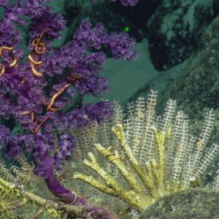
Johnston Atoll is located in the Prime Crust Zone, an area of the Pacific with oceanographic conditions observed to concentrate deep-sea minerals, including economically valuable metals and rare earth elements. The questions of biological connectivity are particularly relevant around Johnston Atoll as the area contains rich biodiversity and is the closest deep water marine protected area to Papahānaumokuākea Marine National Monument and in the same region as the Kingman Reef, Palmyra Atoll, and Kiribati’s Phoenix Islands Protected Area. Thanks to our mapping team, scientists on this expedition can pinpoint the best places to dive for their geological and biological research.
Learn more about this expedition funded by NOAA Ocean Exploration via the Ocean Exploration Cooperative Institute.
Deep Sea Biodiversity & Ancient Volcanoes near Johnston Atoll
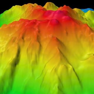
Johnston Atoll, one of the most isolated atolls in the world, is located in the central Pacific Ocean, between the Hawaiian Islands, the Line Islands, and the nation of Kiribati. Around this atoll, the Pacific Remote Island Marine National Monument (PRIMNM) was expanded in 2014 to protect the full 200 nautical mile perimeter of the exclusive economic zone (EEZ) encompassing many unexplored seafloor features.
Johnston Atoll Mapping
This 24-day expedition will involve multibeam and sub-bottom profiler mapping to reveal the seafloor within the Johnston Atoll Unit of Pacific Remote Island Marine National Monument (PRIMNM). Johnston Atoll, one of the most isolated atolls globally, is located in the central Pacific Ocean, between the Hawaiian Islands and the Line Islands. The main objective of this expedition will be to collect high-resolution seafloor bathymetry data where it has not been previously collected.