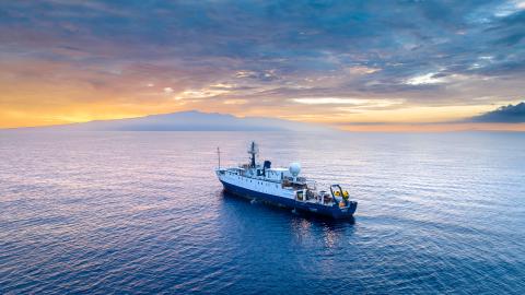
Revealing Secrets of the Pacific Seafloor With Bathymetry
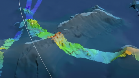
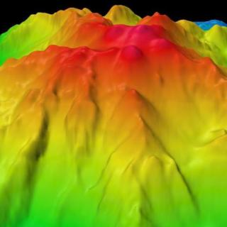
This flythrough shows some of the complex bathymetric maps generated on our current expedition in and around the Johnston Atoll Unit of the Pacific Remote Islands Marine National Monument (PRIMNM) and how we use those maps to identify potential ROV dive targets for our next expedition. Watch and learn more from our Corps of Exploration about the importance of multibeam data to understanding the unique geological features of this mostly unsurveyed region of the Central Pacific.
The high-resolution seafloor bathymetry data we are collecting during this expedition will inform planning for ROV dives on a follow-on expedition examining areas of prime deep sea coral and sponge habitat. Additionally, this project directly supports the National Strategy for Ocean Mapping, Exploring, and Characterizing the United States Exclusive Economic Zone by contributing to mapping the deep waters of the US EEZ along with the Biden-Harris administration’s executive order on tackling the climate crisis at home and abroad (30x30); the GEBCO-Nippon Foundation’s Seabed 2030 program; and the United Nations’ Decade for Ocean Science for Sustainable Development.
Johnston Atoll Mapping
This 24-day expedition will involve multibeam and sub-bottom profiler mapping to reveal the seafloor within the Johnston Atoll Unit of Pacific Remote Island Marine National Monument (PRIMNM). Johnston Atoll, one of the most isolated atolls globally, is located in the central Pacific Ocean, between the Hawaiian Islands and the Line Islands. The main objective of this expedition will be to collect high-resolution seafloor bathymetry data where it has not been previously collected.