E/V Nautilus Installs New EM304 Multibeam Sonar to Explore Deeper and More Than Ever!

The Ocean Exploration Trust is excited to announce that we’ve integrated a new piece of technology onto Exploration Vessel (E/V) Nautilus that will allow us to expand our mapping and exploration capabilities to go deeper than ever before: a Kongsberg EM304 MKII multibeam! Most unmapped areas in the Pacific lie at depths between 4,000 and 6,000 meters. At these depths, the new EM304 will effectively double the area E/V Nautilus was able to map previously, halving survey times and reducing the costs of mapping in remote areas. Acquired with funding provided by the Office of Naval Research to the University of New Hampshire’s Center for Coastal and Ocean Mapping (UNH/CCOM) and implemented in partnership with industry leader Kongsberg, OET is proud to host this new acoustic mapping system.
“Installing this sonar represents the latest state-of-the-art mapping system for deep ocean habitats ranging from the edge of the continental shelf to the deepest parts of the ocean,” says OET Mapping Manager Derek Sowers. “The EM304 is optimized for features of interest we tend to explore in the deep sea, like complex canyons, seamounts, ridges, trenches, seafloor spreading centers, abyssal plains, and subsea volcanoes. It allows us to map and reveal these amazing features in great detail and sets us up for success for further exploration using our ROVs and other assets.”
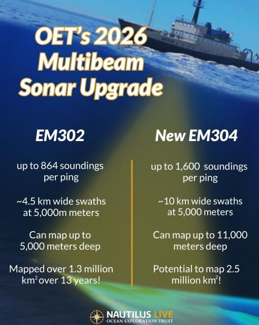
After 13 years of excellent service and 2,269 days at sea, OET has swapped our trusty EM302 multibeam for its EM304 successor system. During this time, we successfully mapped 1.3 million square kilometers of seafloor: an area roughly twice the size of Texas! These data have been a critical part of our contributions to the Seabed 2030 initiative, an international collaborative project to combine bathymetric data to create a comprehensive map of the ocean floor, and the US National Strategy for Mapping, Exploration, and Characterization (NOMEC).
As we move into the next decade of exploration work, we’re investing in this new sonar to make even greater contributions to global ocean exploration. With this EM 304 upgrade, we can create 10-12 kilometer wide swaths in up to 6,000 meters deep water - more than doubling the 4.5 kilometer swaths we were previously able to map in these depths. Importantly, we can also now map much deeper than ever before: up to 11,000 meters, allowing us to reach the deepest parts of our ocean. This is especially critical as we will be exploring some of the deepest ocean regions in the Western Pacific in 2026 and beyond.
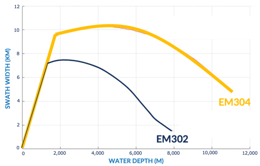
Over the next 10 years, we estimate that the EM 304 will enable us to map an additional 1.2 million square kilometers of seafloor beyond what would have been possible with the EM 302. Another upgrade to this new multibeam is the collection of soundings per ping. The EM 302 collects a maximum of 864, while the new EM 304 collects up to 1,600 in dual ping mode. This higher number should result in terrain maps with higher sounding density and fewer gaps, leading to better maps that help our Corps of Exploration decide on deployment plans for our ROVs and other vehicles. The EM 304’s enhanced swath width performance is largely due to its ability to utilize lower frequency pings in its outer beam sectors, which enables the sound to travel further and return echoes from the seafloor more reliably.
Another exciting innovation of the new multibeam system is that the same sonar array used for bathymetric mapping can also be used to gather sub-bottom profiler (SBP) data. Running the system in this dual mode entails a separate computer and software system, and it can swap pings with the bathymetric workstation to gather bathymetry and SBP data along the same survey line while mapping a feature of interest. SBP data provide insight into seabed geology beneath the surface and sedimentation processes, greatly aiding the geological interpretation of an area.
OET is excited to have E/V Nautilus join other research vessels that have recently upgraded or installed EM 304 systems (including NOAA Ship Okeanos Explorer, R/V Sikuliaq, R/V Gyre, and R/V REV Ocean). Having a compatible EM 304 on E/V Nautilus provides opportunities for collaboration among these ships, as well as the myriad other researchers who use data collected by these platforms.
“Other research vessels have upgraded to this same system, which means this allows us to map at comparable levels of resolution and quality as they are doing. The result will be better and more direct collaboration for everyone in ocean exploration,” says Sowers. “OET is proud to be part of a group of explorers with these state-of-the-art capabilities working together to map the world’s seafloor in high resolution.”
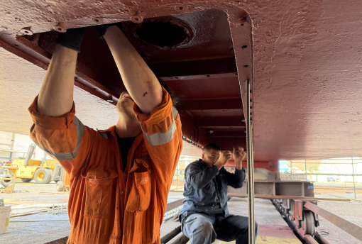
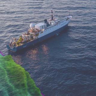
Crew members installing the new sonar on E/V Nautilus.
“Getting this state-of-the-art mapping system installed on E/V Nautilus represents a highly collaborative mission between OET, the US federal government, the sonar manufacturer Kongsberg, and the University of New Hampshire’s Center for Coastal and Ocean Mapping,” says Sowers. “Together, we’re pushing the limits of mapping technology using E/V Nautilus as a testbed for improving the pace and scale of future ocean mapping.”
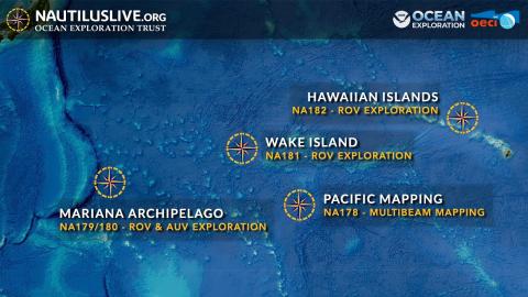
The E/V Nautilus sets sail on its first expedition of the 2026 season (NA178) in June. The ship will spend thirteen days at sea, traveling from Honolulu to Guam, and using the new EM304 multibeam sonar to map uncharted seafloor along the way, including passage over the Mariana Trench. Three senior Kongsberg staff members will join this expedition at sea to field-test new beta software tools and refine the system's SBP capability. Through such private-public partnerships, E/V Nautilus will not only continue to map many previously unsurveyed areas, but will also serve as an important test platform to increase the exploration efficiency of our largely unmapped ocean.
Pacific Mapping
Our first expedition of the 2026 season is a seafloor mapping expedition from Hawaiʻi to Guam, where E/V Nautilus will support subsequent expeditions exploring deep-sea habitats around the Mariana Islands.