Submerged Shorelines in the Southern California Borderland

Wrapping up the 2018 Nautilus Expedition season from November 3-16, 2018, the primary focus of this expedition is the identification and characterization of submerged shorelines associated with offshore banks in the Southern California Borderland region. This is a follow-on to the effort by E/V Nautilus over the last four years to acquire high-resolution mapping data of submerged shorelines and characterize these features primarily with remotely operated vehicles. Dr. Robert Ballard, President of Ocean Exploration Trust, and Dr. Larry Mayer, University of New Hampshire-Center for Coastal and Ocean Mapping, will be Lead Scientists with Expedition Leader Dr. Dwight Coleman, Director of University of Rhod Island-Inner Space Center for this expedition.
Pursuing Paleoshorelines
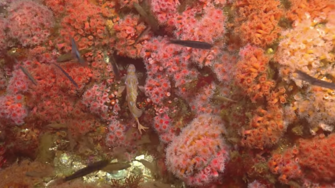
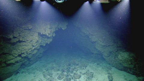
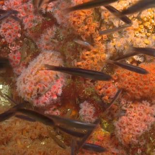
The Southern California coastline did not always look the way it does now. During the last Ice Age, which lasted until about 10,000 years ago, sea levels were hundreds of feet lower than today, and powerful winter waves pounded against the steep rocky coastline, eroding away shorelines of boulders. Spires, caves, and arches were carved out when the less resistant, crumbly material was flushed out in these intertidal zones, leaving more durable rock features behind. Many of these features were submerged as ice sheets and glaciers melted and sea levels began to rise, but reveal themselves in sonar mapping data--these paleo shorelines and sea caves are the main targets our exploration.
Nautilus began working with the Channel Islands National Marine Sanctuary in 2016 to conduct high-resolution mapping and exploratory ROV dives of unsurveyed regions of this offshore sanctuary. In 2017 Nautilus continued this work as part of a larger project to understand sea level history and locate, map, and document submerged shorelines in target regions in the northern Channel Islands.
The 2018 effort to map and document paleoshorelines will focus on offshore banks, as these do not receive terrigenous sediment--created from the erosion of rocks on land--which obscures shoreline features such as caves from view. Sites of interest include Nidever Bank, Tanner Bank, Osborn Bank, and Fortymile Bank, all mapped by Nautilus in 2017 as these features were previously incompletely or poorly mapped or data was unavailable to the public. These new multibeam maps provide a rich dataset to plan autonomous surface vehicle (ASV) and remotely-operated vehicle (ROV) operations for this expedition.
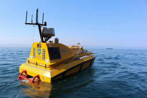
The Autonomous Surface Vehicle (ASV) operated by the University of New Hampshire’s Center for Coastal and Ocean Mapping, is equipped with a sonar mapping echosounder to produce high resolution maps that our team can use to plan additional surveys with ROVs Hercules and Argus for HD video characterization and geological sampling.
Expedition Goals & Objectives
-
Conduct reconnaissance high resolution mapping with a multibeam echosounder mounted on the ASV at outer banks to identify ridge locations that have a high probability for hosting submerged caves
-
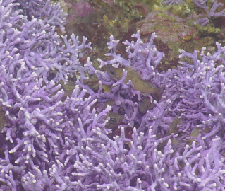
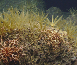
To explore, identify, characterize and assess the geology and ecological communities utilizing ROV Hercules
-
Use ROV HD cameras to visually characterize the paleo shorelines mapped by Nautilus in 2017 and the ASV
-
Sample diagnostic features to help constrain shoreline age and understand the local ecology
-
Submerged Shorelines of California Borderland
The primary focus of this expedition is the identification and characterization of submerged shorelines associated with offshore banks in the southern California Borderland region. This is a continuation of the effort by Nautilus over the last four years to acquire high-resolution mapping data of submerged shorelines and characterize primarily with remotely operated vehicles.