Seafloor Mapping in 60 Seconds
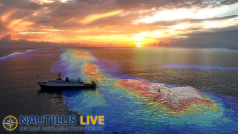
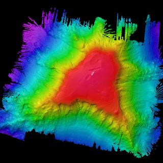
How exactly do we map the seafloor? Onboard E/V Nautilus, our Corps of Exploration uses the Kongsberg EM302 multibeam echosounder to create detailed seafloor maps. By generating sound beams and collecting returning data, this technology allows us to piece together the topography of the deep sea. Seafloor mapping began over a century ago, yet less than 25 percent of the world’s ocean has been charted at high resolutions. Our seafloor maps contribute to the Seabed 2030 initiative, an international collaborative project to combine all bathymetric data to create a comprehensive map of the ocean floor.
Having 3D maps of the seafloor also leads our ocean exploration goals. When exploring little-known ocean regions, we often need to create our own maps to plan efficient and safe operations. Whether focused on a canyon, seamount, or shipwreck, creating a map allows us to identify potential targets, cutting down exploration time and boosting our mission efficiency. Before ROVs are deployed, our team must first map the area to understand the region's characteristics and identify potential benthic habitats, seeps, and other environments and resources worthy of exploration.
Jarvis Island Mapping
Traveling to the southern hemisphere, this expedition takes the team to Jarvis Island, one of the most poorly mapped areas under US jurisdiction, where our high-resolution bathymetric seafloor mapping will add to the world’s baseline knowledge of this poorly studied part of the Pacific Remote Islands Marine National Monument (PRIMNM).