Adventures Across the Pacific: 2024 Field Season Summary
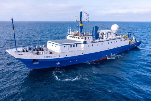
In 2024, E/V Nautilus successfully completed an 8-month field season consisting of 11 multi-disciplinary expeditions that explored the Pacific for a total of 163 days at sea. The 2024 season began with a shakedown expedition in Hawaiʻi to prepare for the fieldwork ahead, followed by others centered on supporting maintenance of the Ocean Networks Canada Cabled Observatory, seafloor mapping across the North and Central Pacific, multi-vehicle explorations in American Samoa, ROV explorations of the Palau National Marine Sanctuary, and deployments of multiple robotic assets to study the physical oceanography around the Palauan Islands. Collectively, 2024 expeditions mapped over 150,000 km2 of seafloor, completed 62 successful ROV dives, 61 deployments of other vehicles, and engaged many millions of viewers around the world.
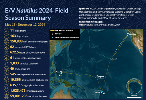
Download the 2024 Expedition Summary PDF.
2024 Shakedown
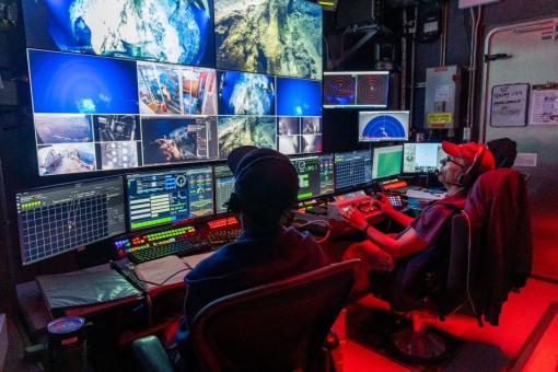
Between May 15-22, E/V Nautilus conducted a shakedown expedition to prepare the ship’s mapping, ROV, and telepresence systems for the 2024 field season. During this 7-day expedition in the Main Hawaiian Islands, the team successfully completed annual quality assurance tests of E/V Nautilus’ mapping and navigation systems, including a multibeam patch test, speed noise testing, and accuracy surveys over a variety of different seafloor depths. The shakedown expedition also included five test dives using the ROV system in different configurations, for a total dive time of over 18 hours to get the vehicles ready for the fieldwork ahead.
Hawaiʻi - British Columbia Mapping
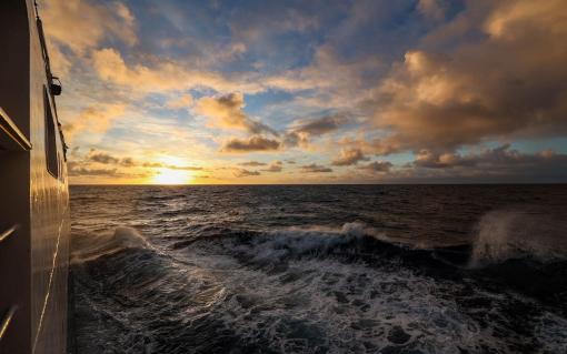
From May 25-June 4 and June 28-July 7, E/V Nautilus conducted two expeditions that mapped the seafloor during transits between British Columbia and Hawaiʻi, focusing on areas that had not previously been mapped. Funded by Ocean Networks Canada, these two expeditions mapped over 42,653 km2 of seafloor, which mostly consisted of abyssal plains but also included passage over unmapped portions of the Mendocino, Pioneer, and Murray fracture zones, as well as several unmapped seamounts. In addition to transit mapping, one of the expeditions (NA162) included deploying seven Argo floats from Ocean Networks Canada to support large-scale ocean monitoring efforts. Argo floats were deployed in international waters along the transit route, thereby adding important coverage to the over 3,800 floats that are currently operational globally.
Hawaiʻi - American Samoa Mapping
Between July 22-August 6, 2024, E/V Nautilus mapped seafloor in the Central Pacific. While the original goal was to conduct ROV operations around Jarvis, the expedition's start had to be delayed due to unforeseen ship repairs. As a result, the expedition shifted its focus to transit mapping operations between Hawaiʻi and American Samoa. Funded by NOAA Ocean Exploration via the Ocean Exploration Cooperative Institute, the expedition mapped 18,680 km2 of seafloor, including 6,555 km2 in the US Exclusive Economic Zone around Hawaiʻi, Palmyra, and American Samoa. The expedition also completed one ROV dive to survey the Makapuʻu precious coral bed located east of Oʻahu. During approximately five hours of bottom time, the ROVs surveyed depths between 450-500 m in an area that had not been explored previously, providing important new information to delineate the boundaries of the bed and inform essential fish habitat designations. The expedition also deployed an acoustic mooring in American Samoa to support cetacean monitoring efforts.text
Ocean Networks Canda Observatory Maintenance
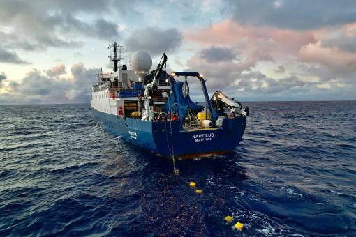
Between June 6-27, E/V Nautilus conducted an expedition in support of Ocean Networks Canada’s NEPTUNE Cabled Observatory. During this 21-day expedition, which was funded by Ocean Networks Canada, E/V Nautilus supported ROV and seafloor mapping operations, as well as deployed and recovered various instruments. Over 692 km2 of seafloor were mapped, focusing on previously unmapped areas between Barkley Canyon and Clayoquot Slope. The mission completed 19 successful ROV dives focused on deploying and recovering sensors, in addition to conducting visual surveys at depths ranging between 370-2,665 m at six different observatory sites. The mission also included 61 h of deck operations not associated with ROV dives, including the deployment of three CTD rosette casts, two moorings, six sediment traps, and five ocean bottom seismometers. In collaboration with the Cable Ship Cable Innovator, the team was able to lay a secondary replacement cable at Cascadia Basin.
E Mamana Ou Gataifale I - American Samoa Multi-Vehicle Exploration
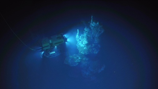
On August 10-28, 2024, E/V Nautilus conducted an expedition focused on integrating exploration technologies from NOAA Ocean Exploration Cooperative Institute partners. Funded by NOAA Ocean Exploration via the Ocean Exploration Cooperative Institute, the expedition used uncrewed surface vehicle DriX launched from a shore-based station in Pago Pago, in combination with autonomous underwater vehicle Mesobot and the Deep Autonomous Profiler launched from E/V Nautilus, to explore seafloor and water column habitats of American Samoa. During 16 days at sea, these advanced exploration technologies were used to map, survey, and sample ocean habitats around Tutuila, Taʻū, and Vailulu’u Seamount. The expedition successfully completed eight Deep Autonomous Profiler and 16 Mesobot deployments, most of which were closely coordinated with shore-controlled DriX operations. The expedition mapped 651 km2 of seafloor, including the entirety of Vailulu’u Seamount, an active underwater volcano that had not been mapped since 2019. The mission also collected 357 eDNA samples to support studies on the marine biodiversity of American Samoa.
E Mamana Ou Gataifale I - American Samoa Deep-Sea Exploration
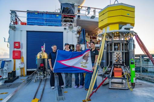
Between September 1-24, 2024, E/V Nautilus completed a second expedition focused on exploring deep-sea habitats around American Samoa. The expedition used the ROV, mapping, and telepresence systems of E/V Nautilus in combination with AUV Sentry to explore Vailulu’u Seamount, areas of historic volcanic eruptions, bottomfish habitats, abyssal plains, and other areas prioritized by the science and resource management community. Funded by NOAA Ocean Exploration, the Bureau of Ocean Energy Management and NOAA Uncrewed Systems Operation Center via the Ocean Exploration Cooperative Institute, the expedition mapped 8,458 km2 of seafloor, including seven different seamounts. The expedition also completed 17 successful ROV dives to depths of 300-3,000 m. Major ROV achievements included the discovery of new vents at Vailulu’u Seamount, as well as the successful integration of two recently developed instruments. This included the Sensor for Aqueous Gases in the Environment that was used to gather in situ methane and carbon dioxide data, and an autonomous eDNA multisampler that was used to filter over 16,000 liters of seawater at depth and collect eDNA samples. The expedition also completed 10 successful dives using AUV Sentry, focused on continuing the search for the Samoan Clipper underwater cultural heritage site, characterizing abyssal plain habitats to support the Bureau of Ocean Energy Management, and detecting hydrothermal vent signals in the water column above Vailulu’u Seamount. While the Samoan Clipper wreck was not located, AUV Sentry mapping surveys revealed detailed geologic features at less than 20 cm resolution. Other AUV Sentry highlights included the deepest surveys in American Samoa (5,500 and 5,800 m dives), the most detailed view to date of the geology associated with the 2006-2019 eruption of Vailulu’u Seamount, and the transmission of data to shore-based scientists in near real time, a unique feat for an untethered autonomous system.
Seafloor Mapping Offshore Howland and Baker Islands
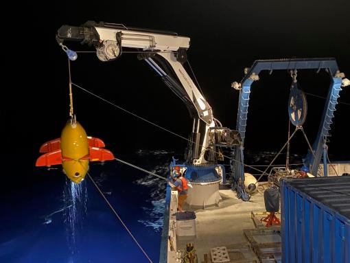
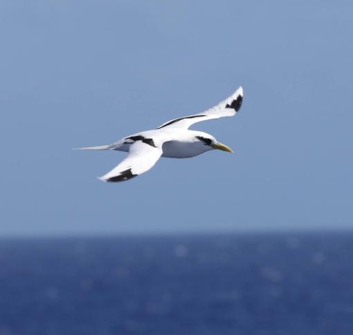
From September 28-October 25, 2024, E/V Nautilus conducted an expedition to map seafloor around the islands of Howland and Baker, as well as other unmapped areas along the transit route between American Samoa and Palau. Funded by NOAA Ocean Exploration via the Ocean Exploration Cooperative Institute, the expedition mapped over 55,151 km2 of seafloor, including 11,484 km2 in the US Exclusive Economic Zone around Howland and Baker, in an area that is being considered for the establishment of a new National Marine Sanctuary where seven different seamounts were mapped for the first time. In addition to dedicated mapping around Howland and Baker, the expedition included transit mapping operations in American Samoa, Kiribati, Tokelau, Republic of Marshall Islands, Federated States of Micronesia, and Palau. Furthermore, the expedition included topside surveys for seabirds and other marine animals. Surveys were conducted for a cumulative time of 360 h, during which trained observers documented over 1,300 individuals from 26 species of seabirds, two species of shorebirds, one species of landbird, five species of cetaceans, dolphins, manta rays, and more.
Lebuu's Voyage- Exploration of the Palau National Marine Sanctuary
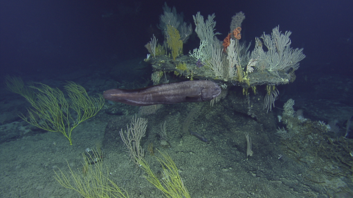
From October 29-November 22, E/V Nautilus conducted two-back-to back expeditions focused on exploring the Palau National Marine Sanctuary. Funded by NOAA Ocean Exploration via the Ocean Exploration Cooperative Institute, these two expeditions mapped over 19,052 km2 of seafloor, and completed 13 successful ROV dives that explored depths between 575-3,200 m during close to 200 h of dive time. Noteworthy ROV observations included the first-ever live observations of two species of anglerfish, the collection of several new species of fishes and invertebrates, high-density coral gardens at eight different locations, and the documentation of large areas of fossilized coral reefs that will contribute to our understanding of previous climate conditions of the region. The expedition also included the collection of 142 eDNA samples to support the monitoring program of the Palau National Marine Sanctuary, including the first ever samples collected at depth.
Mapping and Water Column Exploration Around Palau
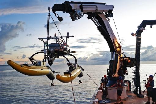
Between November 25-December 12, E/V Nautilus explored the physical and biological oceanography in waters around the Palauan Islands using the ROV, mapping, and telepresence systems of E/V Nautilus, in combination with the deployment of wavegliders, buoyancy gliders, autonomous surface vehicles, and vertical microstructure turbulence profilers from the Scripps Institution of Oceanography. Funded by NOAA Ocean Exploration via the Ocean Exploration Cooperative Institute with additional support from the Office of Naval Research, the expedition completed four successful ROV dives that explored depths between 170-760 m during 29 h of dive time, during which 33 primary samples were collected. Additionally, the expedition successfully completed 10 WAM-V uncrewed surface vehicle deployments, two wave glider deployments, and five buoyancy glider deployments, in addition to mapping the seafloor and the water column in many previously unmapped areas.
Data Access
Data collected during the 2024 E/V Nautilus field season will be given to government agencies in locations where expeditions took place, as well as sent to repositories for archiving and public distribution, links to which are provided below. These datasets are also available from OET upon request. OET encourages the science and management community to make use use of these rich datasets, and requests that appropriate acknowledgment is provided in accordance with OET’s publication policy.
- NautilusLive.org: Background information, highlight imagery and education materials
- Rolling Deck to Repository: Ship navigation, weather and mapping data
- Marine Geoscience Data System: Mapping and ROV data
- YouTube: Full ROV videos and highlights
- University of Rhode Island’s Marine Geological Samples Lab: Geological samples
- Harvard University’s Museum of Comparative Zoology: Biological samples
Broader Impacts
E/V Nautilus expeditions surveyed extensive ocean habitats across both sides of the Pacific, and successfully integrated numerous emerging technologies while sharing the excitement of discovery with millions of people around the world. Expeditions were executed around priorities of the science and resource management community, and contributed directly to the UN Decade of Ocean Science for Sustainable Development, US National Strategy for Ocean Mapping, Exploration and Characterization, Seabed 2030, and the Beyond the Blue: Illuminating the Pacific campaign. Expedition activities also advanced NOAA mission priorities, particularly in terms of understanding ocean changes, sharing that knowledge with others, and conserving marine ecosystems. This work also helped advance priorities on education, diversity and inclusion by providing opportunities for educators and individuals with historically marginalized identities to participate in expeditions. Finally, the data collected on these missions is an essential precursor to future explorations, which will undoubtedly lead to many more discoveries. To this end, data and samples collected on these missions have been deposited in publicly-available repositories to enable follow-on science and management activities.
Education and Outreach
Throughout the 2024 field season, the excitement of exploration and discovery were shared with people of all ages via many different avenues, collectively reaching millions of people around the world. Live-stream video feeds received over 1 million views, and highlight videos garnered over 635,000 views. Expedition content on OET’s social media channels attracted over 59 million impressions. While at sea, the team created 51 new highlight videos, 55 new blogs, and 11 new photo albums, and hosted 545 live ship-to-shore interactions with schools, community events, and professional meetings, reaching over 19,000 people across 43 US States, American Samoa, Guam, US Virgin Islands, Palau, Canada, and 20 other countries. Early results of the 2024 season have been featured in 475 media stories, published in 65 different countries and in 30 different languages. A total of 13 educators and 16 students sailed on 2024 expeditions via OET’s at sea internship and fellowship programs.

Acknowledgments
Thanks to the captain and crew of E/V Nautilus, the Nautilus Corps of Exploration, and all that supported the expeditions from shore. 2024 expeditions were funded by NOAA Ocean Exploration, the Bureau of Ocean Energy Management and NOAA Uncrewed Systems Operation Center via the Ocean Exploration Cooperative Institute, Ocean Networks Canada, and Office of Naval Research.
