OET Assists in US Commitment to Map and Explore Palau
The Ocean Exploration Trust is proud to partner with NOAA Ocean Exploration to help meet a US government commitment to the nation of Palau through three expeditions in the waters of Palau in 2024. While this Western Pacific nation is widely known for its commitment to ocean conservation, today there are major gaps in deep water understanding including over 70% of the exclusive economic zone of Palau unmapped with modern technologies. Mapping and exploring habitats of Palau National Marine Sanctuary (PNMS) provides critical baseline data for managing the preservation of ocean habitats into the future. That fact is one of the main focuses of our expeditions: to fill in as many of those “blue voids” as possible and then explore some of those deep sea habitats with remotely operated vehicles (ROVs).
In 2009, Palau designated its waters as the world’s first national shark sanctuary, later extending these protections to whales, dolphins, and dugongs. Exercising traditional values of conservation, in 2015, the Palau National Congress established the PNMS or Euotelel a Klingil a Debel Belau, which came into full effect in 2020. All extractive activities, such as fishing and mining, are now prohibited in the Sanctuary. OET is privileged to be able to map and explore the waters in and around PNMS this year in collaboration with the Palau International Coral Reef Center, NOAA Ocean Exploration, and other Palauan and U.S. collaborators.
In 2022, Palau and the United States co-hosted the 7th Our Ocean Conference, to address cross-cutting themes on small island states and climate change. At the conference, the United States announced more than 110 commitments, including support for Palau to assist in mapping the Palau National Marine Sanctuary. Through support from NOAA Ocean Exploration via the Ocean Exploration Cooperative Institute, OET is honored to be part of meeting this commitment with mapping and remotely operated vehicle dives. NOAA Ocean Exploration will continue this work with further expeditions in Palau with NOAA Ship Okeanos Explorer in 2025 for the benefit of the broader community.
About Palau
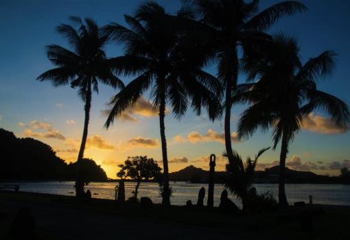
Located roughly 1,500 kilometers east of the Philippines, and 1,500 kilometers southwest of Guam, Palau is an island country in the Western Pacific. Made up of 12 inhabited islands and over 700 islets surrounded by 603,978 square kilometers of open ocean, Palau’s ocean is nearly the size of France. This Big Ocean State is part of Micronesia on the western edge of over 3,500 kilometers of coral islands that extend east into the Pacific.
Early Pacific Island voyagers, known as the Lapita People, first arrived in the Palauan Islands around 4,500 years ago from the Philippines and Indonesia. The islands flourished with connected communities and active canoe voyages within the local islands and across the vast Western Pacific. In 1783, a shipwrecked East Indian Company crew was the first Western contact to reach Palau. Later in the nineteenth century, the nation was colonized by Spain and Germany beginning in 1899. Germany administered Palau until 1914, when Japanese forces occupied the islands. During World War II, major battles were fought in Palau, including the Battle of Peleliu and the Battle of Angaur. In 1947, after the war, the United States took administrative authority over Palau until the nation established independence in 1994.
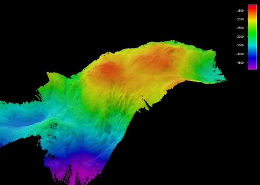
OET recently mapped this seamount on the eastern edge of PNMS between the Yap and Palau trenches with our multi-beam sonar.
Previous Ocean Exploration in Palau
Like in many other Pacific Island nations, the vast majority of marine scientific research in Palau has focused on its shallow-water reefs. Palau is located just northeast of the Coral Triangle, the area with the highest marine biodiversity on Earth. Numerous shallow-water surveys have documented Palau’s rich marine biodiversity, which includes over 2,000 reef species. However, the true marine biodiversity of Palau is likely much higher, since its deep-water habitats remain mostly unexplored.
However, deep ocean exploration has also been conducted for over seventy years in deeper waters. Previous exploration of Palau’s deep sea includes;
- In 1964 and 1967, Lamont-Doherty Earth Observatory’s R/V Venma obtained a limited number of deep-sea cores from the seabed in Palau at depths between 1,800 and 2,500 meters.
- In 1987-1988, deep-sea traps and cameras were used to study commercially valuable caridean shrimps and crabs around Palau. A total of 103 traps were deployed at depths between 170-900 meters as part of this effort.
- In 1993-1996, the Japanese Agency for Marine-Earth Science and Technology (JAMSTEC) conducted several expeditions to explore the Palauan and Yap Trenches, which included 15 dives in Palau using the manned submersible Shinkai 6500 down to depths of 6,600 meters.
- Since 2001, the Coral Reef Research Foundation has conducted deep-sea surveys around the main Palauan Islands to collect biological specimens for the US National Cancer Institute natural product screening program. This effort included 60 submersible dives to depths of 90-360 meters using the manned submersible Deepworker 2000, a Triton manned submersible, and ROV Octopus, as well as over 400 dives using mixed-gas technical SCUBA.
- In 2013, JAMSTEC conducted an expedition to explore the geology of the Mindanao Fracture Zone and the Palau Basin, which included four dives in Palau using the manned submersible Shinkai 6500 to depths of 3,375-6,000 meters.
- In 2014, the National Geographic Society conducted a three-week expedition that included 26 baited drop-camera deployments to depths between 260-3,500 meters. Some of these sites were resurveyed with drop cameras in 2021.
- In 2022, Victor Vescovo led an expedition aboard DSSV Pressure Drop, which included a dive using the manned submersible Limiting Factor that reached the bottom of the Palauan Trench at 8,040 meters.
Despite this exploration activity, depths between 500 - 5,000 meters in Palau’s waters remain highly unexplored, including nearly 200 seamounts with no data collection. Our 2024 expeditions will focus on understanding these important habitats and bridging representative data across all depths of Palau National Marine Sanctuary.
Lebuu’s Voyage
The two legs of the Lebuu’s Voyage expeditions in Palau include seafloor multibeam mapping and ROV exploration to illuminate deep sea habitats around Palau. The expeditions were developed alongside the Palau International Coral Reef Center (PICRC), NOAA Ocean Exploration, and other Palauan and U.S. collaborators. PNMS is one of the most ambitious conservation efforts on Earth. Despite being rich in natural and cultural resources, there is very little data available from deep ocean habitats protected within PNMS. Scientists believe the deep water regions surrounding Palau host rich and diverse marine resources, including over 225 underwater mountain seamounts and extremely deep ecosystems in the Palau Trench.
The expedition was named Lebuu’s Voyage by Palauan stakeholders as part of a strategic effort to advance traditional knowledge and best practices in tandem with scientific understanding. This process is being facilitated by the Bureau of Cultural & Historical Preservation Office, OneReef, and the Palau International Coral Reef Center. All data gathered during the expeditions will be provided to the Palauan government and PICRC to support and enable follow-on exploration and management activities to better understand and care for the ocean.
Stay tuned and watch LIVE on NautilusLive.org as we continue to explore Palau through the end of 2024.
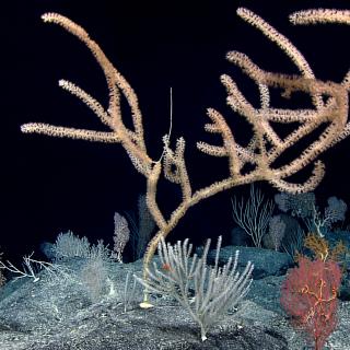
Lebuu's Voyage I - Palau
Palau National Marine Sanctuary (PNMS) –protection secured by Euotelel a Klingil a Debel Belau– is one of the most ambitious conservation efforts on Earth. Despite being rich in natural and cultural resources, there is very little data available from deep ocean habitats protected within PNMS. Working closely with the Palau International Coral Reef Center (PICRC), NOAA Ocean Exploration, and other Palauan and U.S.
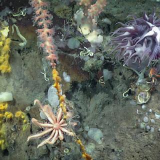
Lebuu's Voyage II - Palau
Building on the progress in the first expedition, this 11-day expedition will continue exploring Palau National Marine Sanctuary (PNMS) to understand seafloor features and the biodiversity that call deep sea habitats around Palau home. Specific cruise objectives will continue to be refined as we work with community and scientific partners.
