Uncovering the Seafloor By Mapping the Gaps

Ocean Exploration Trust’s 2024 NA162 expedition is more than just a transit from Sidney, British Columbia, to Honolulu, Hawaii: it’s an important addition to our long-term goal of mapping the seafloor. During this cruise, funded by Ocean Networks Canada, our Corps of Exploration will spend 10 days mapping previously uncharted seafloor.
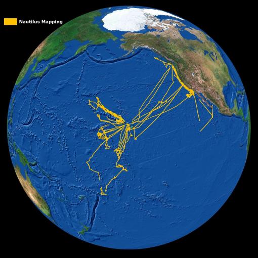
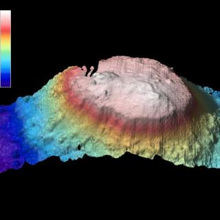
Mounted on the bottom of Nautilus is a Kongsberg 30 kHz EM302 multibeam echosounder that emits 432 acoustic beams per swath, and in most water depths, two swaths per cycle; each of those cycles are individually known as a “ping.” After a beam strikes the seafloor, it bounces back to the ship, where a receiver listens for its return. An individual ping can reach depths between 100 and 7,000 meters (330 to 23,000 feet). A single acoustic beam pulse provides a swath of seafloor as wide as 8,000 meters (26,200 feet). For this expedition, we’ll focus on a method known as “edge-mapping,” where we just slightly overlap a previously mapped track or seafloor. This allows us to meld our new data into other track lines, effectively widening the swaths of coverage.
Aside from personal expedition goals, OET’s mapping data contributes to multiple national and international efforts, including;
US National Strategy for Mapping, Exploration, and Characterization (NOMEC)
The NOMEC Strategy and its Implementation Plan outline the goals and steps that U.S. Federal agencies will take to map, explore, and characterize our oceans and coasts within the U.S. Exclusive Economic Zone (EEZ). The NOMEC Strategy supports UN Ocean Decade goals for creating a clean and resilient global ocean, promoting diversity in STEM fields, and ocean literacy. NOMEC data can help identify marine areas suitable for conservation, contributing to the Biden Administration’s stated goal of conserving 30 percent of U.S. lands and waters by 2030.
The Nippon Foundation-GEBCO Seabed 2030 Initiative
Seabed 2030 is a collaborative project between the Nippon Foundation of Japan and the General Bathymetric Chart of the Oceans (GEBCO). It aims to bring together all available bathymetric data to produce the definitive map of the world ocean floor by 2030 and make it available to all. The project was launched at the United Nations (UN) Ocean Conference in June 2017 and is aligned with the UN's Sustainable Development Goal #14 to conserve and sustainably use the oceans, seas, and marine resources.
Ocean Networks Canada Strategic Plan
The Ocean Networks Canada 2030 Strategic Plan, aligned with the United Nations Decade of Ocean Science, provides an aspirational vision to advance our ocean knowledge. It outlines three bold goals and the strategies that will be employed to deliver solutions for science, society, and industry. Seafloor mapping is an integral part of the plan’s goal for a healthy and resilient ocean.
Mapping the Gaps Southbound
This expedition is a seafloor mapping mission to bring E/V Nautilus from British Columbia back to the Central Pacific for subsequent expeditions of the 2024 field season. This 10-day transit route will fill gaps in seabed mapping within and beyond the U.S. EEZ and thereby support priorities of Seabed 2030, the Ocean Networks Canada Strategic Plan, and the US National Strategy for Mapping, Exploration, and Characterization.