Filling in Bathymetry Gaps from Southern California to Hawai’i

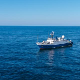
E/V Nautilus will transition to conducting operations within the central Pacific for the next several years, starting with a 10-day mapping expedition funded by NOAA Ocean Exploration through the Ocean Exploration Cooperative Institute. As we move west from North America, we acknowledge the indigenous and local communities of the Pacific Rim and Oceania — including Native Hawaiians, Polynesians, Melanesians, Micronesians, Papuans, and other Pasifika peoples — that have stewarded through generations the ocean, seas, coastlines, and lands of what is now the Pacific Ocean.
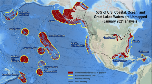
Mapping of the seafloor by echosounder began nearly a century ago, however, more than 80% of the world’s seafloor is still not mapped, even at a resolution of 1 kilometer — and the eastern Pacific Ocean is no exception. Nautilus is equipped with an acoustic echosounder mounted on the ship’s hull that simultaneously collects bathymetric, seafloor backscatter, and water column backscatter data to enable identification of areas or features of interest and the production of high-quality seafloor maps at depths to 7,000 meters.
This expedition is primarily a transit mapping leg from San Pedro, California to Honolulu, Hawai’i as the E/V Nautilus’ operations again move out into the Central Pacific Ocean. Seafloor mapping on this expedition will contribute directly to NOAA Ocean Exploration Cooperative Institute goals to fill bathymetry survey gaps in the U.S. Exclusive Economic Zone (EEZ) southeast of Hawai’i, and will also fill in mapping gaps in international waters during the transit from mainland US to Hawaiʻi. Ocean Exploration Trust provides data to Seabed 2030, as an official partner in this international collaboration which aims to have 100% of the seafloor of the high seas mapped by 2030.

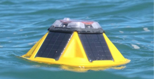
As we conduct seafloor mapping, we are also collaborating with Sofar Ocean to deploy several drifting Spotter buoys in international waters to improve meteorological and oceanographic observations. The buoys monitor metocean conditions (surface waves, winds, currents and sea temperature) and report back in real time through an onboard satellite connection. Data from buoys is integrated with the Sofar global weather program and is publicly accessible in real time through the Sofar weather dashboard, with a free account.
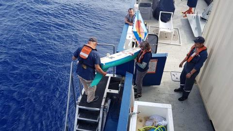
Also along the way, the team will deploy a student-built, sensor-carrying Educational Passages mini boat in international waters. Students at Marco Antonio Firebaugh High School in Lynwood, California prepared this boat and will track it while learning about ocean currents, weather, technology, and history. This 5-foot long uncrewed mini boat has a satellite transmitter, allowing it to be tracked as it sails across the ocean along with an Arduino-based sensor package with air temperature, water temperature, and orientation sensors.
Mapping to the Hawaiian Islands
E/V Nautilus will transition to conducting operations within the central Pacific for the next several years, starting with a 10-day mapping expedition funded by NOAA Ocean Exploration through the Ocean Exploration Cooperative Institute. The mapping on this expedition will contribute directly to filling mapping gaps in the U.S.