Filling in the Gaps: Characterizing the U.S. Exclusive Economic Zone

Mapping the seafloor is a vital component of the E/V Nautilus mission as it contributes to our broader understanding of the biology, geography, and chemistry below the surface. Not only does mapping help our researchers target future sites of exploration, but filling gaps in mapping coverage also contributes to Seabed 2030, an international initiative to complete mapping of the global ocean floor by the end of the decade.
During the final expedition of our 2020 expedition season, Nautilus is mapping within the Pacific Coast Region of the U.S. exclusive economic zone (EEZ) off the coast of Southern California. Established in 1983, EEZ areas located within U.S. waters are dedicated to advance the development of ocean resources and promote the protection of the marine environment. But to do so effectively, it is essential to first characterize the seafloor.
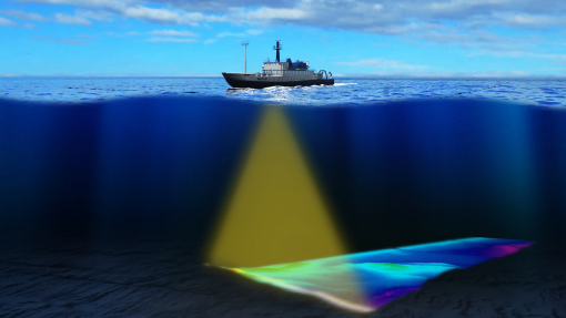
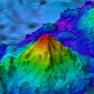
Only about 13% of our world’s oceans have been acoustically mapped. Nautilus is equipped with a multibeam sonar and sub-bottom echosounder to collect bathymetric, surface sediment characterization, subsurface geology, and water column data. Satellites equipped with altimetry sensors have also been used to derive the bathymetry of the entire seafloor by sensing gravity anomalies of the sea surface that can be linked to topography. These types of seafloor mapping data are useful for identifying areas or features of interest, creating bathymetric charts for ROV dive planning and situational awareness, and locating hydrothermal vents and gas or oil seeps.
Over the course of 23 days, Nautilus will map gaps in the available bathymetry to provide the foundational data set of high-resolution bathymetry, backscatter and water column data that will support future exploration and characterization. In November 2019, a Presidential Memorandum on Ocean Mapping of the U.S. EEZ was issued, outlining the importance in improving the exploring, mapping, and characterizing of the Nation’s ocean resources in aiding the development of economic, security, and environmental interests. The mapping on this expedition will contribute directly to filling these gaps in the U.S. EEZ, and also aligns with the goals of Seabed 2030 to explore the ocean in areas that have never been explored.
US EEZ Mapping
Our 2020 expedition season will culminate in a mapping expedition as we fill in coverage gaps located within the U.S Exclusive Economic Zone (EEZ) off the coast of southern California.