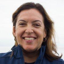
Sage Tezak
Tell us about your work/research. What kinds of things do you do?
As the GIS Analyst for Greater Farallones National Marine Sanctuary (GFNMS), there is quite a bit of variety in my day-to-day tasks. Overall, I am responsible for providing GIS services to all facets of the Farallones Sanctuary – Science, Education, Management, and Resource Protection. Some days, I find myself creating StoryMaps, other days I am cleaning remotely operated vehicle (ROV) navigation data. In addition to a ton of computer/desk time, I also have opportunities to get out in the field, ranging from an ROV research cruise where we are characterizing the habitat or an on the water vessel and mooring survey in Tomales Bay. My work translates data into digestible information that tells a compelling story and strengthens the effectiveness of sanctuary programs.
What sparked your initial interest in your career?
In 2005, I enrolled in a certificate program in Geographic Information Systems at San Francisco State University. After the first class, I was hooked! I went on to earn a certificate in GIS, and for several years, I dabbled in GIS whenever I had the opportunity. In 2014, with over fifteen years of professional experience in natural resource management, I set my sights on a new career goal. I followed my passion for all things GIS, and earned a Master’s in Geographic Information Systems.
Who influenced you or encouraged you the most?
The capabilities of GIS is so exciting! Every day I am inspired to start a new project, or present data in a different way. There is so much that GIS can do…I just wish I had more time!
What element of your work/study do you think is the most fascinating?
The instant gratification of seeing data that was just collected displayed on a map! Then turning the data into consumable information that was not previously considered in decision-making processes.
What other jobs led you to our current career?
My project-based tenure at Greater Farallones National Marine Sanctuary has resulted in a myriad of opportunities and accomplishments. Through these experiences, I have provided products and structure to the Conservation Science and Ecosystem Protection Departments of the sanctuary. I've had many great opportunities: Coordinator for the Bolinas Lagoon Ecosystem Restoration Project, Conservation Science Specialist working on both the White Shark Stewardship Monitoring Program & Rocky Intertidal Monitoring Project, and Manager of the Seabird Protection Network. Through these experiences, I learned my true passion - geographic information systems (GIS).
What are your degrees and certifications?
Master of Geographic Information Systems, University of Washington, WA
Master of Arts, Environmental Studies: Behavioral Conservation, Prescott College, AZ
Geographic Information Systems Certificate, San Francisco State University, CA
Bachelor of Science, Natural Resources Planning & Interpretation: Individual Design Marine Science, Journalism & Interpretation, Humboldt State University, CA
What are your hobbies?
I enjoy snowboarding, SCUBA diving, and photography.
How did you get involved with the Nautilus Exploration Program?
I work for NOAA, through the National Ocean Service, Office of National Marine Sanctuaries. This is my first cruise on board E/V Nautilus. I am thrilled and very fortunate to be part of the navigation & mapping team on this cruise.
What advice would you give someone who wants to have a career like yours?
Be ready to volunteer and work as an intern. Volunteer to gain experience working in the field, as well as working in the office to process and analyze data.
Expeditions
Sage participated in the following Ocean Exploration Trust expeditions:
