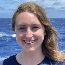
Kara Sanford
Tell us about your work/research. What kinds of things do you do?
I am currently in my final year of geomatics engineering at UNB and have taken courses in ocean mapping, remote sensing, land surveying, and GIS over the last few years. For my senior design project, my group members and I are designing a low-cost open-source sonar system along with an education platform to help foster the learning of hydrographic surveying without the constraint of complex systems and high costs. I can’t wait to dive deeper into the world of hydrography upon graduation!
What sparked your initial interest in your career?
I knew I wanted to study engineering at UNB after high school but wasn’t sure which discipline to choose. I attended a presentation about Geodesy and Geomatics Engineering at UNB and it immediately captured my interest. I’ve always had an interest in what lies beneath the sea surface but hadn’t considered making a career path out of it until I discovered the ocean mapping portion of my program.
Who influenced you or encouraged you the most?
I have been the most influenced by one of my professors at UNB, Dr. Ian Church. He made me aware of this internship opportunity as well as the Canadian Hydrographic Conference that I attended in 2020. His enthusiasm for ocean mapping and student success has played a vital role in my interest in this field.
What element of your work/study do you think is the most fascinating?
I was honestly shocked when I found out how much of the ocean remains unmapped by multibeam sonar systems. The thought of mapping a part of the ocean no one has ever explored before is incredible. I think my senior design project has been the most exciting part of my studies because it allows anyone with any amount of hydrographic knowledge to discover what really is under the sea surface.
What other jobs led you to your current career?
Throughout my degree I have had the opportunity to participate in 3 co-op work placements with the Canadian Hydrographic Service. My first two placements were both 4 months long and I primarily worked on updating charts. My last placement was 16 months long and I participated in 3 hydrographic surveys along the eastern shore of Nova Scotia, Canada. I also gained experience creating an ENC and processing multibeam sonar and LiDAR data! To say the least, CHS has inspired me to pursue a career in the hydrography field.
What are your degrees and certifications?
Bachelor of Science in Engineering, Geodesy and Geomatics Engineering -- University of New Brunswick (final year).
What are your hobbies?
I have lots of hobbies! I love reading, writing in my journal, doing yoga, hiking, biking, and going to the gym. I am also quite the foodie, so I like to try new recipes for fun!
How did you get involved with the Ocean Exploration Trust?
I found out about the seafloor mapping internship aboard the E/V Nautilus in 2019 from my professor at UNB. Itching to gain at-sea experience, I immediately applied for the 2020 expedition season. Due to Covid-19, I had to defer until this year, so I am readier than ever to set sail!
What advice would you give someone who wants to have a career like yours?
My strongest piece of advice for someone interested in ocean mapping would be to network, network, and network! You can learn so much from professionals in the industry and gather great insight and advice. Individuals in this field of study know it very well, so don’t feel intimidated by the amount of knowledge out there; ask lots of questions! There is so much to learn, and everyone has to start somewhere.
Expeditions
Kara participated in the following Ocean Exploration Trust expeditions:
