Rediscovering SS Coast Trader
Contributed by Science Communication Fellow Amber Hale
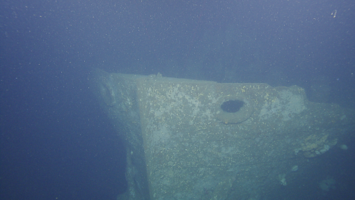
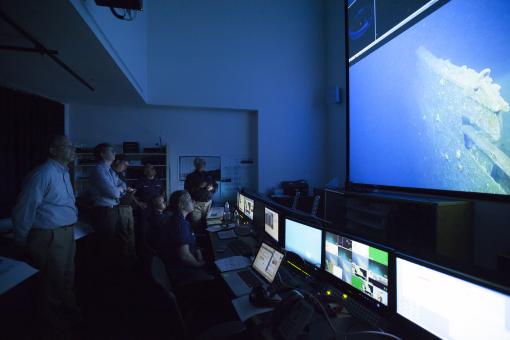
Seventy five years after US engagement in WWII, a potential marine pollution risk begins to emerge in the form of the many vessels sunk at the time that may still harbor barrels of oil. SS Coast Trader, a vessel torpedoed at the border between American and Canadian waters now rests at the edge of a national marine sanctuary staging a potential risk to the delicate marine ecosystem. As such, a major objective of the Cascadia Margin leg of the 2016 field season of the E/V Nautilus was to complete a visual survey of the SS Coast Trader shipwreck. In collaboration with Capt. Richard Sanders of the US Coast Guard and NOAA maritime archaeologist Dr. James Delgado ashore, our Corps of Exploration on E/V Nautilus launched the ROVs to confirm the target identified through sonar mapping efforts by the Canadian Hydrographic Survey was indeed SS Coast Trader and to survey the current condition of the shipwreck.
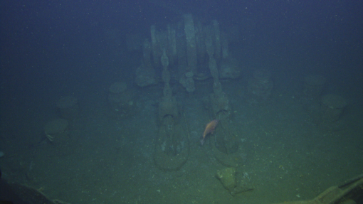
SS Coast Trader was built in 1920 by the Submarine Boat Company in Newark, New Jersey, but by the onset of World War II it was operating as a merchant ship in the North Pacific. On June 7, 1942 SS Coast Trader was departing the Port of Angeles headed toward San Francisco carrying a 1250 ton cargo of newsprint. Shortly after clearing the Juan de Fuca Strait SS Coast Trader was torpedoed by a Japanese Imperial Navy submarine, I-26. The torpedo hit the starboard side near the stern. Following impact SS Coast Trader sank in approximately 40 minutes and settled on the bottom at a depth of approximately 148 meters. All crew members were able to abandon the ship prior to sinking and all survived, save one who succumbed to exposure to the elements.
In 2010, an analysis of thousands of known shipwrecks in US waters was conducted to identify high-risk targets. Of those, 87 shipwrecks were identified as potential pollution risks. SS Coast Trader was added to this short list not because of its newsprint cargo, but for the 8,088 barrels of bunker oil it was carrying when it sank. Since no fire was reported and no oil was seen on the surface following the sinking, it is believed that SS Coast Trader still harbors a significant amount of oil.
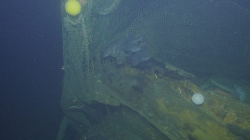
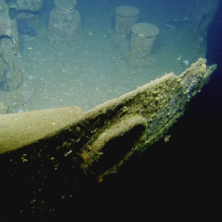
ROVs Argus and Hercules were deployed and descended to the site and began a visual survey of the shipwreck. A visual survey indicates that no artifacts were removed from the site. As the ROVs neared the site it was clear that in the 74 years since sinking, SS Coast Trader had been colonized by a variety of marine life and was serving as an artificial reef. We observed lingcod, yellow-eyed rockfish, many sea stars, and gastropods. We also came across several trawl nets that had been caught on the shipwreck over time. These nets represent a significant financial loss for the fisherman as well as a persistent hazard to the marine life in the vicinity.
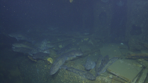
Suspended line and net also create a major entanglement hazard for our ROVs. The Hercules and Argus pilots were in constant communication with each other, working closely with navigators and the bridge officers to maintain a safe spatial arrangement of Hercules, Argus, and E/V Nautilus. Everyone's eyes were watching for loose ropes that could trap the ROVs.
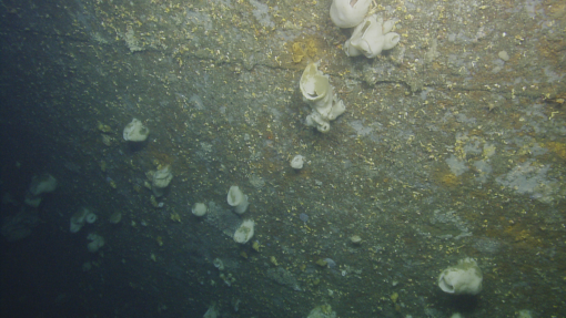
Capt. Sanders, who was joining us via telepresence from the Inner Space Center, was interested in the corrosion rate of the steel hull. Captain Sanders and cadets at the US Coast Guard Academy study corrosion of ships for both historical importance and to engineer modern solutions for the maritime industry. He was searching for signs of weakness in the hull plates and rivet sites. Previous reports have concluded that the rivets, which are made of a different quality of steel than the hull plates, have an increased rate of corrosion. The team took extra time viewing seams and rivets as they surveyed the shipwreck.
After successfully completing the dive objectives, the ROVs returned to deck for the night. They would be launched again the next day with a new dive plan. The scientists aboard, at the Inner Space Center, and around the world will be pouring over SS Coast Trader data for months to draw conclusions from this dive.
Seeps and Ecosystems of the Cascadia Margin
Methane is a powerful greenhouse gas and an important commercial resource that fuels many elements of our lives on land. Scientists are beginning to understand the complex and varied ways methane fuels life beneath the sea as well. Nautilus will study methane seep habitats along the length of the Cascadia Subduction Zone, from southern British Columbia to northern California.
