Nautilus Team Creates First High Resolution Maps of Mesoamerican Reef

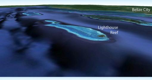
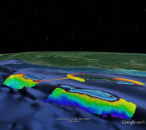
After a long weekend of "mowing the lawn" with a high-resolution multibeam mapping system, the Corps of Exploration aboard E/V Nautilus have created the first high resolution maps of the Mesoamerican reef. The image above shows the known seafloor along Lighthouse Reef off Belize after and before Nautilus mapping activities in the area.
The bottom image shows a view from Google Earth before the mapping. The top image overlays the new bathymetry on that image to show a 50 fold increase in seafloor resolution. The depth is shown by the colors. Red indicates a depth of 500 meters, while dark blue indicates 3200 meters deep. The slope and canyon features you can see in the image are visible in detail for the first time.
The Mesoamerican reef is the world's second largest barrier reef, stretching 600 miles along the coast of Central America. It is home to an amazing diversity of sea life and is largely unexplored, especially in the deeper regions where Nautilus has been working for the past week. Learn more about the reef in our background blog.
The maps were made using Nautilus's multibeam sonar. The system can efficiently map the seafloor in waters ranging from 10 meters to 7,000 meters deep, all while the ship cruises at up to 10 knots. The sonar collects bathymetric data, surface sediment characteristics, and water column data. The information it collects helps to identify areas or features of interest to plan for ROV dives.
Update:
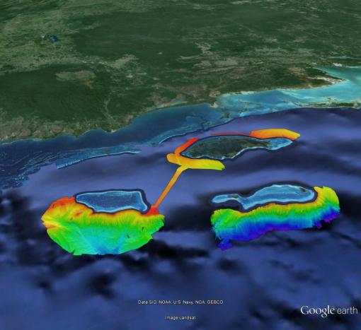
Below are additional maps reflecting the extent of the mapping at the end of the cruise.

Mesoamerican Reef
The deep waters around and off the coasts of the Belizean cayes and atolls are among the least studied areas of the Caribbean Sea. The 2014 Nautilus cruise to the western Caribbean will conduct seafloor mapping and ROV exploration of the areas around and offshore the cayes and atolls of the Belize Barrier Reef, including potential mud volcanoes off Turneffe and Lighthouse atolls.