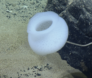
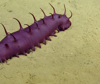
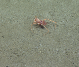
Main navigation
Expedition
Science & Tech
Team
Gallery
Education
Join
Utility navigation
About
Ocean Exploration Trust
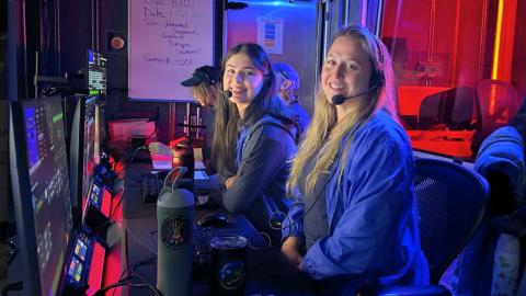
Our Founder
Board of Directors
Staff
Partners & Sponsors
Chartering Our Technology
Employment Opportunities
Participants
Pressroom
Contact
Donate
Open search form
Search
Facebook
Bluesky
X / Twitter
Instagram
YouTube
LinkedIn
TikTok
Current expedition
Seafloor Mapping Offshore Howland & Baker Islands
August 20 – September 10, 2025
Description and highlights
Current Status
In Transit
Update
Seafloor mapping is currently paused as we go through through the Samoa EEZ en route to Rarotonga. We are working to avoid some weather systems in the area.
20 hours 56 minutes ago
Ship Location
Western Pacific Ocean
Nautilus video channel menu
1
2
3
You must have JavaScript enabled to use this form.
Message
Our team is not available to answer questions at this time.
Technology
Acoustic Systems
Hull-mounted Sonar
Telepresence
Satellite communication system
Ship Heading
Wind Speed
Wind Angle
More data
Ship location
Current Watch
Lexie DelViscio
Seafloor Mapper
Recent Highlights
Blog:
Meet Ocean Explorer Lexie DelViscio
View video
Video:
Titanic Discovery’s 40th Anniversary: Dr. Robert Ballard and New Exhibition
Blog:
Meet Ocean Explorer Ella Magrum-Stanley
Recent Posts