Luʻuaeaahikiikekumu - Exploring The Ancient Volcanoes of Liliʻuokalani Ridge

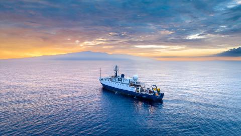
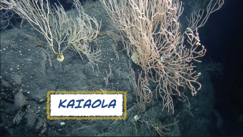
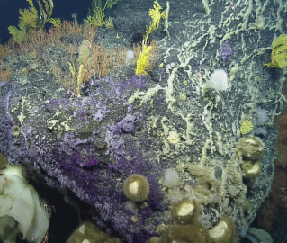
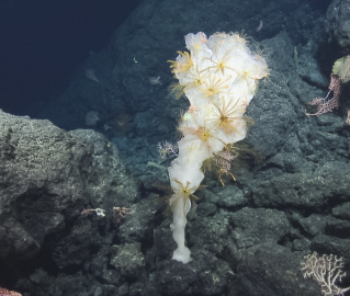
Our second expedition of 2022 brings us back to Papahānaumokuākea Marine National Monument (PMNM), north of the Hawaiian Islands, to explore Liliʻuokalani Ridge. Expedition Leader Dwight Coleman and Lead Scientists Dr. Beth Orcutt and Dr. Valerie Finlayson will lead the team in gathering samples from various depths of these seamounts. Primary objectives include determining the geologic origins and age of these features as part of better understanding of the formation of the Northwestern Hawaiian Islands. These seamounts will also be surveyed for biodiversity with expectations to find rich coral and sponge communities which are commonly found on seamounts of these depths throughout PMNM.
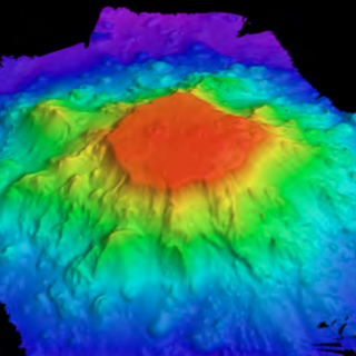
During a 20-day expedition in 2021, the team used the ship’s multibeam mapping sonar across Liliʻuokalani Ridgeige to map 32,840 sq km and create detailed visualization of seamounts targeted for mapping. The priority of this expedition was to map the seamounts within PMNM, although mapping also extended to the north to provide information on the extended geologic structure. Full coverage mapping was completed on four seamounts inside the PMNM and a fifth seamount was partially mapped. All except one were found to be flat-topped guyots having summit depths between 583 m and 997 m, notably deeper than summits at nearby Hawaiian ridge features.
This year, the team returns for the first visual exploratory surveys of the seamount chain looking to investigate a puzzling split in the seamount trail. Hotspot volcano chains are generally linear features, drawing interest about what geologic processes may have split this subsea mountain group. Thousands of seamounts rise from the seafloor of the Central and Western Pacific in complex patterns where distribution and geologic origins remain to be fully understood.
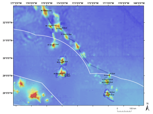
Overview of dive site locations along the Liliʻuokalani Ridge Seamounts. The curved white line indicates the boundary of the US EEZ and the present boundary of Papahānaumokuākea Marine National Monument (PMNM). The straight white line in the lower-left portion of the figure indicates the original boundary of PMNM.
The expedition name Luʻuaeaahikiikekumu (Luʻu-a-ea-a-hiki-i-ke-kumu) represents the journey to and the work in the foundation, or the foundation of the ocean/islands. The mappings of the Liliʻuokalani Ridge seamounts in October 2021 allowed us to look at the source and foundation of our oceans and islands with ROV dives. Ke kumu refers to the foundation, the source or origin. The Ocean Exploration Trust Hawaiʻi and Papahānaumokuākea expeditions close with a return to the Liliʻuokalani Ridge, thus returning to the source or beginning of your journey. This action of returning to or arriving at the source reflects an action of pani (to close). The work is complete, for now, as the kumu is also a source of inspiration for future work.
As we visit Papahānaumokuākea, the ancestral homeland of the Native Hawaiian people and the largest marine conservation area in the US, we gratefully acknowledge generations of indigenous Hawaiians and today’s stewards of these waters. OET is working closely with PMNM collaborators to inform research priorities at sea and from shore, ensure culturally-grounded collection protocols, and connect with local communities through ship-to-shore connections and the development of education resources in ‘Ōlelo Hawaiʻi (Hawaiian language).
Luʻuaeaahikiikekumu - Ancient Seamounts of Liliʻuokalani Ridge
This expedition will have E/V Nautilus returning to Papahānaumokuākea Marine National Monument (PMNM) to build on the accomplishments of the 2021 Luʻuaeaahikiikalipolipo expedition, which mapped the previously unmapped Liliʻuokalani Ridge Seamounts. The team returns for the first visual exploratory surveys of the seamount chain looking to investigate a puzzling split in the seamount trail.