Many of the world’s offshore marine environments experience prolific natural seepage of hydrocarbons to the seafloor. In the waters off North America alone, natural hydrocarbon seepage is estimated to contribute more than 50 million gallons of oil to marine waters in a year. Hydrocarbon gas is also emitted from seafloor seeps. It rises through the water as bubble plumes and is likely to be a significant source of methane to the atmosphere. Despite the large volume of crude oil and gas released from these seeps, the seepage rates are slow enough that local seep environments support large, specialized communities of underwater organisms. Multiple studies have shown that these communities and their associated chemical and geologic processes are very heterogeneous, and can change significantly from one region of hydrocarbon seepage to another.
The Gulf of Mexico contains hundreds of natural seafloor seeps that can be studied very effectively using both automated and remotely operated vehicles (AUVs and ROVs). This cruise will study the seep environment in the western Gulf of Mexico. Shallow sediment cores from this region suggest seepage in the western Gulf may be less prolific than the better-studied portions of the eastern Gulf. The Corps of Exploration seeks to characterize this seep environment and understand the biologic and geologic processes that are associated with it. The results of the study will provide a baseline to compare the variability of natural seep environments within a single geographic region.
Key Concepts
- This is a 2-part expedition (mapping, then ROV/AUV operations). The mapping team will be the advance team to go into an area for exploration to produce quality maps that can be used to plan ROV dives for exploration of the most interesting areas.
- During this first expedition, we will be mapping the surface and shallow subsurface geology of 3400 km (2112 miles) of the seafloor in water depths from 1000-3000 meters (3280-9842 feet). With the ship speed of 10 knots, the planned work will take 7-8 days.
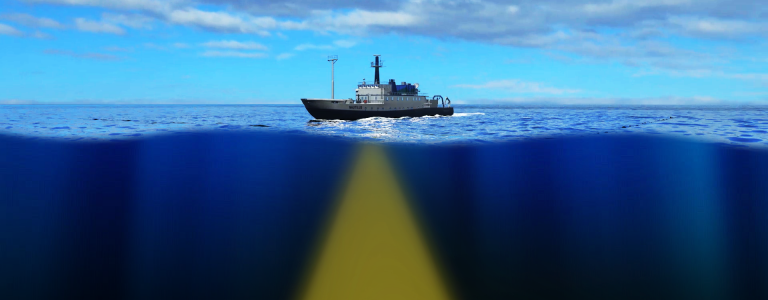
- The two mapping systems, a multibeam sonar echosounder and sub-bottom profiler will help scientists understand the surface, water column (backscatter), and subsurface geology associated with seeps.
- Mapping in July will help inform the planning of lead scientists for the ROV/AUV expedition in early August. The maps from the first expedition will allow the ROV/AUV team target their dives onto the most geologically interesting areas, such as areas where we think we’ve found natural seeps.
- In addition to being excellent planning tools, high-resolution maps provide spatial awareness to our ROV pilots, who must navigate some very difficult terrain like volcanic calderas and steep escarpments.
- Determining the distribution, abundance, and activity of natural gas seeps is important because it is a missing piece of our understanding of the Earth’s carbon budget. Natural gas seeps from the sea floor, which are commonly, but not exclusively methane, are now thought to be more common and need to be accounted for when trying to understand global sources of greenhouse gases, which affect the Earth’s climate.
- The natural gas seeps are also energy sources for chemosynthetic organisms and provide habitat to unique communities of organisms. Locating the seeps with a multibeam can help us target these seeps for ROV exploration of the benthic communities, which can lead to the conservation of critical habitat.
