Sea Level Changes Past, Present, and Future

Contributed by Navigator CAPT Emil Petruncio, USN (Ret.).
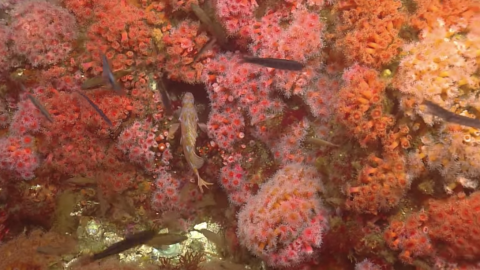
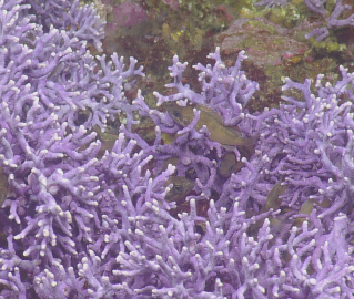
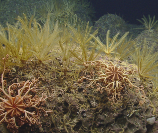
Our exploration of submerged shorelines in the Southern California Borderlands has a wide range of potential applications. We may spur future research by characterizing the geology and ecological communities of these previously unexplored marine terraces. By locating sea caves which may have offered shelter to early settlers of North America, we may generate new questions for marine archeologists and paleontologists to investigate. Another application may be helping oceanographers and climate scientists gain a better understanding of past, present, and future sea level rise. Determining the age of shells and other material located on these paleoshorelines can help us infer when these submerged shorelines were beaches, and hence confirm estimates of local and global sea level rise rates since that time. Understanding those sea level rise rates can help place current observations and projections for future sea level rise into historical context.
Recent research indicates that global sea level is rising, and the rate of this rise is accelerating. Since the early 1990s, sea level has risen at a rate of about 3 millimeters per year, or one foot per century, which is two to three times as fast as the rate during 1900-1990. Plausible scenarios for global sea level rise between now and 2100 range from about one to eight feet. The uncertainties which result in this broad range of scenarios are associated with gaps in our knowledge about the physical processes which contribute to sea level rise and about future choices regarding carbon emissions.
Two approaches are used to constrain the range of plausible scenarios for future sea level rise: the process-based approach, and the semi-empirical approach. Each approach has strengths and weaknesses. The process-based approach involves direct simulation (numerical modeling) of atmospheric, ocean, and ice processes involved in sea level rise. While this approach enables us to apply sophisticated models incorporating advances in Earth system science, a drawback is that we have an incomplete understanding of some of these physical processes, such as contributions from land ice (i.e., ice sheets and glaciers). The semi-empirical method involves the development of statistical relationships between global temperatures and sea level, based on historic trends. The semi-empirical method may compensate for gaps in our understanding of the physical processes involved, but the derived statistical relationships may not hold for future changes; i.e., processes important to future sea level changes may be different from those which contributed during the period used to develop the statistics.
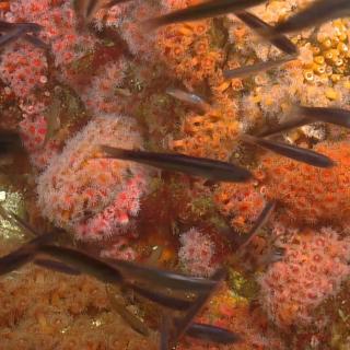
To better inform the semi-empirical method of estimating future sea level rise, dates of historic sea levels are determined from a variety of methods, including carbon dating of ancient peat, marine mud, foraminifera, mangroves, and thorium dating of corals which are known to live within certain depth ranges. Multiple lines of evidence indicate that sea level was nearly 400 feet lower 19,500-22,000 years ago, during the Last Glacial Maximum. As glaciers retreated and glacial lakes drained, sea level rose at various rates, with occasional surges (“Melt Water Pulses”) alternating with periods of relatively constant sea level (“still stands”). Melt Water Pulses occurred over periods ranging from several centuries to nearly two thousand years, and involved rates of sea level rise ranging from about three to nearly 15 feet per century. To relate these historical rates to projections for the remainder of this century: a three-foot rise by 2100 is among the more conservative scenarios, while a 15-foot rise is considered to be beyond the extreme high end of most projections. Still stands occurred for periods ranging from one to three thousand years. During these still stands, wave action formed beaches and carved sea caves and arches out of ancient cliffs.

One still stand of particular interest in the exploration of the Southern California Borderlands is the one that occurred between 12,500 and 13,500 years ago, when sea level was about 230 ft lower. It was during this period of lower sea level that the northern Channel Islands (San Miguel, Santa Rosa, Santa Cruz, and Anacapa) existed as one large island referred to as Santa Rosae. Dating of human remains and tools indicate that early North Americans inhabited Santa Rosae approximately 13,000 years ago. It is very plausible that they also inhabited other nearby islands, including those which later became submerged due to sea level rise. As we explore the paleoshorelines of Tanner Bank, Nidever Bank, Osborn Bank, and other areas of the Southern California Borderland, we may discover caves which could have offered shelter to the earliest inhabitants of this area. Whether we locate new caves or not, dating of the geological and biological samples we obtain from these ancient marine terraces may lead to improved understanding of past and present sea level rise, and reduce the uncertainty in projections for the centuries that lie ahead.
References:
NOAA Lab for Satellite Altimetry
Colorado University Sea Level Research Group
Submerged Shorelines of California Borderland
The primary focus of this expedition is the identification and characterization of submerged shorelines associated with offshore banks in the southern California Borderland region. This is a continuation of the effort by Nautilus over the last four years to acquire high-resolution mapping data of submerged shorelines and characterize primarily with remotely operated vehicles.